
|
Informação de Base 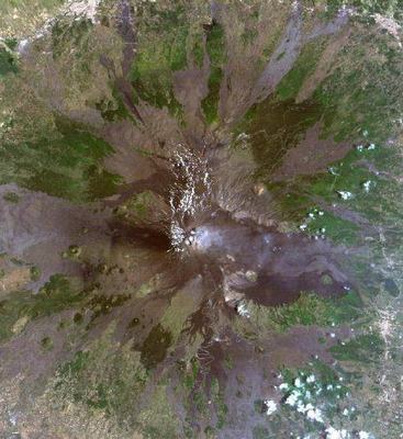 Mount Etna - Landsat 3, 2, 1 band combination.  Mount Etna - Landsat 4, 5, 3 band combination. Dados do ERS  Digital Elevation Model of the summit of the Mount Etna. 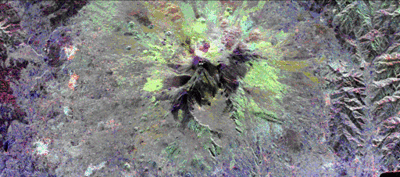 The summit of the Mount Etna volcano on the island of Sicily, Italy, one of the most active volcanoes in the world, is shown near the cenre of the radar image. Lava flows of different ages and surface roughness appear in shades of purple, green, yellow and pink surrounding the four small craters at the summit. Etna is one of the best studied volcanoes in the world and scientists are using this radar image to identify and distinguish a variety of volcanic features.
This image was aquired on 11 October 1994 by the Spaceborne Imaging Radar-C/X-Band Synthetic Aperture Radar (SIR-C/X-SAR) aboard the Spaceshuttle Endeavour. |