| | | | |
 |
|
Σχετικά με το Eduspace Τι είναι το Eduspace;Ποιο εργαλείο προσφέρει; Επιλέξτε τη γλώσσα σας Αρχές Τηλεπισκόπησης Τι είναι η ΤηλεπισκόπησηΤηλεπισκόπηση σε βάθοςΗ ιστορία της Παρατήρησης της ΓηςΧαρτογράφηση και Δορυφορικά ΔεδομέναΔορυφορικές τροχιέςΔορυφόροι παρατήρησης της Γης Μέσα Πολυμέσα Γκαλερί εικόνωνΓκαλερί βίντεοΥπηρεσίες Αναζήτηση στο Eduspace
| | | | | | | | Article Images |  |
Τεχνολογία Ραδιοεντοπισμού (RADAR)
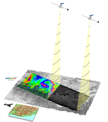
| A satellite passes over an area and records data about it. Two or more passes are needed to create the InSAR (Synthetic Aperture Radar Interferometry) images, used to examine changes in ground height.
Credits: U.S. Geological Survey | |  |  | |
| | | | | Colour radar images can be produced by combining three single images from different dates (e.g.35 days apart) to produce a multi-temporal composite. Each individual date/image is displayed in one of the three colours used to form any colour picture, ie red, green and blue. The different amounts of colour from each date combine to produce other colours that can be interpreted by experienced image processors.
Credits: ESA | | | | |
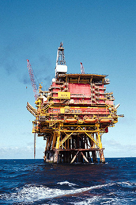
| | | | | What a radar 'sees' is different to what our eyes observe. Imagine that you are at the beach and you look out towards the water. The water may be smooth or there may be waves, depending on the wind's speed. However, for the sensor, the rougher the water surface, the greater the reflection of the microwave energy that will be recorded, and therefore the brighter (whiter) the water will appear in the image.
Credits: ESA | | | | |
| | | | | This image shows a color composition of the city of Bucharest, Romania, as seen from the spaceborne radar onboard the ERS-1 satellite.
Credits: ESA | | | | |
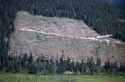
| | | | | ERS Radar multitemporal image of Porto Velho (Brasil). Human-made deforestation is seen as coloured rectangular areas. The city of Porto Velho (Brazil) is depicted in white.
Credits: ESA 1998 | | | | |
| | | | | Radar satellite image of a cultivated area in The Netherlands, where a network of roads is clearly visible as dark linear features.
Credits: ESA | | | | |
| | | | Χρήση των ραδιοεντοπιστικών απεικονίσεων
| | | | | | | | | | | | | |
| | Τηλεπισκόπηση σε βάθος ΕισαγωγήΚανάλια MSS LandsatΦασματικές ΥπογραφέςΧαρτογράφηση της βλάστησηςΤαξινόμηση των περιοχώνΑτμοσφαιρικές παρεμβολές
|


")