Übung 1 – Bildbetrachtung und Vektorzeichnung
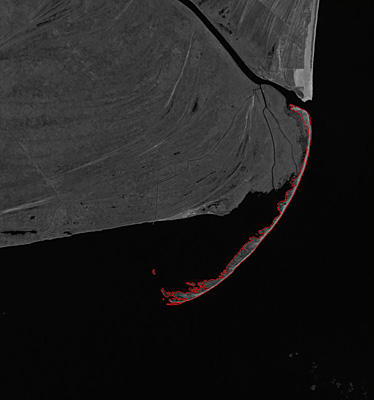
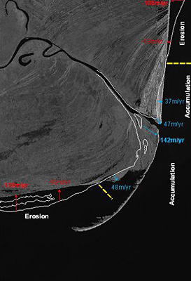
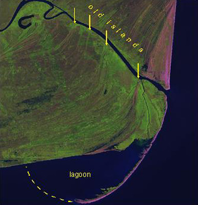
Landsat image acquired in 2000, with bands 5, 4, and 3 displayed as red, green and blue respectively. Yellow annotations show old islands and predicted evolution of coastal zone.