 The MERIS sensor and the Globcover Project


 |  | MERIS
| |
Page 1 2 
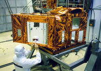
a) The MERIS sensor The MEdium Resolution Imaging Spectroradiometer (MERIS) is one of Envisat’s 10 instruments. It operates in the solar reflective spectral range. Fifteen spectral bands with a spatial resolution of 300 metres can be selected by ground command.
MERIS was designed to acquire data over the Earth whenever illumination conditions are suitable. The instrument's 68.5° field of view around nadir covers a swath width of 1150 km.
MERIS’s primary mission is to measure the sea colour of the oceans and coastal areas. As a secondary mission it is also capable of estimating:
- Cloud type, top height, and albedo
- Top and bottom indices of atmosphere vegetation
- Photosynthetically available radiation
- Surface pressure
- Water vapour total column content for all surfaces
- Aerosol load over land
- Vegetation indices
- Fractional Absorbed Photosynthetically Active Radiation (FAPAR)
MERIS measures the reflected solar radiation from the Earth's surface and clouds in the visible and near-infrared spectral regions. Consequently, observation is nominally limited to the day side of the Earth. No. | Band centre (nm) | Band width (nm) | Applications | 1 | 412.5 | 10 | Yellow substance and detritus pigments | 2 | 442.5 | 10 | Chlorophyll absorption maximum | 3 | 490 | 10 | Chlorophyll and other pigments | 4 | 510 | 10 | Suspended sediment, red tides | 5 | 560 | 10 | Chlorophyll absorption minimum | 6 | 620 | 10 | Suspended sediment | 7 | 665 | 10 | Chlorophyll absorption & fluorescence reference | 8 | 681 | 7.5 | Chlorophyll fluorescence peak | 9 | 708.75 | 10 | Fluorescence reference, atmosphere corrections | 10 | 753.75 | 7.5 | Vegetation, cloud, O2 absorption band reference | 11 | 760.625 | 3.75 | O2 R- branch absorption band | 12 | 778.75 | 15 | Atmosphere corrections | 13 | 865 | 20 | Atmosphere corrections | 14 | 885 | 10 | Vegetation, water vapour reference | 15 | 900 | 10 | Water vapour |
| Page 1 2 Last update: 16 April 2013

 |  |  Vegetation in South America

|  Background

| • | Vegetation in South America (http://www.esa.int/SPECIALS/Eduspace_Global_EN/SEM94FNW91H_0.html) |  | • | Main Ecosystems (http://www.esa.int/SPECIALS/Eduspace_Global_EN/SEMF5FNW91H_0.html) |  | • | Vegetation Indices (http://www.esa.int/SPECIALS/Eduspace_Global_EN/SEMC6FNW91H_0.html) |  | • | SPOT VEGETATION imagery (http://www.esa.int/SPECIALS/Eduspace_Global_EN/SEM6CFNW91H_0.html) |  |  Exercises

| • | Exercise 1: NDVI - Vegetation from space (http://www.esa.int/SPECIALS/Eduspace_Global_EN/SEM3ZINW91H_0.html) |  | • | Exercise 2 : NDVI Animation (http://www.esa.int/SPECIALS/Eduspace_Global_EN/SEMY3JNW91H_0.html) |  | • | Exercise 3: NDVI dynamics by biogeographical zones (http://www.esa.int/SPECIALS/Eduspace_Global_EN/SEM6EJNW91H_0.html) |  |  Related links

| • | MERIS product handbook (http://envisat.esa.int) |  | • | MIRAVI (http://www.esa.int/miravi) |  |

|