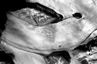
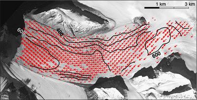
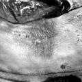
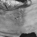
By correlating two images of a glacier taken at different times it is possible to measure the displacement of the glacier between Time 1 and Time 2. This technique is called ‘image matching’ or ‘feature tracking’.
The principle of image matching consists in identifying the same point in two satellite images taken at different times. If, between Time 1 and Time 2, this point has moved, for instance due to glacier flow, the point will have different coordinates in both images. The difference in these coordinates is the horizontal movement of the point.
Unfortunately this technique doesn’t work for all glaciers and images. It is important that corresponding points be identifiable in both images. This will not be the case if the ice melt was too strong between the two acquisition times, or if a snow fall covered the glacier at one of the two times. In addition, large glacier parts might not have sufficient objects on their surface to track.
 | |
Glacier ice flow
|
| • | Introduction (http://www.esa.int/SPECIALS/Eduspace_Global_EN/SEMDPUZ14CH_0.html) |
|
Background
|
| • | The dynamics of glaciers (http://www.esa.int/SPECIALS/Eduspace_Global_EN/SEMMTUZ14CH_0.html) |
|
Exercises
|
| • | Worksheet introduction (http://www.esa.int/SPECIALS/Eduspace_Global_EN/SEM5WUZ14CH_0.html) |
|
| • | Exercise 1: Correlation of repeated images (LEOWorks 3) (http://www.esa.int/SPECIALS/Eduspace_Global_EN/SEMRZUZ14CH_0.html) |
|
Eduspace - Software
|
| • | LEOWorks 3 (http://esamultimedia.esa.int/multimedia/LEOWorks3.exe) |
|
Eduspace - Download
|
| • | ASTER.zip (http://esamultimedia.esa.int/images/EduSpace/AST.zip) |
|
| • | GoogleEarth file (http://esamultimedia.esa.int/multimedia/GoogleEarth_file eduspace_glacier.kmz) |
|