ESA
Education
Accueil
Météo et climat
Changement global
Les catatastrophes naturelles
Changements côtiers
Delta du Danube
Marées noires
Déforestation
Parc National de Bardia
Bassin du Congo
Kameng-Sonitpur
Le Kilimandjaro
Rondonia
Shillong et Guwahati
La Glace
Analyse des glaciers avec l'imagerie radar
Antarctica 2003
Changement climatique et glaciers
Retrait des glaciers dans les Alpes
L'écoulement des masses glaciaires
Surveillance des glaciers de l'Himalaya
La télédétection de la glace et de la neige
Urbanisation
Córdoba
Le Caire
Katmandou
L'Himalaya
Vallée de Katmandou
Lagos
Végétation
Aire de Conservation de l’Annapurna
Perdus dans les Andes
Zone de Conservation du Ngorongoro
Delta intérieur du Niger
Amérique du Sud
Recherche
Article Images
L'analyse des images satellites - Partie 3
Retour a l'article
Download:
HI-RES JPEG
(Size:
11 kb
)
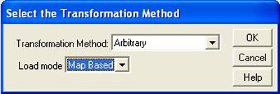
Kameng-Sonitpur Elephant Reserve – Selection of transformation method for opening of the GIS theme showing the forest boundaries in 1994.
Retour a l'article
Download:
HI-RES BMP
(Size:
253 kb
)
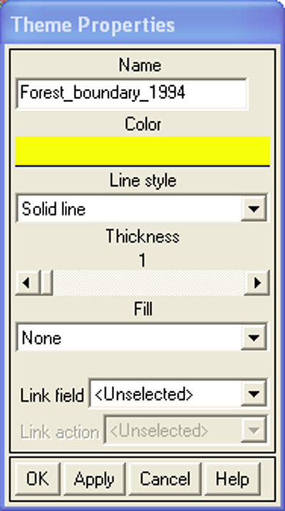
Kameng-Sonitpur Elephant Reserve – Select a colour for the forest boundaries in the Theme Properties window.
Retour a l'article
Download:
HI-RES BMP
(Size:
619 kb
)
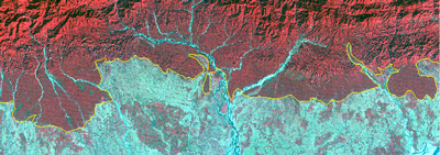
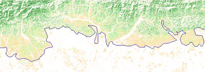
Kameng-Sonitpur Elephant Reserve – False colour combination of 1994 image with forest boundaries.
Retour a l'article
Download:
HI-RES BMP
(Size:
622 kb
)
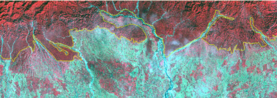
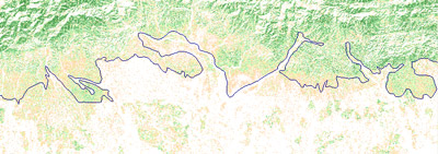
Kameng-Sonitpur Elephant Reserve – False colour combination of 2003 image with forest boundaries.
Retour a l'article
Download:
HI-RES BMP
(Size:
619 kb
)
Kameng-Sonitpur Elephant Reserve – NDVI image of 1994 with forest boundaries.
Retour a l'article
Download:
HI-RES BMP
(Size:
805 kb
)
Kameng-Sonitpur Elephant Reserve – NDVI image of 2003 with forest boundaries.
Kameng-Sonitpur
Introduction
Réserve d’éléphants
L’éléphant d’Asie
Conflits homme-éléphant
Exercices
Introduction
Création d’une carte et l’étude de la KSER
L'analyse des images satellites
Eduspace - Logiciels
LEOWorks 3
ArcExplorer
Eduspace - Téléchargement
ks_papermap.zip
ks_satelliteimg.zip
Ressources
Liens Utiles
Copyright 2000 - 2014 © European Space Agency. All rights reserved.