Disappearing Arctic ice
21 September 2007
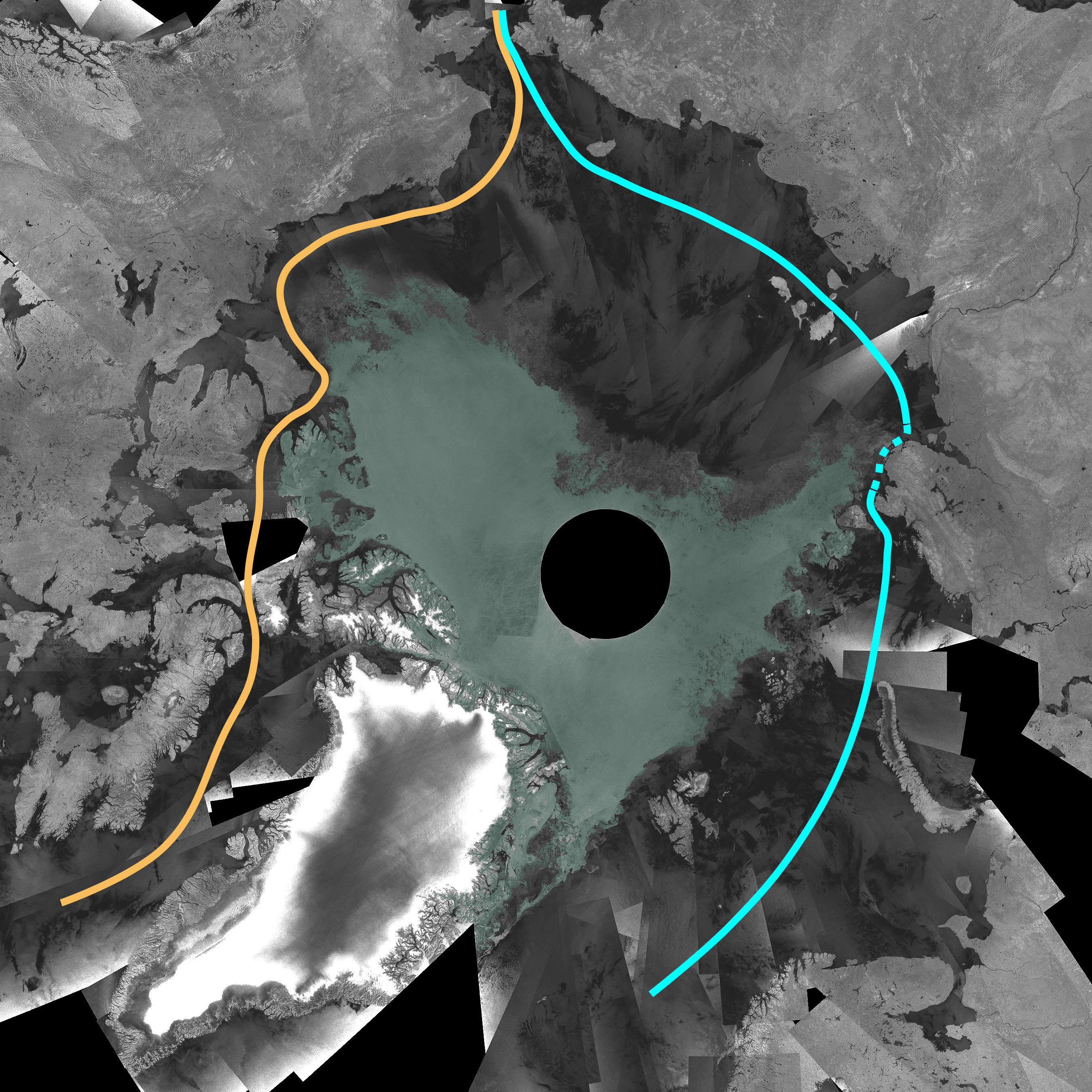
For more than 500 years, navigators have been seeking an ice-free route between the Arctic islands of northern Canada. Many explorers died in the quest to find a Northwest Passage linking the Atlantic and Pacific Oceans. However, the Arctic ice sheet has begun to shrink rapidly. New radar images obtained by ESA’s Envisat show that the area of Arctic sea ice is now at its lowest since satellite measurements began nearly 30 years ago. The result is the temporary opening up of the previously impassable Northwest Passage.
Arctic ice cover increases in the northern winter and decreases each northern summer. However, the rate of summer loss is accelerating. A mosaic of nearly 200 images taken by Envisat in September 2007 showed that the Northwest Passage was fully navigable, while the Northeast Passage along the Siberian coast was only partially blocked.

Danish scientist Leif Toudal Pedersen said: "We have seen the ice-covered area drop to just around 3 million sq km, which is about 1 million sq km less than in 2005 and 2006. There has been a reduction of the ice cover over the last 10 years of about 100,000 sq km per year on average, so a drop of 1 million sq km in just one year is extreme.”


