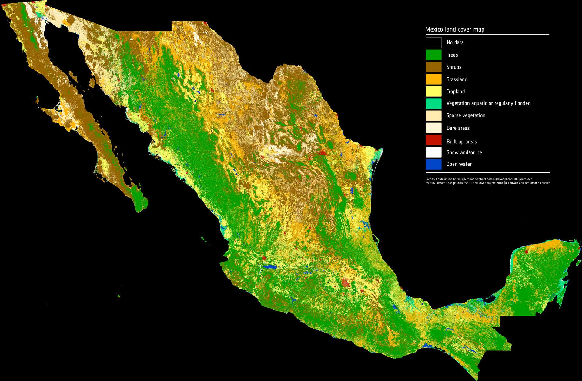
Zooming in on Mexico’s landscape
As part of a scientific collaboration with the Mexican Space Agency and other Mexican scientific public entities, ESA has combined images from the Copernicus Sentinel-2 mission to produce a detailed view of the different types of vegetation growing across the entire country.
The high-resolution land-cover map combines images captured by Copernicus Sentinel-2 between 2016 and 2018.
Sentinel-2 is a two-satellite constellation built for the EU’s Copernicus environmental monitoring programme. Each identical satellite carries a multispectral imager that can distinguish different types of vegetation and crops. It can also be used to determine numerous plant indices such as the amount of chlorophyll and water in leaves to monitor changes in plant health and growth.
The mission has a myriad of uses, one of which is to provide information to map land cover so that changes in the way land is being used can be monitored.
Thanks to this Copernicus mission and to ESA’s Climate Change Initiative Land Cover project, Mexico’s land cover has been mapped at a resolution of 10 m.
Land-cover mapping breaks down the different types of material on Earth’s surface, such as water bodies, different forms of agriculture, forests, grasslands and artificial surfaces.
This information is important for understanding changes in land use, modelling climate change, conserving biodiversity and managing natural resources.
This is a valuable source for scientific studies and practical applications alike.
Daniela Jurado from Mexico’s National Commission for the Knowledge and Use of Biodiversity said, “Having access to such a detailed map is not only useful for scientific research such as understanding fluxes associated with the carbon cycle, but also for managing our natural resources and for conserving biodiversity.”
“It is also important for land-use management and for monitoring urban expansion.”
Alejandra Aurelia López Caloca, from the Center for Research in Geospatial Information Sciences added, “Indeed, this new map reveals a lot about our country. It is very helpful for studying the growth of cities and how rural areas are transitioned into urban environments. In addition, it is going to be a real help to understand where bodies of water are highly dependent on precipitation and to pinpoint those areas that are at risk of flooding.
“The new map allows us to identify the status land cover, specifically the agricultural kind so this will really help us understand how our land is being farmed.”
ESA has been coordinating global land cover maps since 2002 through its GlobCover and Climate Change Initiative Land Cover projects at a resolution of 300 m. But with the Copernicus Sentinel-2 pair now in orbit, land cover can be mapped at a resolution of 10 m.
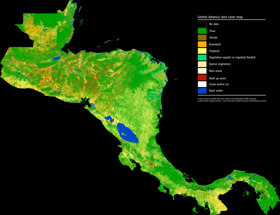
In the same vein, a land-cover map of Central America is also now available.