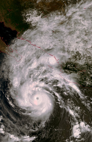
Hurricane Elida, off the coast of Mexico, 25 July 2002
Elida is a tropical storm that started forming off the coast of Mexico on 23 July 2002. After few days, it turned into a powerful hurricane with wind gusts reaching speeds over 200 km/hour.
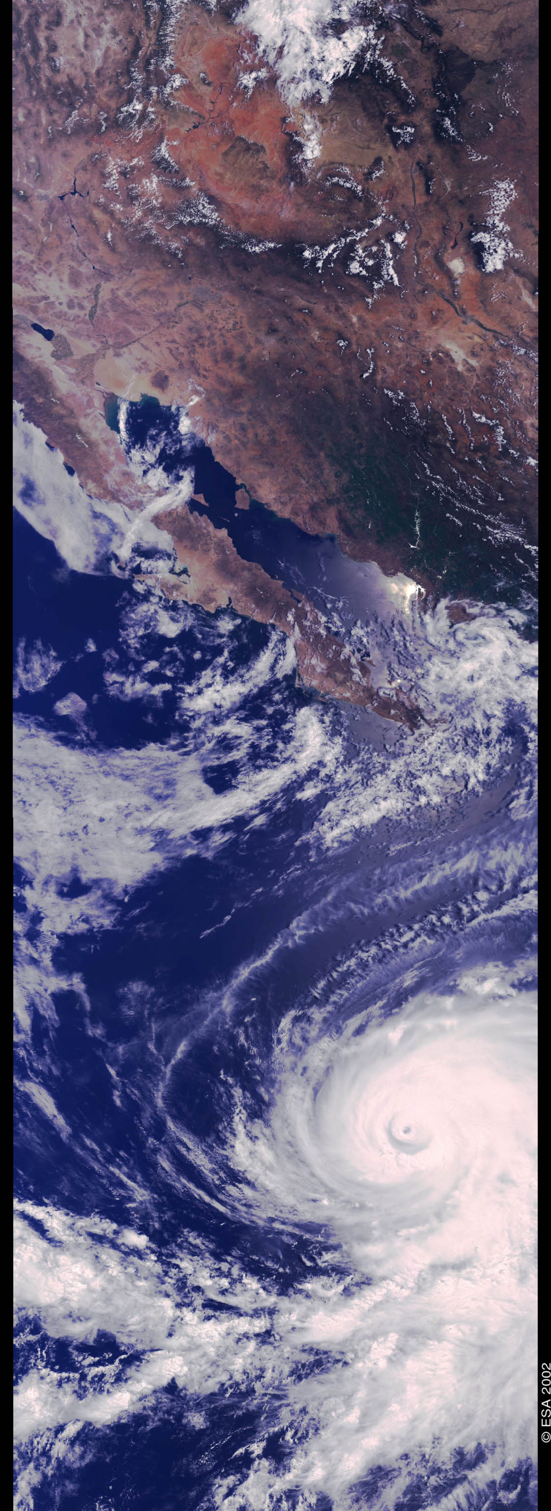
On 25 July 2002, an image of the storm at the height of its strength was acquired by the Medium Resolution Imaging Spectrometer (MERIS) carried on ESA’s Envisat satellite. The storm’s central eye is perfectly visible.
To the north, the 1000 km-plus long Baja Peninsula provides a graphic reference of the size of this giant atmospheric event. Since Elida formed, it has moved northwest at an approximate speed of 30 to 40 km/hour. Its track is along the coast of Mexico, heading off the coast of the Baja peninsula. Elida will last several days before it will slowly lose its strength and dissipate.
This is the first time that Envisat’s MERIS sensor has observed such an event. The sensor measures radiation in 15 frequency bands to provide information about ocean biology, marine water quality, and land vegetation, along with data on land, cloud and water vapour.
From MERIS raw observations, an entire suite of atmospheric parameters will be proposed to Envisat users involved in atmospheric studies. These parameters include: cloud reflectances, cloud optical thickness, cloud albedo, cloud top pressure, cloud type and water vapour concentration. In total, about 20 geophysical products and corresponding data manipulation tools will be delivered to scientific users.
MERIS will provide data at two resolutions, 300 m and 1.2 km. Its 1150-km swath results into a three-day global coverage. The MERIS mission objectives are focused on marine biology but they have been extended to enable land and atmosphere monitoring as well.
Technical Information:
Instrument: MEdium Resolution Imaging Spectrometer (MERIS)
Date of Acquisition: 25 July 2002
Orbit number: 2099
Instrument features: Reduced Resolution stripe of 2300 km length and 1150 km width (1200-meter resolution).