
Rescue drones tested within Italian volcanoes
Interconnected drones have been dispatched into volcanic territory to test their use for civil protection, to help guide responses to natural disasters using novel PNT technology. The project, named Pathfinder, is supported through ESA’s Navigation Innovation and Support Programme, NAVISP. Two test campaigns have been undertaken to date, around the active Stromboli Island volcano and within the Astroni Nature Reserve, in a volcanic crater near Naples.
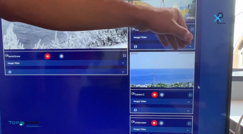
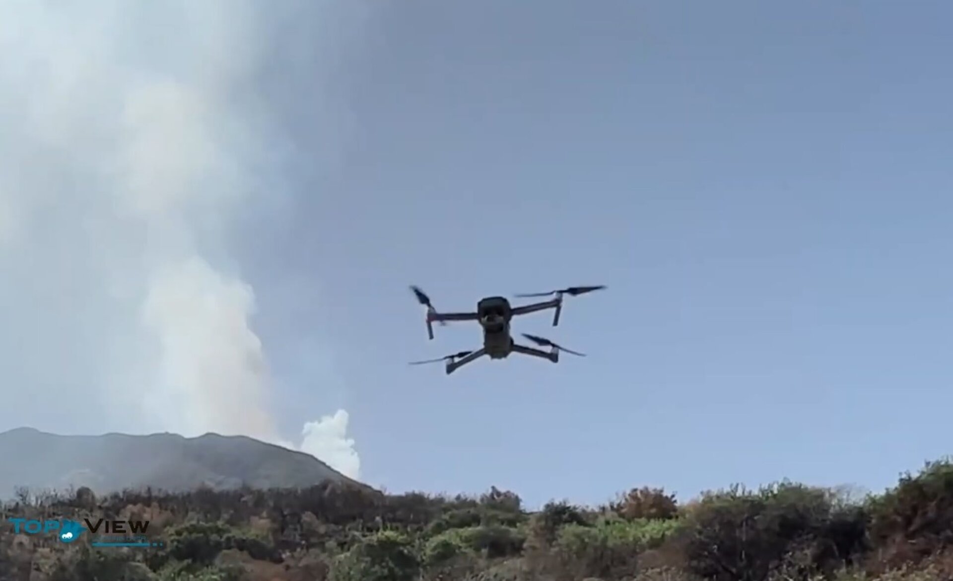
In response to disaster events, the prototype Pathfinder fleet management system combines satnav-based positioning, navigation, and timing – PNT – with communication technologies to enable situational awareness of rescue teams, personnel, and assets. The drones serve to monitor rapidly-evolving situations and guide the collection of critical samples, such as material expelled by volcanoes.
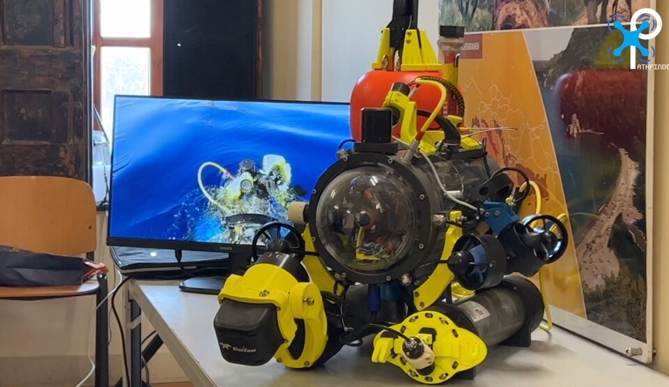
Their presence also facilitates crucial tasks such as identifying individuals in distress and expediting rescue efforts. For maximum effectiveness during times of crisis, the coordinated use of airborne drones is combined with ground rovers following a newly-developed cooperative positioning technique, as well as underwater vehicles where required.
With the support of NAVISP, the Pathfinder system’s inaugural trial took place in and around Mount Stromboli in Italy’s Tyrrhenian Sea. This complex landscape, influenced by volcanism, seismicity, slope instability, and the potential for tsunamis, made it an ideal choice for the initial demonstration campaign. The primary focus of this campaign was the verification and validation of overall end-to-end system functionality.
Various drones were deployed to monitor the area and provide insightful analysis of the recorded events. Among the objectives, underpinned by bespoke robust PNT solutions, the campaign aimed to overcome challenges such as establishing an independent communication infrastructure in situations where the existing one proved unreliable. Additionally, it explored the implementation of real-time and near-real-time video monitoring and surveillance systems to enhance context and situational awareness.
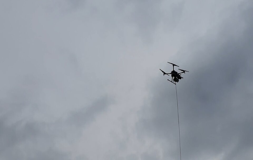
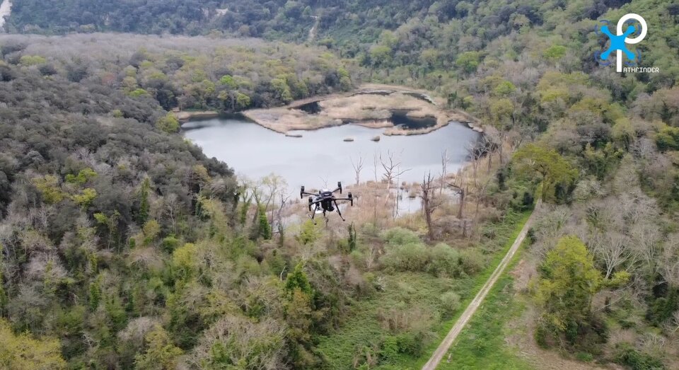
A second test campaign took place this spring in the Astroni crater near Naples, providing an opportunity to explore alternative use cases for the system, such as monitoring local flora and fauna during emergency situations. A master tethered drone oversaw additional drones tasked with charting the position of animals in the 247-hectare Astroni crater, which is a WWF-recognised nature reserve, part of the volcanic Phlegraean Fields west of Naples.
Considering the high probability of communication infrastructure being disrupted during a disaster, Pathfinder’s tethered master drone serves as a reliable and independent communication hub, enabling situational awareness beyond the visual line of sight. This independent setup ensures continuous and reliable positioning and communication even in situations where traditional infrastructure would be compromised.
“In effect the master drone serves as a 'pseudo satellite' or 'pseudolite', providing augmentation data to enhance the accuracy of satellite navigation within the test zone,” explains Marco Nisi, managing the project at Italian firm Sistematica.
“Additionally, this drone serves as a gateway to the automated aerial vehicles' broader airspace management system, ensuring avoidance of any potential conflicts with other aerial traffic. Meanwhile a separate Mobile Mission Unit is utilised to collect all the acquired data and enables mission planning for the interconnected drones, ensuring efficient coordination and execution of tasks.”
The Pathfinder project is being undertaken by a consortium led by Sistemtica S.P.A., with the Civil Protection Centre of the University of Florence, TOPView s.r.l, Fondazione LINKS Leading Innovation & Knowledge for Society, Politecnico Interdepartmental Centre for Service Robotics (POLITO) and ALPHA Consultants.
The aim is that having proved the added value of Pathfinder to supporting rescue teams and civil protection authorities, the consortium will move to a commercialisation phase. Pathfinder is supported through NAVISP Element 2, aiming to boost Member State competitiveness through the development of improved or innovative commercial products.


Access the video
About NAVISP
ESA navigation specialists are supporting cutting-edge European companies in the development of new navigation technologies and services – in support of Europe's industrial competitiveness, autonomy, and leadership. The result is ESA’s Navigation Innovation and Support Programme, NAVISP.
NAVISP is looking into all kinds of clever ideas about the future of navigation: ways to improve satellite navigation, alternative positioning systems and new navigation services and applications.
For more information, visit the NAVISP webpage.