Revealing coastline dynamics of the Danube Delta
Hundreds of satellite images spanning 30 years have been compiled to show the evolution of the Danube Delta – the second largest river delta in Europe. These findings were presented today at ESA’s Living Planet Symposium taking place this week in Bonn, Germany.
Coastal areas have been subjected to intense urbanisation and population growth, and most affected are low-lying areas such as deltas.
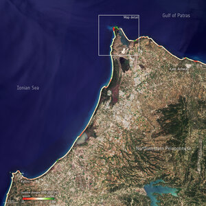
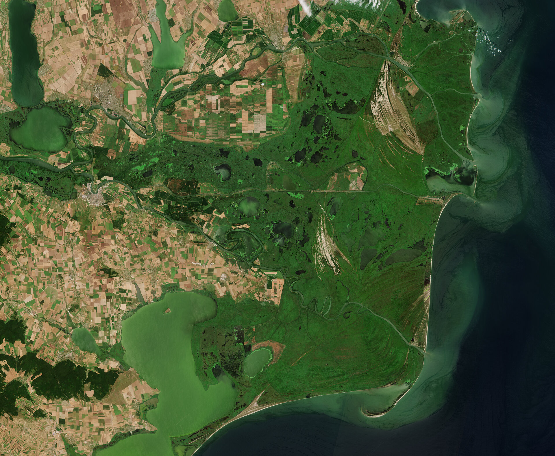
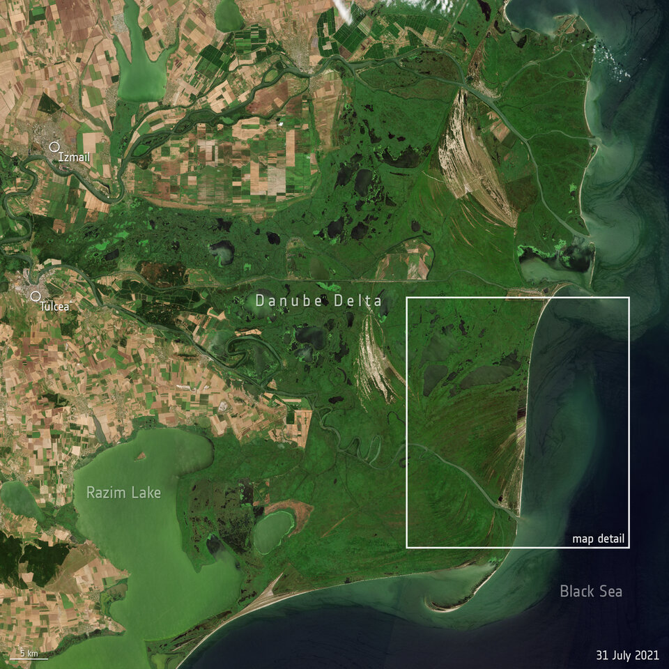
Deemed a UNESCO Biosphere Reserve, the Danube Delta is one of the most important ecosystems of its kind and, like many other deltaic areas across the globe, has seen its share of human pressure over the past decades. Reduced sediment inputs in coastal areas have led to an increased fragility and expansion of erosion which need to be carefully monitored.
The Space for Shore project, funded by ESA, provides a variety of tools for monitoring coastal erosion using Earth observation products. The consortium is composed of technical experts from five European countries. During the first phase of the project, one of the key areas of interest was investigating the Danube Delta wetland and its coastline.
Terrasigna, in collaboration with the Sfântu Gheorghe Marine and Fluvial Research Station, processed and analysed more than 200 individual satellite images – including data from the Copernicus Sentinel-2 mission and the US Landsat 5 and Landsat 8 missions.
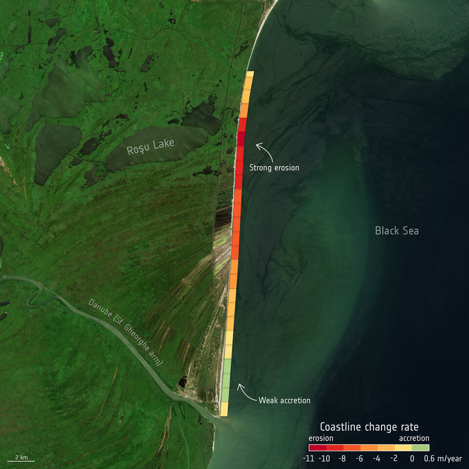
This long time-series covered a period of 30 years, spanning from 1990 until 2020, and extended over 130 km of coastline.
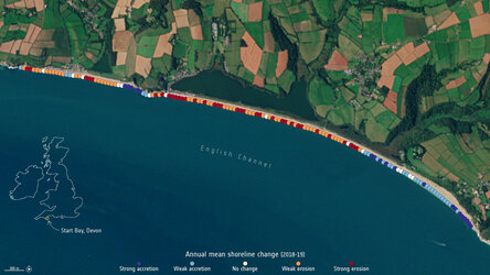
Thanks to the large number of observations available, the team were able to detect the complex dynamics of change patterns in the delta. While some areas saw constant periods of erosion, some regions experienced varying magnitudes of erosion and accumulation over the 30 years. For the first time, the team were able to pinpoint sections that were stable, or on the contrary, had accelerated their erosion rate.
The results show that the Danube Delta, between Sulina and Cape Midia, is characterised mainly by erosion processes. Only approximately 38% of this part is accumulative, while the rest was erosive. The maximum observed shoreline retreat was 330 m, which translates to roughly 11 m of erosion per year. On the opposite side, the maximum accretion rates barely exceed 4 m per year.
Therefore, the highest shoreline advances were observed in the southern part of the region, where the beach advanced more than 120 m over the course of 30 years.
Although other factors contribute to the distribution of erosion and accumulation areas along the Danube Delta, a good correlation between rates of erosion and the stability of the submerged sandbars were observed by the team.
The high number of observations allowed the team to compare different patterns of coastal sedimentary dynamics and behaviour which could not have been possible using the standard surveying techniques. These include the extent of accumulation rates induced by the 2005-2006 historical river floods, the impact of high-energy storms and the subsequent beach recovery after these events.
These results where then validated based on in situ measurements and very high-resolution imagery, with the results showing high accuracies for both indicators, which supports the utility of Earth observation data for such studies.
Sorin Constantin, Earth observation data scientist at Terrasigna, commented, “Such capabilities offered by satellite missions and the finesse achieved by the tools developed are valuable for a better management of coastal areas, not only in the Danube Delta region, but also for the more tourist locations in southern Romanian. Here, due to erosion intensification, measures were made in order to combat the loss of beach area.
“During the last years, extensive nourishment activities were undertaken for multiple sectors. Providing detailed analyses concerning coastal dynamics to the authorities, with the help of Earth observation satellites, will hopefully lead to better decision-making in terms of coastal protection.”
Olivier Arino, Senior Advisor for ESA’s Directorate of Earth Observation Programmes, added, “The latest report from the Intergovernmental Panel on Climate Change predicts an increase of sea level rise ranging from half a metre to one metre by the end of the century. This would only increase the erosion of coastal areas as part of this study, and many other areas worldwide. Thanks to satellite data available and the Space for Shore project, we are able to provide evidence-based up-to-date information for the extent of erosion for coastal managers across the region.”
This research was presented at ESA’s Living Planet Symposium taking place this week in Bonn, Germany. Those attending are hearing about the latest scientific findings on our planet and how observing Earth from space supports environmental research and action to combat the climate crisis. They are also hearing about novel space technologies and about the new opportunities emerging in the rapidly changing sector of Earth observation.
Selected sessions are being livestreamed, see ESA’s Web TV channels.