
Just add AI for smarter satnav... from rogue drone detection to safer driving
With our society producing more data than ever before, Artificial Intelligence, AI, is allowing us to gather, analyse and make use of it in novel ways, including in space programmes. Now AI is also being applied to satellite navigation by the engineering teams of ESA’s NAVISP programme, working with European industry and academia to invent the future of navigation. The result is a growing portfolio of prototype services, variously employed to improve space and Earth weather forecasting, enhance the performance of autonomous cars and boats, and help identify rogue drones in sensitive airspace.
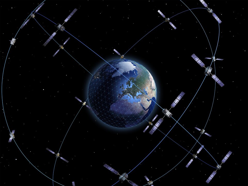
Satellite navigation is a ubiquitous presence in all our lives, employed for so much more than simply transportation, from precision farming to managing power grids, financial trading to communication links. Signals from space are processed through complex mathematical models using highly precise algorithms to yield centimetre-level accuracy – under optimal signal conditions.
ESA’s Navigation Innovation and Support Programme, NAVISP, seeks to improve European competitiveness across the entire Positioning, Navigation and Timing, PNT, domain by developing novel products, systems, and services. One way to do this and make satnav performance even better is by combining Global Navigation Satellite Systems, GNSS, with other technologies, from inertial sensors and machine vision to 5G and 6G and now, increasingly, Artificial Intelligence – AI.
“AI comprises all techniques enabling computers to mimic intelligence, whether they be data analysis systems or the embedded intelligence overseeing an autonomous vehicle,” explains Rafael Lucas Rodriguez, Head of the NAVISP Technical Programme Office.
“What AI is very good at, through so-called Machine Learning, ML, is extracting meaningful information to identify useful patterns that would otherwise have gone unseen. Satellite navigation is among the fields yielding large amounts of data, so within our sector AI could also serve as the basis of novel approaches and services.”
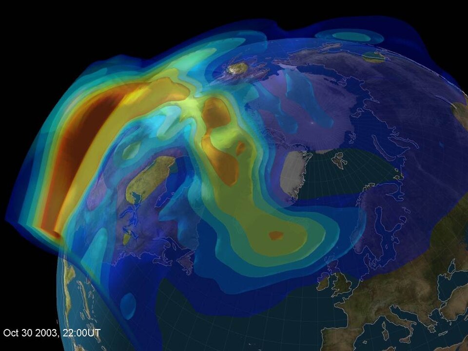
Sifting space weather data
The first step is to access useful data, and the more data the better, in order to better train ML models. NAVISP’s CAMALIOT project is based on an Android app that collects raw GNSS data from participating smartphones. People were encouraged to become ‘citizen scientists’ simply by leaving their phones on and beside a window overnight, so that the app can acquire raw GNSS data via their phones’ inbuilt satnav receiver. More than 12 000 volunteers have participated to date, yielding more than 131 billion measurements covering Europe and the globe.

The next step has been to apply ML to look for patterns in the data related to variations in the ionosphere – an electrically active segment of Earth’s atmosphere, which can affect the propagation of GNSS signals – due to space weather, as well as weather effects in the troposphere closest to Earth’s surface, such as ‘rain fade’. The results have the potential to improve the accuracy of both Earth and space weather forecasting.
AI sharpening automotive positioning
NAVISP’s AIGNSS project has applied AI-enabled algorithms to one of the most safety-critical aspects of PNT research: boosting the performance of GNSS positioning in the service of autonomous driving. Satnav is a baseline technology for assisted and autonomous driving, allowing vehicles to estimate where they are and how fast they are going, typically employed in combination with other positioning methods such as inertial sensors, cameras and radar, and other signals of opportunity.

The problem is that GNSS performance can vary widely based on the surrounding environment. The smooth faces of buildings and other artificial structures can cause misleading signal reflectance – known as ‘multipath’ – while city centre ‘urban canyons or thick tree cover can reduce the number of satellites visible in the local sky.
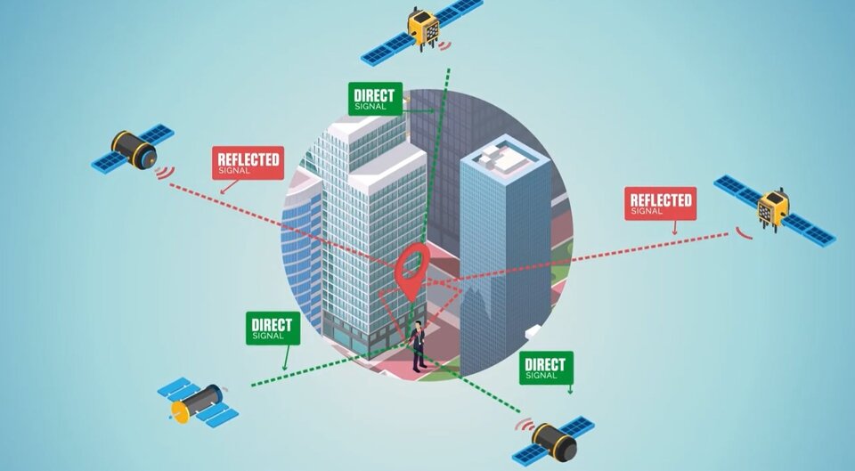
The AIGNSS project gathered real-world driving data using multiple satnav constellations, including Europe’s Galileo, and frequencies from a variety of roadways settings in the UK, then applied sophisticated signal analysis to identify multipath interference and estimate ranging error. Adding AI to the various algorithms used led to performance improvements, although not substantial in character.
Rafael Lucas explains: “These outcomes do perform valuable knowledge for successful algorithm development, and the establishment for a multi-purpose, multi-device testbed for data acquisition and processing.”

Steering into future waters
AI and ML is also being applied to the study of autonomous shipping in the world’s first dedicated test area, set up with NAVISP support. The Trondheimsfjorden Autonomous Vessel Test Area, based in a Norwegian fjord, has been equipped with advanced technologies including communication infrastructure, positioning sensors and technologies and Internet of Things connectivity to capture everything that occurs within the waterway.
ML is being used to analyse test outcomes, to understand any deviations from planned performance, while also being applied to the embedded intelligence steering the vessels themselves.

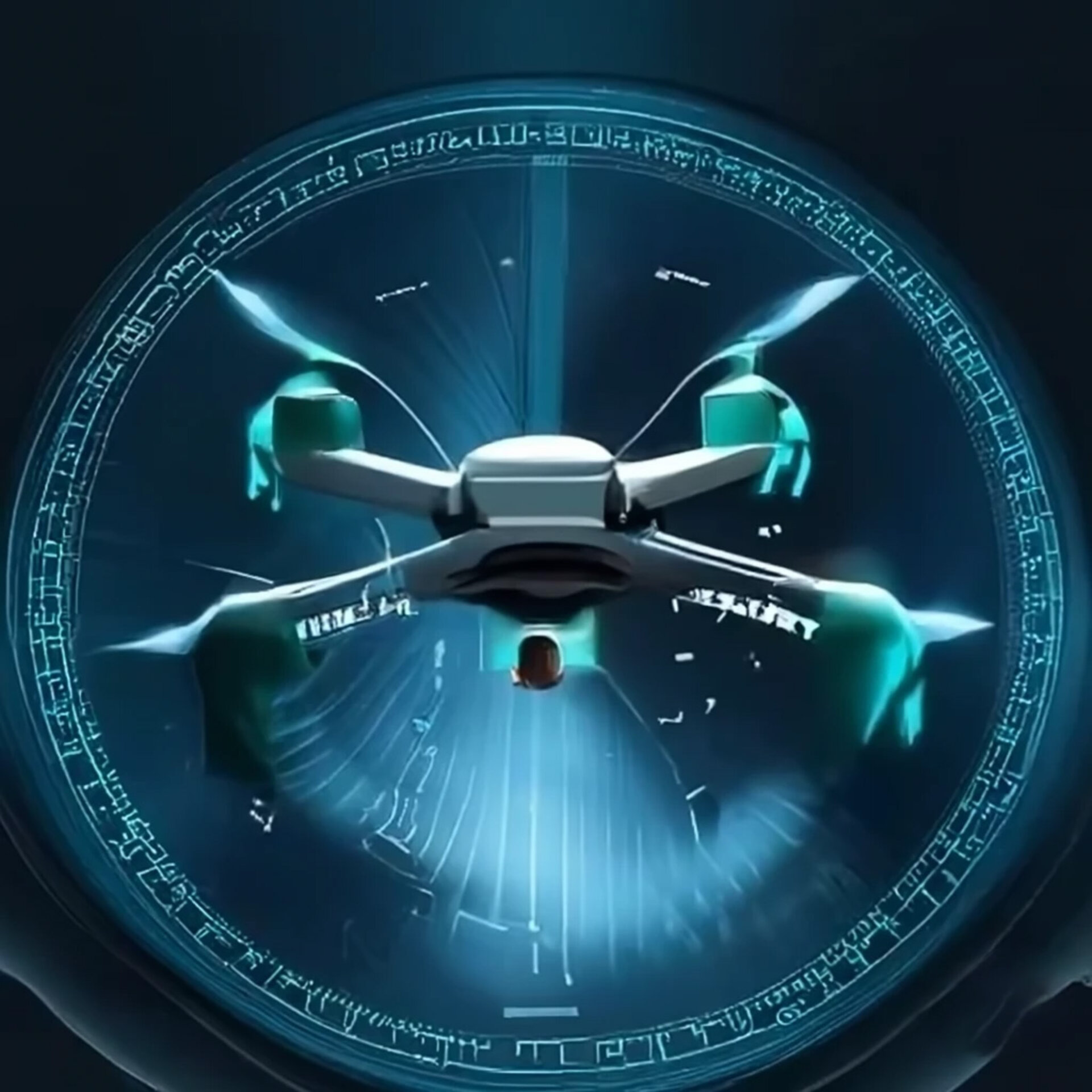
AI watches the skies
Meanwhile NAVISP’s MEDuSA project is looking skyward, to try and counter the growing problem of intrusive drones. The incidence of accidental or intentional intrusion of drones onto sporting events, ports or other critical infrastructure is increasing. Gatwick Airport in the UK was closed for three days in December 2018 and hundreds of flights were cancelled following the repeated sighting of drones around airport runways.
MEDuSA offers a means of detecting drones in all visibility conditions, as well as estimating their trajectories through an innovative radar-based approach where GNSS signals are employed as the radar signal source of opportunity for sensors to detect around the area of interest – favouring Galileo signals in particular because of their highly stable signals plus their added-value Open Service Navigation Message Authentication service in preparation, offering robustness and protection against spoofing attacks. MEDuSA algorithms spot drones through ‘forward scattering detection’ caused by their passage, involving the detection of slight signal phase anomalies.
ML, combined with predictive ‘Kalman filters’, take this data to derive the drone’s onward trajectory, allowing an alarm to be raised and countermeasures deployed.


Access the video
About NAVISP
ESA navigation specialists are supporting cutting-edge European companies in the development of new navigation technologies and services – in support of Europe's industrial competitiveness, autonomy, and leadership. The result is ESA’s Navigation Innovation and Support Programme, NAVISP.
NAVISP is looking into all kinds of clever ideas about the future of navigation: ways to improve satellite navigation, alternative positioning systems and new navigation services and applications.
For more information, visit the NAVISP webpage.