Agency
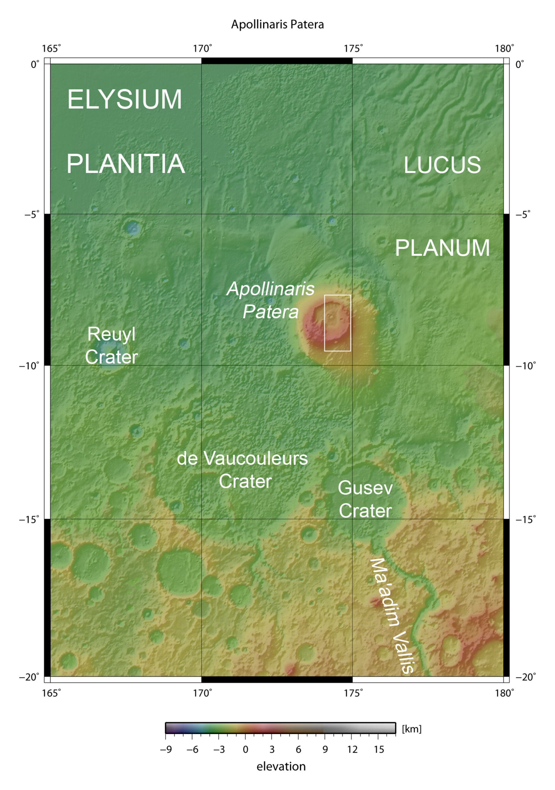
Map showing Apollinaris Patera in context
This map shows the location of Apollinaris Patera, a volcano lying at approximately 7.2° South and 174.6° East. It is an ancient shield volcano located at the northern edge of the Southern Highlands, lying to the south-east of Elysium Planitia and to the north of Gusev Crater. The volcano measures approximately 180 by 280 kilometres at its base and rises to a maximum of 5 kilometres above the surrounding terrain.
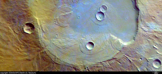
Apollinaris Patera caldera in false colour

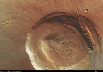
Apollinaris Patera caldera (north to the right)
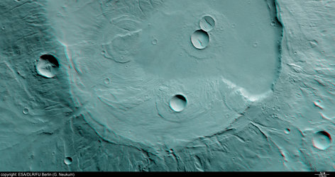
Apollinaris Patera caldera, 3D anaglyph

Apollinaris Patera caldera, black and white