Science & Exploration
Reull Vallis
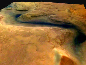
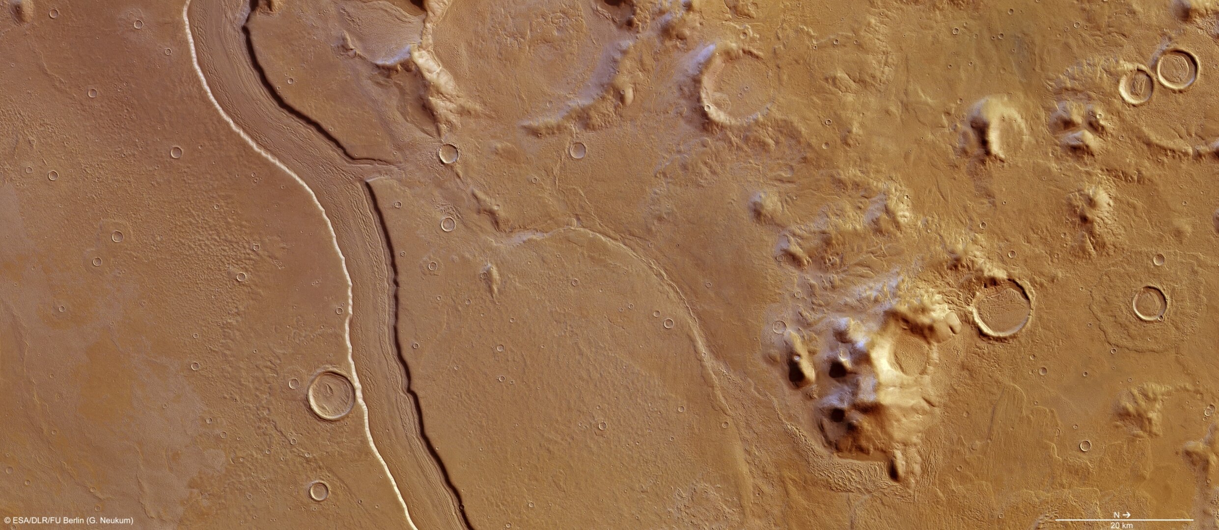
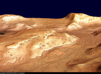
High-Resolution Stereo Camera (HRSC) nadir and colour channel data taken during revolution 10657 on 14 May 2012 by ESA’s Mars Express have been combined to form a natural-colour view of Reull Vallis. Centred at around 41°S and 107°E, the image has a ground resolution of about 16 m per pixel. The river-like channel is believed to have been formed by flowing water, which at some distant epoch cut through highland terrain and successively formed smooth plains. With a width of close to 7 km and a depth of around 300 m, the valley floor shows clear linear features believed to be ice-rich, and formed by debris and ice in a manner not dissimilar to the formation of glacial valleys on Earth.

Perspective view of Reull Vallis
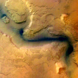
Reull Vallis - HRSC image 15 January 2004
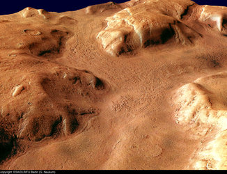
Perspective view of Reull Vallis, looking south-east
Perspective view of Reull Vallis, looking west