United space in Europe
Subsidence in Denmark
Applications

Subsidence in Denmark

01/06/2016 1560 views 11 likes 361236 ID
  • HI-RES JPG [627.65 kB]

Thank you for liking

You have already liked this page, you can only like it once!

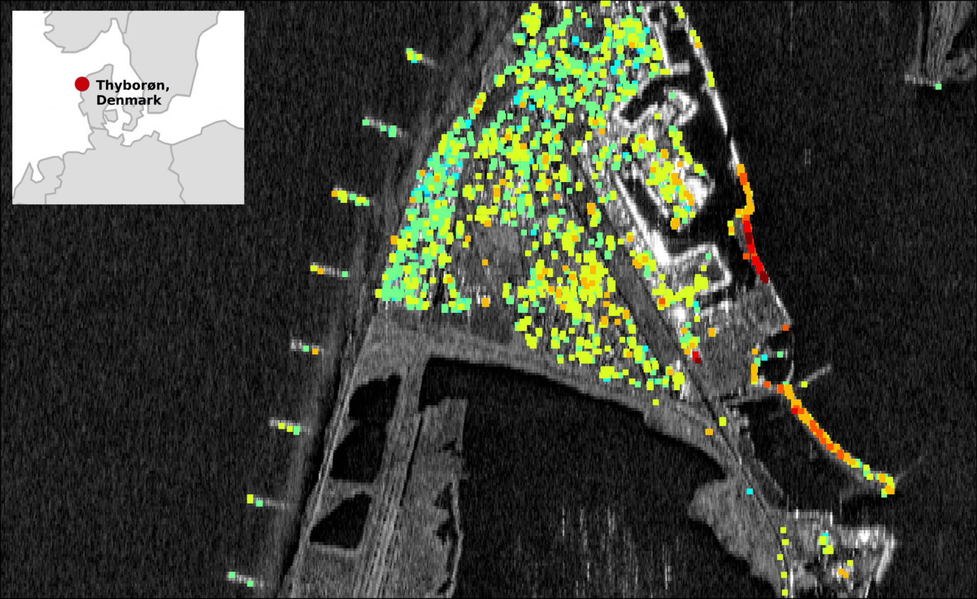
This map shows Thyborøn in Jutland, Denmark, where each coloured square is a measurement of the ground deformation. Green is stable, warmer colours indicate subsidence, and colder colours show uplift. A trend from stable in the west to subsidence in the east can be seen. This causes problems for wastewater pipes in the area. There is also a high rate of subsidence around the harbour. Sentinel-1A images from March 2015 to March 2016 were used to generate this map.

Read full story: Mapping that sinking feeling

  • contains modified Copernicus Sentinel data (2015–16), processed by ESA SEOM INSARAP study/PPO.labs /Norut/SDFE, CC BY-SA 3.0 IGO
  • Observing the Earth
  • Sentinel-1
Subsidence from salt mining
Applications

Subsidence from salt mining

Image 1526 views 11 likes
San Francisco displacement
Applications

San Francisco displacement

Image 14363 views 30 likes
Vulnerable shores
Applications

Vulnerable shores

Image 1312 views 6 likes
Millennium Tower sinking
Applications

Millennium Tower sinking

Image 13158 views 48 likes
Tracking every move
Applications

Tracking every move

Image 3661 views 23 likes