Strengthening drought resilience in Ethiopia
The majority of the seven million inhabitants of the Afar and Somali regions of Ethiopia are livestock farmers and depend on semi-mobile livestock for their livelihoods. But their economic and social systems are under pressure due to population growth and the impact of climate change, which is linked to increasing frequency and severity of droughts and floods.
In collaboration with the Ethiopian Ministry of Agriculture, GIZ has developed a programme to strengthen drought resilience and help local people deal with this situation. One of the aims is to rehabilitate degraded water catchment areas and pasture areas in dry valleys.
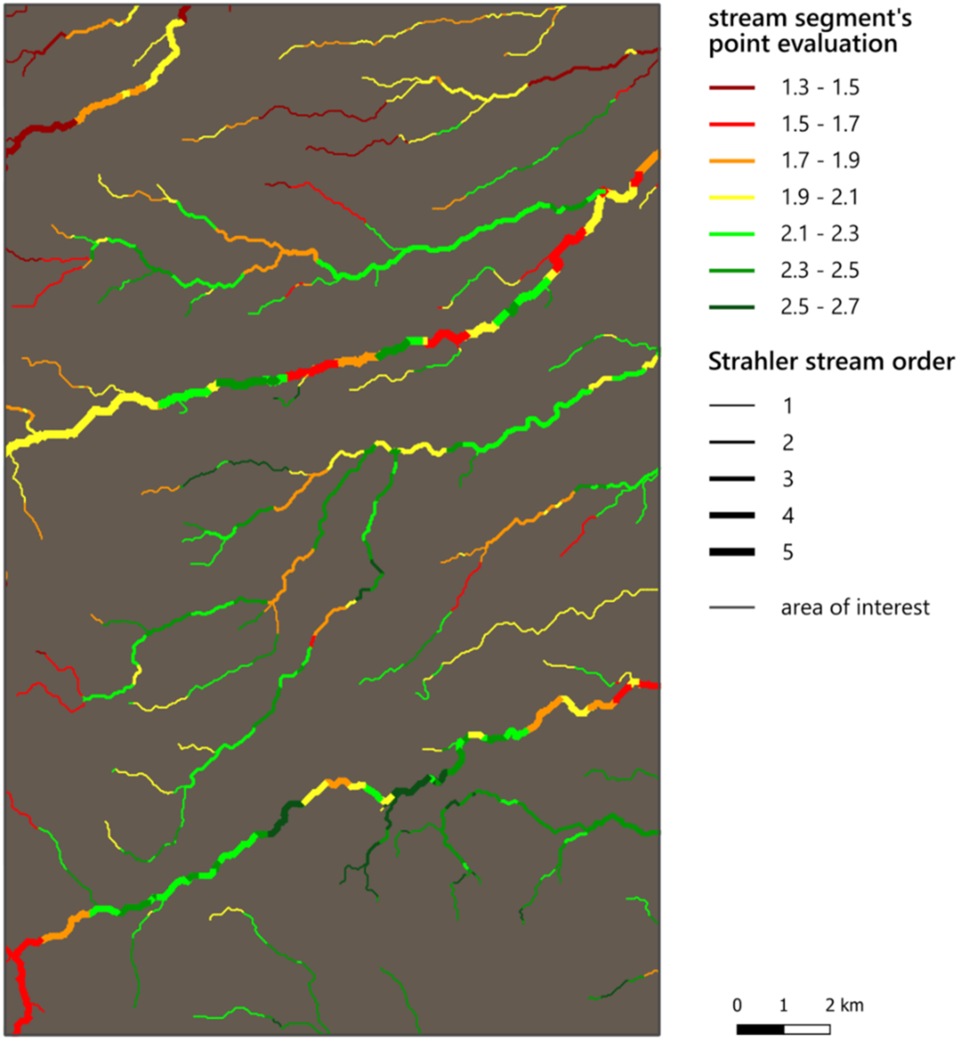
In 2020, ESA's EO Clinic service providers Everis (Spain), GREENSPIN (Germany) and World from Space (Czech Republic) supported GIZ and its Ethiopian partners by providing information derived from satellite data that could be used to prioritise and select intervention sites. The team delivered Earth observation mapping products on riverbed locations, soil type, agricultural cultivation, road networks, settlements, and more, using a series of global and local datasets. The ultimate aim was to support GIZ Ethiopia and its partners in their selection of sites for the construction of weirs – small dams built across rivers to control the upstream water level.
This map of an area in Ethiopia is partly based on satellite data and was produced in the EO Clinic project for GIZ. It shows the suitability of different river segments for rehabilitation intervention, ranging from low (dark red) to high (dark green). The thickness of the lines are proportional to the river/stream size based on their hierarchy of tributaries.