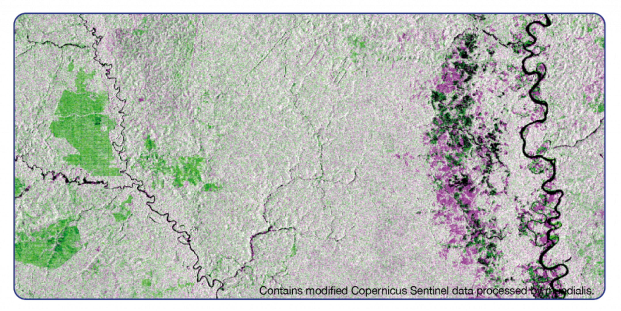
Forest growth and loss
This image from Copernicus Sentinel-1 shows forest (re)growth in green and forest loss in pink.
It is an example application of the HERMOSA platform, which German companies mundialis and terrestris began developing in 2018 as part of an ESA Business Applications activity. At first, HERMOSA was a system that used satellite imagery to locate degraded land and areas prone to food insecurity. But over the last three years, HERMOSA has grown into a complete four-in-one platform that identifies areas in need of restoration, provides practical assistance when planning and implementing a restoration project, enables the monitoring and reporting of plant growth, and shares information on best practices.
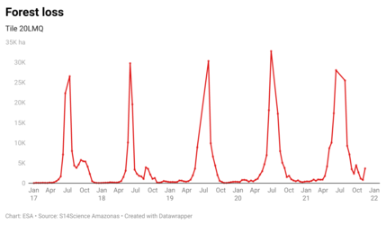
HERMOSA uses data from many satellites, including the Copernicus Sentinel-1 and -2 missions, to create maps of land cover and land use, including areas covered by forest. This enables users of the platform to monitor deforestation, forest degradation and forest gain, helping decision makers to locate areas in need of restoration, as well as to monitor logging and tree growth.