Guidance from above for saving energy on Earth
Space technologies can be used to help conserve energy here on Earth. Systems are already available to track energy use and to deliver real-time energy conservation advice using satellite navigation.
ESA has supported a range of companies as they develop business ideas for smart energy use, and the Agency continues to support the Galileo Masters competition for innovative use of satellite navigation.
Carbon Diem, is a smartphone app developed by the ESA-supported company Carbon Hero. The app is the first automated carbon calculator. It monitors the person’s movements but still guarantees the carrier’s privacy.
The software uses satellite navigation data to calculate the environmental impact of travel. It can figure out what kind of transport is being used, and how much energy that consumes, with very little input from the user. The carbon footprint of the user can then be calculated.
Reporting carbon footprint is mandatory in some countries as companies are asked to demonstrate more careful use of energy. Showing a cautious attitude towards energy use can also help improve customer and consumer confidence in a company.

Satellite navigation has also been used to improve efficiency of cars – not by changing the mechanics but by improving driver behaviour. Systems such as GreenDrive have been created to help drivers make the most of their fuel.
GreenDrive combines information on where a vehicle is located, what the road conditions are, and the type of car being used, to calculate and advise the driver on the most economical driving style to use. An audio prompt tells the driver when to accelerate, when to brake , and when to keep speed constant. Its inventors say these smooth and safe driving techniques can lead to energy savings of 15-25%.

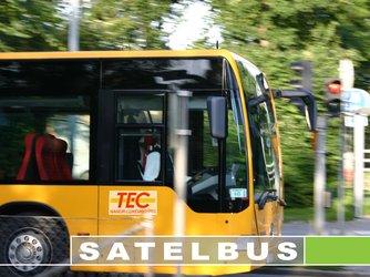
One good way of economising on fuel is to travel in groups. Whilst public transport is practical in large cities with dense populations, it becomes a little trickier when users live far apart and want to travel at different times. Some areas provide a bus-on-demand service, and space technology can make for a more efficient and convenient service.
ESA’s Belgian national technology transfer partner, Creaction, managed a Canadian-Belgian initiative, the SatelBus – a satellite-based on-demand bus services project.
Using ESA’s Artemis satellite, SatelBus allowed passengers to place a request with a call centre and be included in the bus route almost immediately. The changes in schedule were managed by software every five minutes which could then send a new bus route directly to the driver out on the road.
The SatelBus demonstration phase was partly funded by ESA. It united a satellite space segment, operated by Vitrociset EPB and satellite communication terminals provided by EMS Satcom Inc., as well as hub equipment to be installed at the ESA ground station at Redu, in Belgium.
The system was successful in tests in Belgium and France in 2006, when SatelBus-equipped buses serviced rural areas for six months.