• → European Space Agency

      • Space for Europe
      • Space News
      • Space in Images
      • Space in Videos
    • About Us

      • Welcome to ESA
      • DG’s blog
      • For Member State Delegations
      • Business with ESA
      • Law at ESA
      • ESA Exhibitions
      • ESA Publications
      • Careers at ESA
      • ESAshop
    • Our Activities

      • Space News
      • Observing the Earth
      • Human and Robotic Exploration
      • Space Transportation
      • Navigation
      • Space Science
      • Space Engineering & Technology
      • Operations
      • Telecommunications & Integrated Applications
      • Preparing for the Future
    • Careers at ESA

    • For Media

      • Media
      • ESA TV
      • Videos for professionals
      • Photos
    • For Educators

    • For Kids

    • ESA

    • Observing the Earth

    • Copernicus

    • Sentinel-1

    • Radar vision
    • Introducing Sentinel-1
    • Applications
    • Oceans and ice
    • Changing lands
    • Emergency response
    • About the mission
    • Facts and figures
    • Satellite constellation
    • Instrument
    • About the launch
    • Operations and data
    • Data flow
    • Data products
    • Multimedia
    • Image gallery
    • Video gallery
    • Downloads
    • 2019 calendar
    • Documents & publications
    • Services
    • Subscribe

    ESA > Our Activities > Observing the Earth > Copernicus > Sentinel-1

    Sentinel-1A spots potential oil slick from missing EgyptAir plane

    Sentinel-1A detects slick
    20 May 2016

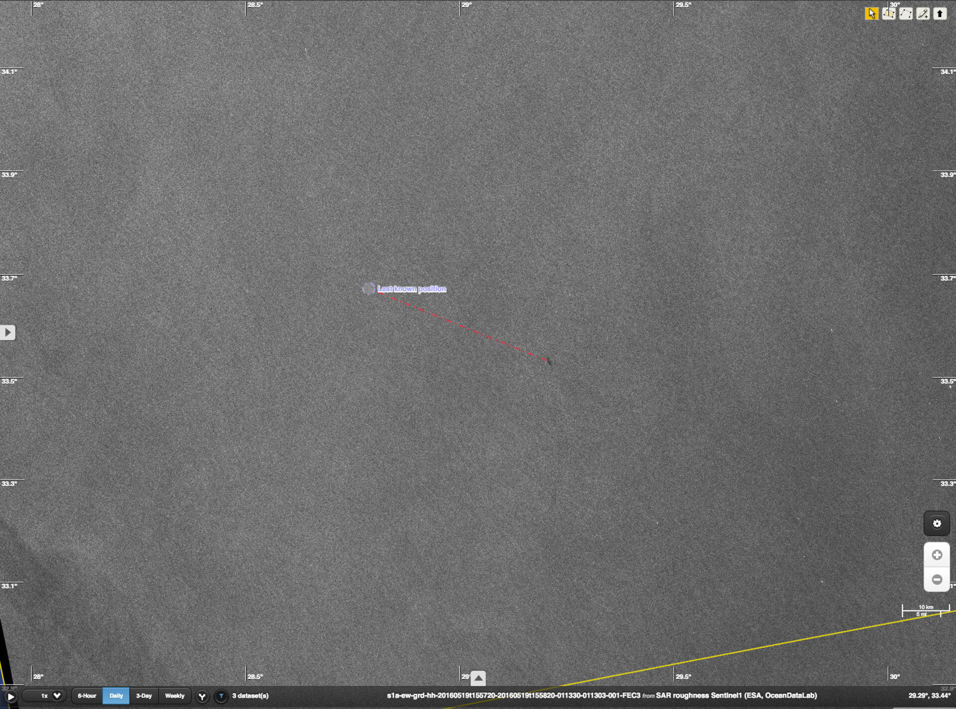
    The Sentinel-1A radar satellite has detected a potential oil slick in the eastern Mediterranean Sea – in the same area where EgyptAir flight MS804 disappeared early yesterday morning on its way from Paris to Cairo.

    The image was acquired by Sentinel-1A yesterday at 16:00 GMT (18:00 CEST).

    ESA has given information related to the image to the relevant authorities to support the search operations.

    Since the plane disappeared, ESA and experts have been scrutinising satellite data to see if anything could be found to indicate wreckage or oil floating on the sea.

    According to the satellite image, the slick was at 33°32' N / 29°13' E – about 40 km southeast of the last known location of the aircraft. The slick is about 2 km long.

    Closer view of slick (zoom in of above image)

    There is, however, no guarantee that the slick is from the missing aircraft.

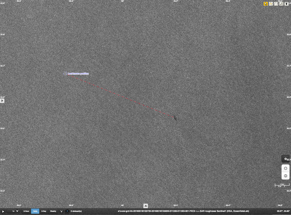
    A second image (not shown here) from this morning at 04:00 GMT (06:00 CEST) shows that the slick has drifted by about 5 km.

    The Sentinel-2A satellite will pass above the same area on 22 May, and experts will continue to study the images returned for further clues.

    Both Sentinel satellites were launched as part of Europe’s environmental monitoring Copernicus programme, led by the European Commission.

    ESA and the European Commission have released this information in parallel.

    Rate this

    Views

    Share

    • Currently 4.5 out of 5 Stars.
    • 1
    • 2
    • 3
    • 4
    • 5
    Rating: 4.7/5 (179 votes cast)

    Thank you for rating!

    You have already rated this page, you can only rate it once!

    Your rating has been changed, thanks for rating!

    28830
    Tweet
    • Sentinel-1
    • Sentinel-2
    • Sentinel data access
    • Related links
    • OceanDataLab
    • App Store
    • Subscribe
    • mobile version
    • ESA Observing the Earth Twitter

    @ESA_EO

    • FAQ

    • Site Map

    • Contacts

    • Terms and conditions