• → European Space Agency

      • Space for Europe
      • Space News
      • Space in Images
      • Space in Videos
    • About Us

      • Welcome to ESA
      • DG’s blog
      • For Member State Delegations
      • Business with ESA
      • Law at ESA
      • ESA Exhibitions
      • ESA Publications
      • Careers at ESA
      • ESAshop
    • Our Activities

      • Space News
      • Observing the Earth
      • Human and Robotic Exploration
      • Space Transportation
      • Navigation
      • Space Science
      • Space Engineering & Technology
      • Operations
      • Telecommunications & Integrated Applications
      • Preparing for the Future
    • Careers at ESA

    • For Media

      • Newsroom
      • ESA TV
      • Videos for professionals
      • Photos
    • For Educators

    • For Kids

    • ESA

    • Observing the Earth

    • Copernicus

    • Sentinel-2

    • Colour vision
    • Introducing Sentinel-2
    • Applications
    • Plant health
    • Changing lands
    • Water bodies
    • Disaster mapping
    • About the mission
    • Facts and figures
    • Satellite constellation
    • Instrument
    • About the launch
    • Operations and data
    • Data flow
    • Data products
    • Essential groundwork
    • Multimedia
    • Image gallery
    • Video gallery
    • Downloads
    • 2019 calendar
    • Documents & publications
    • Services
    • Subscribe

    ESA > Our Activities > Observing the Earth > Copernicus > Sentinel-2

    Sentinel-2 delivers first images

    First image from Sentinel-2A
    29 June 2015

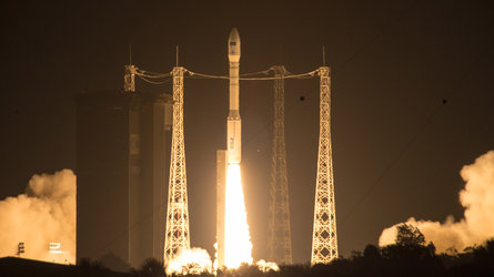
    Just four days after being lofted into orbit, Europe’s Sentinel-2A satellite delivered its first images of Earth, offering a glimpse of the ‘colour vision’ that it will provide for the Copernicus environmental monitoring programme.

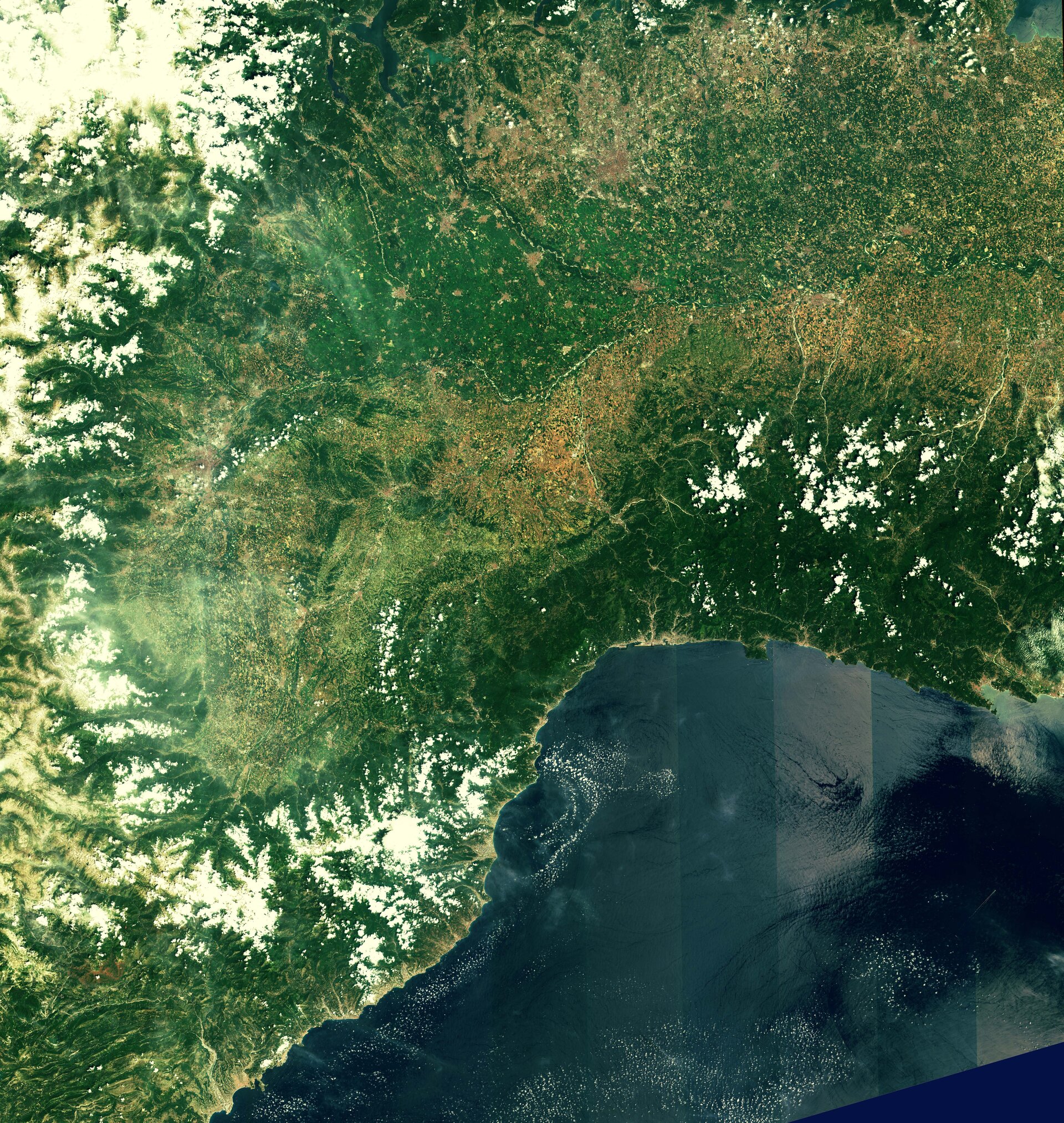
    With a swath width of 290 km, the satellite’s first acquisition began in Sweden and made a strip-like observation through central Europe and the Mediterranean, ending in Algeria.

    The data were relayed in real time to Italy’s Matera ground station, where teams eagerly awaited their arrival for processing.

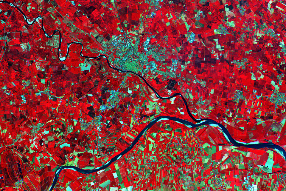
    While northern and central Europe were mostly cloudy, Italy’s typical sunny weather allowed the teams to get their first glimpse of the multispectral instrument’s capabilities over the northwestern part of the country and the French Riviera – and they were excited by what they saw. With a ground resolution of 10 m per pixel, the images show individual buildings in Milan, agricultural plots along the Po River, and ports along the southern French coast.

    Milan, Italy

    “This new satellite will be a game changer in Earth observation for Europe and for the European Copernicus programme,” said Philippe Brunet, Director for Space Policy, Copernicus and Defence at the European Commission.

    The Director of ESA’s Earth Observation Programmes, Volker Liebig, commented, “Sentinel-2 will enable us to provide data for the programme’s land monitoring services and will be the base for a wide spectrum of applications reaching from agriculture to forestry, environmental monitoring to urban planning.”

    French Riviera

    The multispectral imager is being calibrated during the commissioning phase – which will take about three months to complete – but the quality of these first images already exceeds expectations.

    In addition to demonstrating the imager’s high resolution, these initial data also foreshadow the mission’s land-monitoring applications in areas such as agriculture, inland and coastal waters and land-cover mapping.

    The imager’s 13 spectral bands, from the visible and the near infrared to the shortwave infrared at different spatial resolutions, take land monitoring to an unprecedented level. In fact, Sentinel-2 is the first optical Earth observation mission of its kind to include three bands in the ‘red edge’, which provide key information on the state of vegetation.

    Po Valley, Italy

    This weekend’s activities also demonstrated that the operational processor works flawlessly, paving the way for the mission’s systematic data generation to come.

    Sentinel-2A is the second satellite for Europe’s Copernicus programme, following the Sentinel-1A radar satellite launched last year.

    Designed as a two-satellite mission, Sentinel-2 will provide optical imagery on a five-day revisit cycle once its twin, Sentinel-2B, is launched in 2016.

    Rate this

    Views

    Share

    • Currently 4.5 out of 5 Stars.
    • 1
    • 2
    • 3
    • 4
    • 5
    Rating: 4.7/5 (153 votes cast)

    Thank you for rating!

    You have already rated this page, you can only rate it once!

    Your rating has been changed, thanks for rating!

    45898
    Tweet

    Related articles

    Flight director and project rep watching mission progress from the Main Control Room at ESOC during the Sentinel-2A liftoff, 23 June 2015

    Sentinel-2A completes critical first days in space26 June 2015

    Flight director and project rep watching mission progress from the Main Control Room at ESOC during the Sentinel-2A liftoff, 23 June 2015

    Sentinel-2A completes critical first days in space26 June 2015 Last night marked the end of Sentinel-2A's first three days in space, which saw teams on the ground working around the clock to ensure the spacecraft is ready for its 'colour vision' mission.

    Second Copernicus environmental satellite safely in orbit23 June 2015

    Second Copernicus environmental satellite safely in orbit23 June 2015 The ESA-developed Sentinel satellite – Sentinel-2A – was launched today, adding a high-resolution optical imaging capability to the European Union Copernicus environmental monitoring system.

    • Copernicus
    • Sentinel-2
    • Sentinel data access
    • Related links
    • European Commission Copernicus site
    • Airbus
    • Follow us
    • #Sentinel2
    • App Store
    • Subscribe
    • mobile version
    • ESA Observing the Earth Twitter

    @ESA_EO

    • FAQ

    • Site Map

    • Contacts

    • Terms and conditions