
Earth from Space: Ocean link
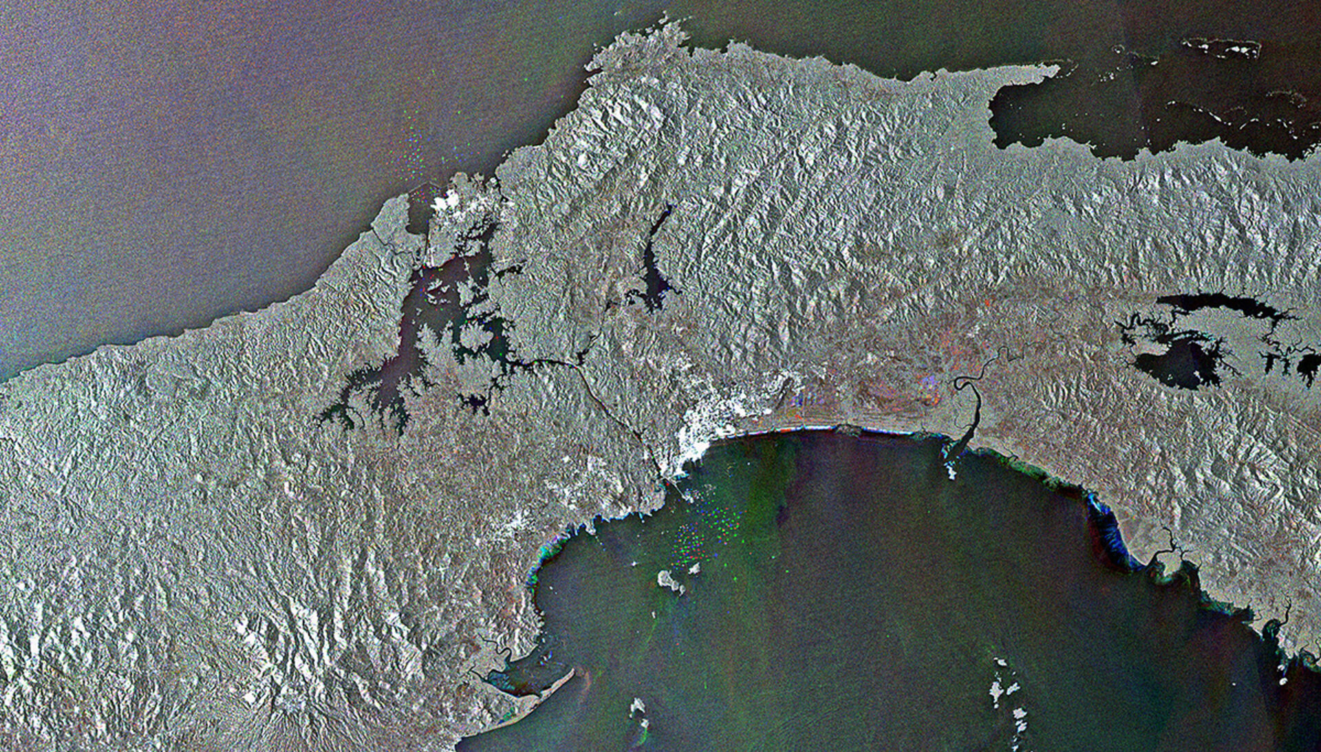
Central Panama and its 80 km-long ship canal that connects the Atlantic – via the Caribbean Sea – and Pacific Oceans are pictured in this Envisat image.
Completed in 1914, the Panama Canal is one of the greatest engineering projects of the last century. ‘Locks’ at either end of the waterway are used to lift entering ships up to the canal’s level of 26 m, and lower them to sea level as they exit.
The canal sees 12 000–15 000 vessels pass every year. It takes an average of 8–10 hours for a ship to transit.
On either end of the canal, ships that are entering, exiting and waiting to cross the waterway appear as dots of red, green and blue. We can even see them in the channel and in the large Lake Gatun.
The artificial Lake Gatun was created between 1904 and 1914 as part of the water system for the Panama Canal. Because Panama has a winter dry season, the surplus water stored in the Lake helps keep the locks operating.
Also near either end of the canal, high radar reflections appear as clusters of white dots at Panama City on the southern shore and Colon on the northern shore.
The Central American nation is about the size of the Czech Republic. It enjoys a tropical climate, and is an attractive tourist destination for its beaches, mountains and rainforests.
In the 1940s, nearly 70% of Panama was covered by forests. Today, forests cover less than half of the country, mainly due to logging operations, infrastructure development and cattle ranching.
Forests play a crucial role in Earth’s carbon cycle by absorbing carbon from the atmosphere and the reduction of forest cover can have major negative effects on our climate.
This image is a compilation of three images from Envisat’s radar acquired on 24 December 2011, 23 January 2012 and 22 February 2012.
This image is featured on the Earth from Space video programme.

