Landslide warnings from satellites may save lives
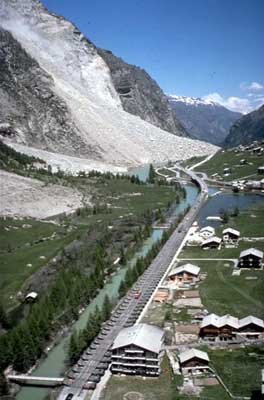
As winter rains come, thousands of square kilometres of territory across Europe's heart face a looming threat: steep slopes and waterlogged soils combine to trigger landslides.
A build-up of groundwater within a slope increases its weight and decreases its cohesiveness, weakening the slope's ability to resist the remorseless pull of gravity. The heavy earth flows downward. For all in the path of a landslide the results are devastating, and frequently lethal.
"In Italy, landslides have claimed an average of 54 victims per year during the last half century," says Nicola Casagli of Italy's National Group for Hydro-geological Disaster Prevention (GNDCI),a research network working with Italy's Civil Protection Department.
"The extreme rainfall of our climate, our mountainous geography and recent uncontrolled urbanisation of unstable land makes us one of the countries most affected by landslide hazards. The total cost of direct damage done by Italian landslides is estimated at between one and two thousand million Euro per year."
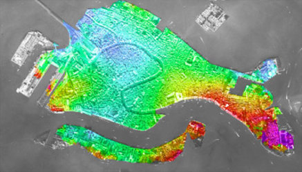
Very gradual ground shifts are known to precede more major landslides. Often these are on a scale of millimetres – too slight to even be noticed by local observers, but enough to be detected via satellite using a powerful technique called radar interferometry.

It involves mathematically combining multiple radar images of the same site - acquired using instruments such as the Synthetic Aperture Radar (SAR) aboard ESA's ERS spacecraft - in such a way that tiny changes in the landscape occurring between images are highlighted.
This technique is the basis of a new project called Service for Landslide Monitoring (SLAM), enabling landslide susceptibility mapping across parts of Italy and Switzerland, two of the European countries most under threat. GNDCI is one of three national-level users working with SLAM, along with Italy's Ministry of the Environment and Switzerland's Federal Office for Water and Geology (FOWG).
"Surface movements assessed over wide areas are one of the best indicators of landslide activity, and can be employed for risk forecasting," added Casagli. "Extremely slow movements usually occur for several weeks or months before a sudden collapse."
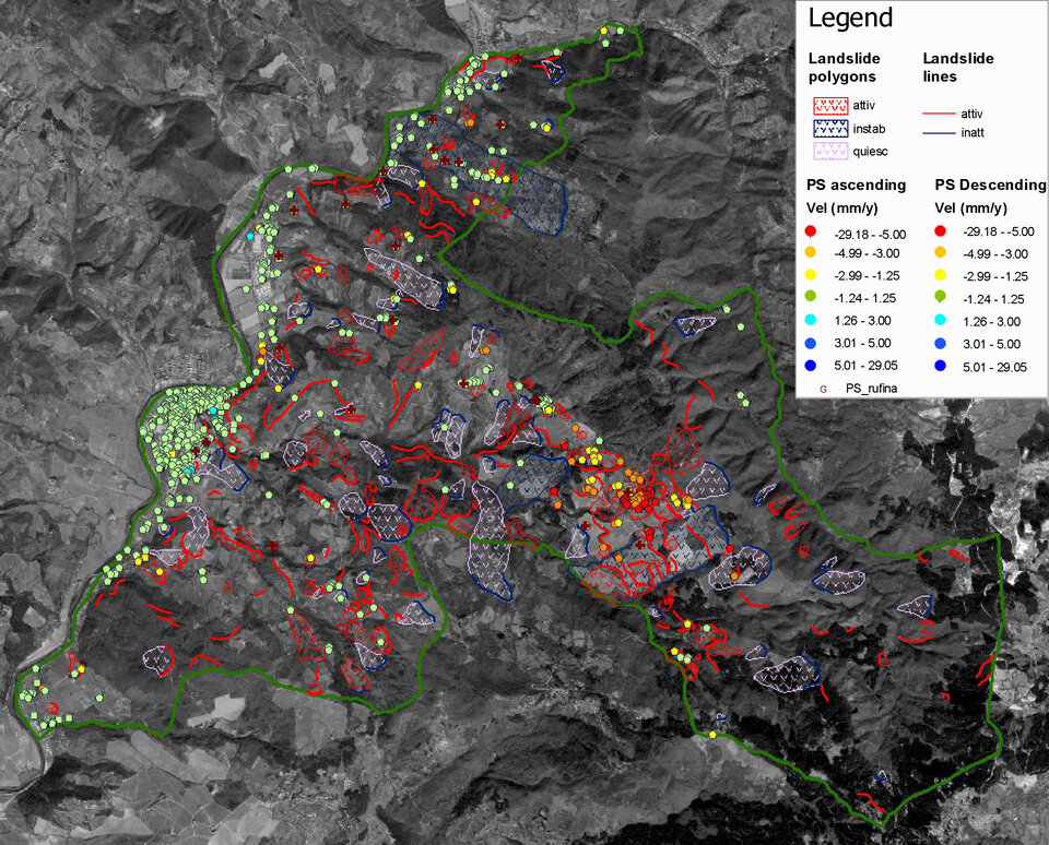
Trial services are being provided across Italy's Arno river basin as well as a section of the Campania region. In Switzerland the service covers the eastern Valais and Berne cantons.

"Our interest is to have a tool evaluate landslides and mass displacements all across the Swiss Alps," explains Hugo Raetzo of FOWG. "About 8% of Swiss territory is vulnerable to landslides, making up thousands of square kilometres. The annual landslide frequency varies with the weather – heavy rainfall can potentially re-accelerate existing landslides."
Three different service products are available: a large-scale Landslide Motion Survey identifying areas affected by landslides across an entire river basin, a reduced-scale Landslide Displacement Monitoring measuring ground deformation over particular sites of interest, and Landslide Susceptibility Mapping which merges the previous data products with thematic maps of land use, slope, geomorphology and other relevant parameters to provide geological hazard maps.
More than a decade's worth of ERS data archives are being exploited to derive SLAM products. These products disclose new and essential information to the institutions charged with landslide risk and hazard management. Benefits from the service include the identification and characterisation of displacements both known and previously unknown and the verification of remedial interventions performed in the past to stabilise particular landslides.
The SLAM service is being formally implemented in February and will run until the end of this year. It is entirely funded as part of ESA's Data User Programme and is carried out by an international consortium led by Planetek Italia with five other partners: Tele-Rilevamento Europa, Gamma Remote Sensing, Spacebel, Geotest and Florence University.