
Mapping moisture
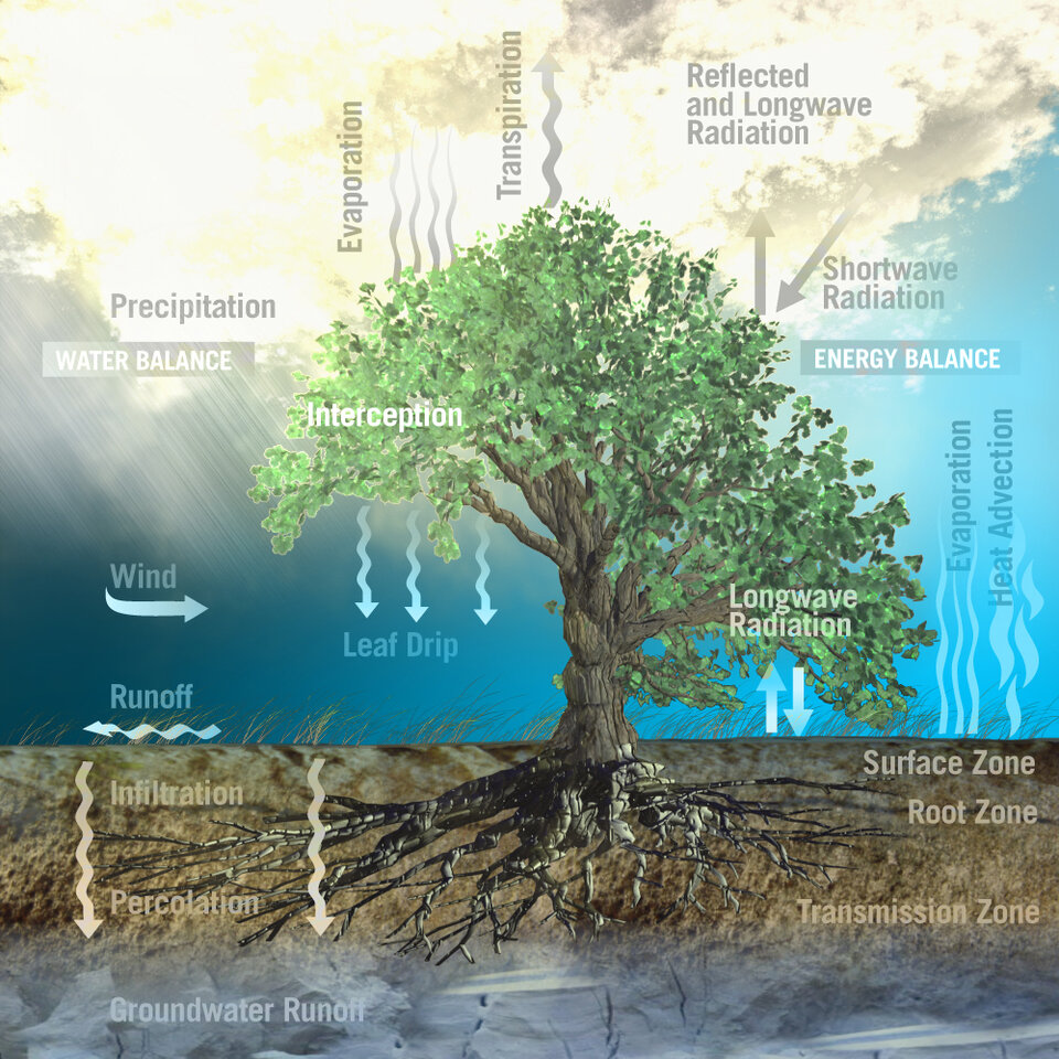
The amount of water in the soil and salinity in the oceans may not seem connected, but, in fact, they are both key variables linked to Earth’s water cycle, affecting weather and climate.
Variations of moisture in soil and salinity in the surface waters of the ocean are a consequence of the continuous exchange of water between the oceans, the atmosphere and the land.
Prior to the launch of SMOS in 2009, there were relatively few global datasets on either soil moisture or ocean salinity. SMOS is now helping to fill this gap thereby improving our knowledge of the global water cycle.
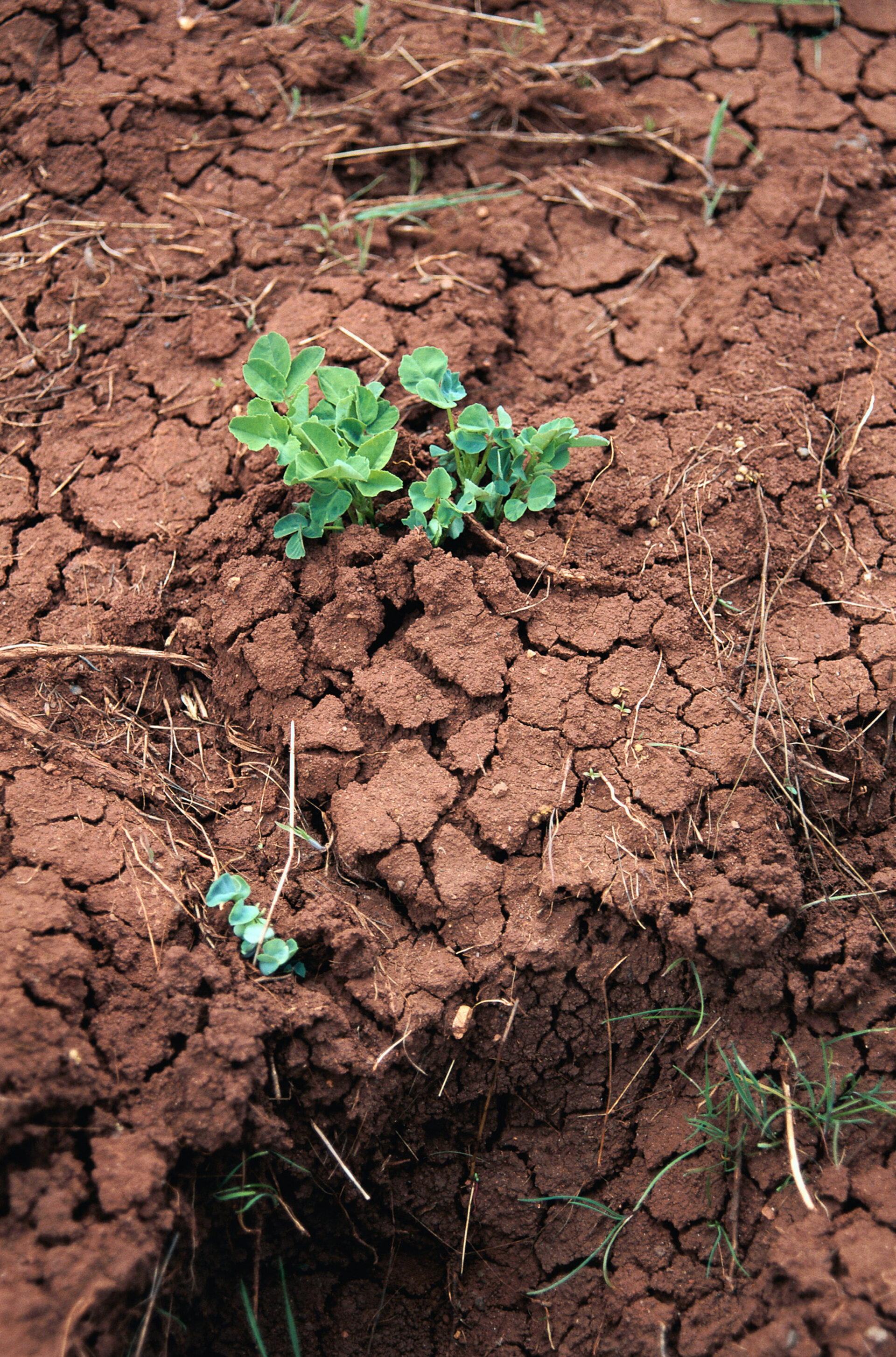
Over land, SMOS is providing a global image of surface-soil moisture every three days with an accuracy of 4% at a spatial resolution of 50 km – comparable to detecting one teaspoon of water mixed into a handful of soil
Estimation of soil moisture in the root zone is important for improving short- and medium-term meteorological forecasting, hydrological modelling, monitoring photosynthesis and plant growth, and estimating the terrestrial carbon cycle. Timely estimates of soil moisture are also important for contributing to the forecasting of hazardous events such as floods, droughts and heat waves.
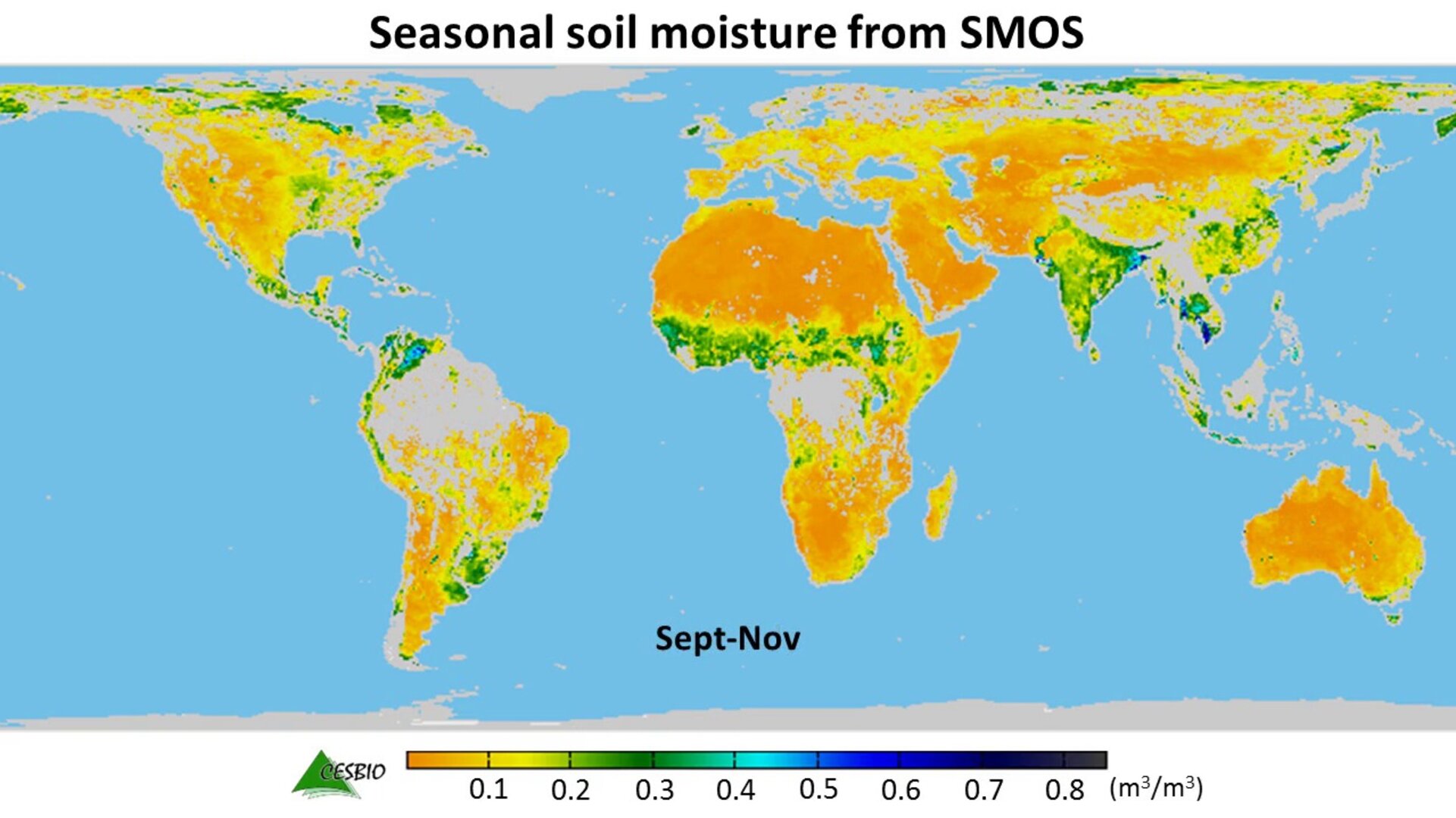
The animation below uses five years of SMOS data to show how, on average, moisture in the soil changes with the seasons around the world.

Access the video
It illustrates how change is more pronounced at higher latitudes, but monsoon dynamics in the Indian subcontinent are also clearly visible. The ‘Sahel transition’ region in Africa is well depicted and seasonal flooding in regions such as La Plata in Argentina and the Orinoco Basin in Venezuela can also be seen.
As well as benefiting science, SMOS is being used for a number of practical applications.
For example, the mission’s near-realtime observations are now being integrated into the European Centre for Medium-Range Weather Forecasts’ system, helping to improve air temperature and humidity forecasts near the surface. The inclusion of SMOS observations is also helping to improve the prediction of rain.
In addition, the US Department of Agriculture Foreign Agricultural Service has started to incorporate data into their forecasting system to help predict how the health of plants will change and, therefore, how productive they will be.


