• → European Space Agency

      • Space for Europe
      • Space News
      • Space in Images
      • Space in Videos
    • About Us

      • Welcome to ESA
      • DG's News and Views
      • For Member State Delegations
      • Business with ESA
      • ESA Exhibitions
      • ESA Publications
      • Careers at ESA
    • Our Activities

      • Space News
      • Observing the Earth
      • Human Spaceflight
      • Launchers
      • Navigation
      • Space Science
      • Space Engineering
      • Operations
      • Technology
      • Telecommunications & Integrated Applications
    • For Public

    • For Media

    • For Educators

    • For Kids

    • ESA

    • Observing the Earth

    • Understanding Our Planet

    • Securing Our Environment

    • Benefiting Our Economy

    • About securing our environment
    • Space & Environment Intelligence

      • Global Monitoring for Environment & Security

        • Overview
      • International treaties implementation

        • Overview
        • Wetlands convention
        • Combat Desertification convention
        • Kyoto Protocol
      • Safeguarding World Heritage sites

        • Overview
        • Gorilla habitats
    • Space & Public Safety

      • Civil protection assistance

        • Overview
        • Fire mapping
        • Earthquake rescue support
        • Flood monitoring
        • Pollution tracking
      • Humanitarian aid support

        • Overview
      • Epidemiology understanding

        • Overview
    • About Observing the Earth

      • How does Earth Observation work?
      • How to get Earth observation data
      • Integrating Earth Observation in your job
      • Earth Observation users speak
    • Opportunities with us

      • Education & training
      • International cooperation
      • Milestones & announcements
    • Multimedia

      • Image Gallery
      • Video Gallery
      • Online resources
      • RSS feeds

    ESA > Our Activities > Observing the Earth > Securing Our Environment

    Fire mapping

    Logging makes forest fires more devastating
    Forest fire in Borneo

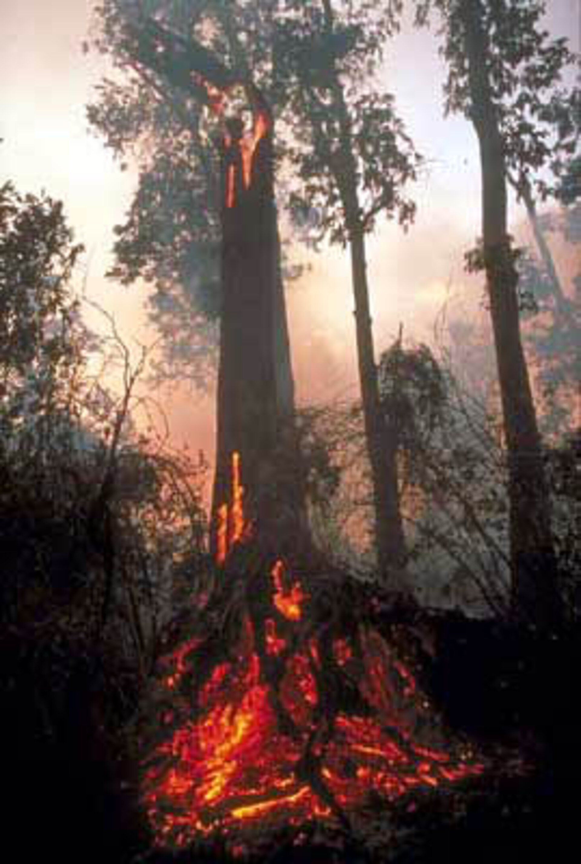
    Major fires are visible from space – satellites detect not only the smoke billowing from major conflagrations but also the burn scars left in their wake and even the fires themselves – appearing as 'hotspots' when scanning the Earth's surface in infrared wavelengths.

    The long hot summer of 2003 had disastrous consequences for Europe's forests, sparking massive blazes across the continent. With many millions of Euros worth of damage done, assessing the full scale of destruction was a task in itself, but satellites have a demonstrated ability to provide rapid mapping of burnt areas.

    During the height of the fires in early August, Portugal’s Civil Protection Agency invoked the International Charter on Space and Major Disasters to request satellite images of the blazes. Envisat’s Medium Resolution Imaging Spectrometer (MERIS) instrument acquired the images needed, which were then relayed via the Artemis communication satellite to ESA’s Frascati ground station in Italy where they were processed and passed directly to Portuguese authorities.

    Once the blazes were over, MERIS was employed once again to provide speedy estimates of the total area affected. This was performed using 250-metre resolution post-fire images of the whole of Portugal and segmenting and classifying the entire land surface according to a standardised vegetation index to identify the burnt zones.
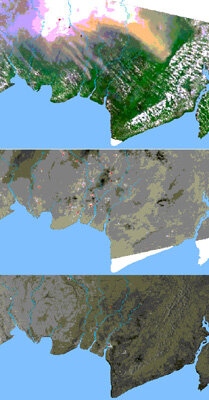
    A total burnt area of 347973 hectares as of late August was derived from this process, larger than a third again than the whole of Luxembourg, and broadly agreeing with estimates based on land-based sources. A similar fast track damage estimate was carried out for the aftermath of fires in the South of France and Corsica.

    MERIS, AATSR and ASAR images of Borneo peat fires

    This fast-track estimation exercise for the two countries builds on ESA’s previous experience of mapping burnt forest areas of Italy between 1997 and 2000, for a project in co-ordination with the Italian Civil Protection Agency called ITALSCAR.

    The exercise also anticipates a new project called Risk-EOS, part of the Services Element of the joint ESA-EU Global Monitoring for Environment and Security (GMES) initiative. The purpose of Risk-EOS is to use Earth Observation data to provide European civil protection agencies with early warning of forest fires as well as other threats.

    As well as pre-fire risk mapping and post-fire damage assessment, the eventual aim of Risk-EOS and similar activities is to provide real-time operational information to fire fighters as they fight forest blazes.

    By combining Earth Observation with satellite telecommunications, a Canadian-based facility called Remote Emergency Management via Satellite (REMSAT) has proven the feasibility of providing such a service - even in inaccessible regions - supporting fire fighters in-situ from a mobile centre.

    And in Spain a campaign called DEMOBIRD has managed to deliver infrared satellite imagery identifying fire 'hotspots' at the centre of forest blazes in Galicia, coupled with risk maps showing where the fire was most likely to spread. Delivery time from raw orbital data to processed products in the hands of the user came to around an hour and a half.

    Last update: 12 July 2004

    Rate this

    Views

    Share

    • Currently 0 out of 5 Stars.
    • 1
    • 2
    • 3
    • 4
    • 5
    Rating: 0/5 (0 votes cast)

    Thank you for rating!

    You have already rated this page, you can only rate it once!

    Your rating has been changed, thanks for rating!

    12
    facebook
    twitter
    reddit
    google plus
    digg
    tumbler
    digg
    blogger
    myspace
    • Related news
      • ESA satellite assesses damage of Norway’s largest fire
        • Greeks get space-based help in wake of deadly fires
          • Greece suffers more fires in 2007 than in last decade, satellites reveal
            • European hot spots and fires identified from space
            • Related missions
            • ERS overview
            • Envisat overview
            • In depth
            • International Charter on Space and Major Disasters
            • Data User Element
            • Earth Watching
            • Related links
            • REMSAT

    Connect with us

    • RSS
    • Youtube
    • Twitter
    • Flickr
    • Google Buzz
    • Subscribe
    • App Store
    • LATEST ARTICLES
    • · CryoSat hits land
    • · Ariane 5 completes seven launches …
    • · Measuring skull pressure without t…
    • · Malargüe station inauguration
    • · The solar wind is swirly
    • FAQ

    • Jobs at ESA

    • Site Map

    • Contacts

    • Terms and conditions