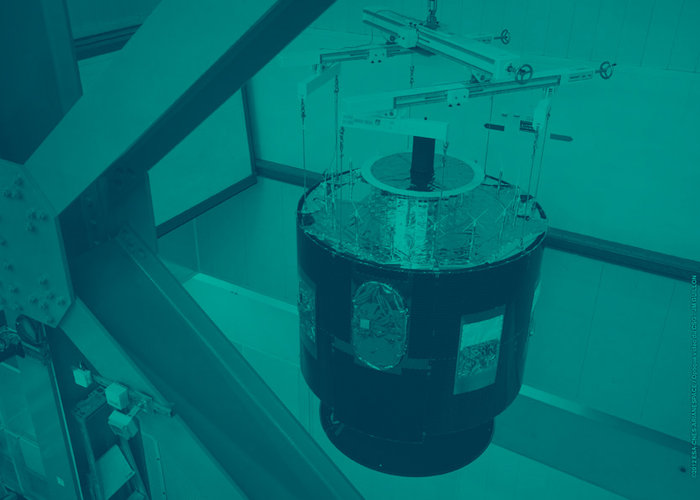
• → European Space Agency

      • Space for Europe
      • Space News
      • Space in Images
      • Space in Videos
    • About Us

      • Welcome to ESA
      • DG's News and Views
      • For Member State Delegations
      • Business with ESA
      • ESA Exhibitions
      • ESA Publications
      • Careers at ESA
    • Our Activities

      • Space News
      • Observing the Earth
      • Human Spaceflight
      • Launchers
      • Navigation
      • Space Science
      • Space Engineering
      • Operations
      • Technology
      • Telecommunications & Integrated Applications
    • For Public

    • For Media

    • For Educators

    • For Kids

    • ESA

    • Observing the Earth

    • Living Planet

    • Meteorological missions

    • MetOp

    • MetOp at a glance
    • Overview
    • Why we need MetOp
    • Facts & figures
    • History
    • Satellite

      • About the satellite
      • Payload Module
      • Service Module
    • Instruments

      • Overview
      • Technical summary
    • Launch

      • Launch sequence
      • Launcher
    • Mission operations

      • Operations
      • Orbit
    • Resources

      • Publications
      • General links
      • Glossary
      • Acronym list
    • Multimedia
    • MetOp images
    • MetOp videos
    • MetOp animations
    • Help
    • Services
    • Subscribe

    ESA > Our Activities > Observing the Earth > The Living Planet Programme > Meteorological missions > MetOp

    MetOp's polar orbit

    Orbit

    Until the launch of MetOp-A, Europe's weather satellites had all been placed in geostationary orbit. The first of these Meteosat missions was launched in 1977 to monitor the weather over Europe and Africa. The success of the initial series of seven satellites led to the development of a new improved series of four Meteosat Second Generation (MSG) satellites to provide higher resolution (in frequency, resolution and spectral coverage) images of the Earth's disc. So far, two MSG satellites have been launched – MSG-1 in 2002 and MSG-2 in 2005.

    For almost 30 years, the Meteosat satellites have been delivering imagery essential for the improved short-term weather forecasting, we have become accustomed to. However, there was a need for complimentary polar-orbiting satellites which, with their low orbital altitude, could realise very accurate observations of numerous aspects of the atmosphere and, due to their polar orbit, could achieve global coverage in a few days.

    The data from these satellites are vital for both operational meteorology and climate monitoring. Prior to the launch of MetOp-A, data from polar-orbiting satellites were provided by the satellites operated by the United States’ National Oceanic and Atmospheric Administration (NOAA). With MetOp, Europe assumed its role within an international system of meteorological satellites in polar orbit, much as had been previously achieved with Meteosat.

    MetOp and NOAA orbits
    MetOp and NOAA orbits

    Although MetOp-A is in a polar orbit, it does not pass exactly over the geographic poles but is slightly inclined at an angle of 98.7° to the Equator. At an altitude of 817 km, it takes about 100 minutes to complete one orbit. During the time it needs to complete an orbit, the Earth has rotated around 25° which means observations are made over a different section of the Earth in each orbit. With the sun being at a constant angle to the plane of MetOp-A’s orbit, the satellite is in a so-called sun-synchronous orbit.

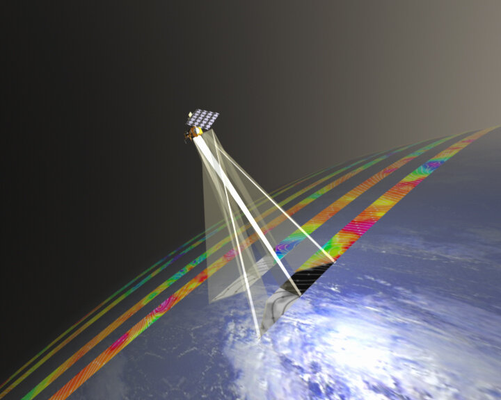
    Different instruments have different swath widths and hence take different times to observe the entire Earth. However, all the instruments achieve almost complete global coverage within five days. All global data are provided to users within 2.25 hours after being taken.

    Within the Joint Polar System, the international system to which MetOp forms a part, MetOp is responsible for the morning orbit which passes over the Equator at 09.30 local time, whilst the NOAA satellite occupies the afternoon orbit which passes over the Equator at 14.30 local time. Together, these two orbits maximise the coverage over which the observations are made and provide inputs needed for the computer numerical models on which our weather forecasts depend.

    Last update: 3 April 2012

    Rate this

    Views

    Share

    • Currently 0 out of 5 Stars.
    • 1
    • 2
    • 3
    • 4
    • 5
    Rating: 0/5 (0 votes cast)

    Thank you for rating!

    You have already rated this page, you can only rate it once!

    Your rating has been changed, thanks for rating!

    38
    facebook
    twitter
    reddit
    google plus
    digg
    tumbler
    digg
    blogger
    myspace
    • Related links
    • Eumetsat logo
      Eumetsat logo
      EUMETSAT  
    • NOAA
    • CNES
    • Meteosat Second Generation
      Meteosat Second Generation
      Meteosat Second Generation

    Connect with us

    • RSS
    • Youtube
    • Twitter
    • Flickr
    • Google Buzz
    • Subscribe
    • App Store
    • LATEST ARTICLES
    • · CryoSat hits land
    • · Ariane 5 completes seven launches …
    • · Measuring skull pressure without t…
    • · Malargüe station inauguration
    • · The solar wind is swirly
    • FAQ

    • Jobs at ESA

    • Site Map

    • Contacts

    • Terms and conditions