Introducing MetOp
The Meteorological Operational satellite programme (MetOp) is a European undertaking providing weather data services to monitor the climate and improve weather forecasts. The programme was jointly established by ESA and the European Organisation for the Exploitation of Meteorological Satellites (Eumetsat), forming the space segment of Eumetsat's Polar System (EPS).
The programme also represents the European contribution to a cooperative venture with the United States’ National Oceanic and Atmospheric Administration (NOAA), which for the last 40 years has been delivering meteorological data from polar orbit, free of charge, to users worldwide.
Launched in October 2006, MetOp-A, the first satellite in the series of three, replaced one of two satellite services operated by NOAA and is Europe’s first polar-orbiting satellite dedicated to operational meteorology. Once operational in orbit, responsibilities for the meteorological satellite services have been shared between the USA and Europe.
The MetOp satellites are designed to work in conjunction with the NOAA satellite system, flying in complementary orbits. MetOp's polar orbit is Sun synchronous, so that the satellite track along the Earth is always at the same local time, in this case in the mid-morning. NOAA still continues to operate its mid-afternoon orbit satellite service as part of the Polar Orbit Enviromental Satellites (POES) system.
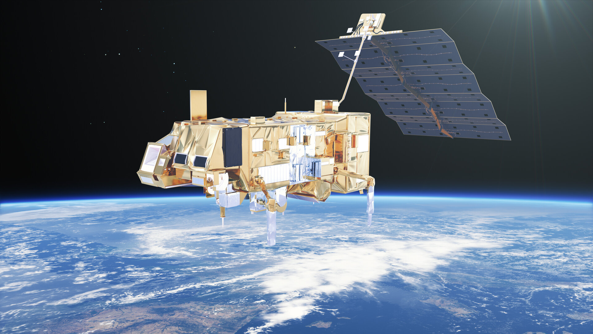
Of the instruments carried by MetOp, five are new-generation European instruments, while the others have a well-proven heritage and have been provided by NOAA and the French Space Agency (CNES).

Polar orbiting satellites orbit at a lower altitude – typically 800 km compared with
With an array of sophisticated instrumentation, the MetOp satellites can provide data of unprecedented accuracy and resolution on a host of different variables such as temperature and humidity, ocean surface wind speed and direction and concentrations of ozone and other trace gases – thus marking a major advance in global weather forecasting and climate monitoring capabilities.
In addition, these new weather satellites provide imagery of land and ocean surfaces as well as search and rescue equipment to aid ships and aircraft in distress. A data relay system is also onboard, linking up to buoys and other data collection devices.
MetOp-B, the second satellite in the series, was launched on 17 September 2012 and operates in tandem with MetOp-A, increasing the wealth of data even further. The third and final satellite, MetOp-C, was launched on 7 November 2018.
Launching a new satellite every 5–6 years guarantees a continuous delivery of high-quality data for medium- and long-term weather forecasting and climate monitoring.
Building on the current series of MetOp weather satellites, a new family of MetOp missions, the MetOp Second Generation series, is being developed and will comprise three pairs of satellites to secure essential information for weather forecasting and climate prediction for more than 20 years.