• → European Space Agency

      • Space for Europe
      • Space News
      • Space in Images
      • Space in Videos
    • About Us

      • Welcome to ESA
      • DG's News and Views
      • For Member State Delegations
      • Business with ESA
      • ESA Exhibitions
      • ESA Publications
      • Careers at ESA
    • Our Activities

      • Space News
      • Observing the Earth
      • Human Spaceflight
      • Launchers
      • Navigation
      • Space Science
      • Space Engineering
      • Operations
      • Technology
      • Telecommunications & Integrated Applications
    • For Public

    • For Media

    • For Educators

    • For Kids

    • ESA

    • Observing the Earth

    • Understanding Our Planet

    • Securing Our Environment

    • Benefiting Our Economy

    • About understanding our planet
    • Space and Earth Monitoring

      • Land

        • Overview
        • Rivers & lakes
        • Volcanoes
        • Coastal zones
        • Wetlands & deserts
      • Oceans

        • Overview
        • Wind & waves
        • Ocean colour & algae blooms
        • Sea Surface Temperature
        • El Niño
      • Ice

        • Overview
        • Ice and climate
      • Atmosphere

        • Overview
        • Water vapour & clouds
        • Aerosols
        • Ozone hole
        • Climate change
      • Biosphere

        • Overview
        • Forests
        • Carbon cycle
    • About Observing the Earth

      • How does Earth Observation work?
      • How to get Earth observation data
      • Integrating Earth Observation in your job
      • Earth Observation users speak
    • Opportunities with us

      • Education & training
      • International cooperation
      • Milestones & announcements
    • Multimedia

      • Image Gallery
      • Video Gallery
      • Online resources
      • RSS feeds

    ESA > Our Activities > Observing the Earth > Understanding Our Planet

    Land

    Overview

    The land surface of our Earth is home to humankind as well as most of the world's flora and fauna. Though dwarfed by the sea it still covers a vast area: if all Earth's land was put together without the oceans it would form a planet only slightly smaller than Mars.

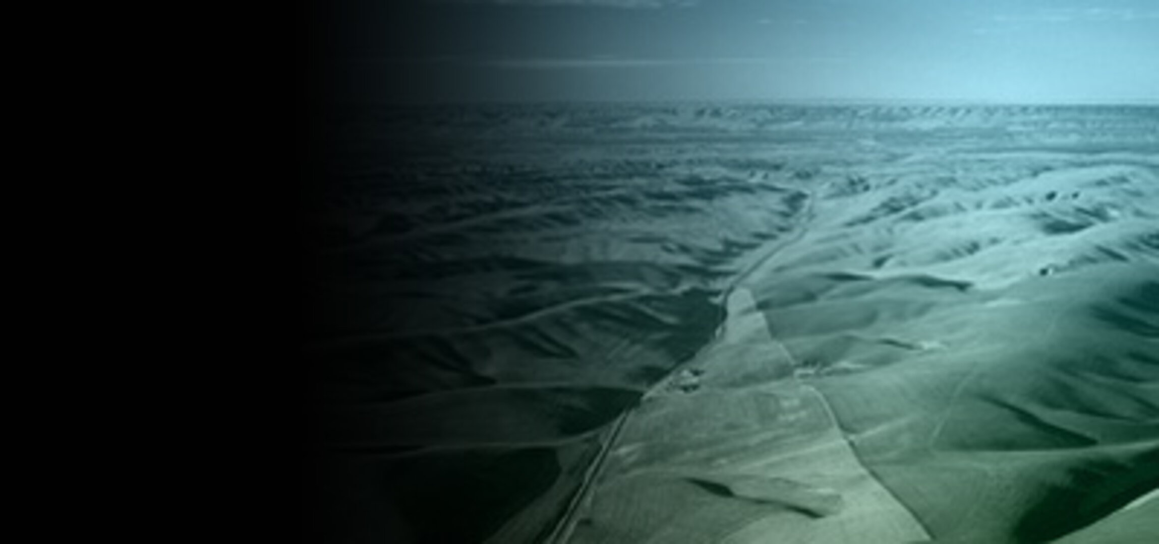
    Getting to know our home ground

    Billions of years of geological movement, atmospheric weathering and sustained biological activity have left the Earth's land surface with the most varied terrain in the solar system. Satellite observations let us know our home ground in greater detail than ever before.

    Satellite sensors enable the objective global classification of surface land cover, mapping the distribution of forests, deserts, water bodies, agricultural land and human settlements. They can also be used to precisely measure surface topography.


    Minerals and biomass

    Light from the Sun shining back from the Earth's surface is not perfectly reflected: its spectrum has been altered by contact with materials on the ground.

    By identifying changes in this reflected light, a class of satellite instrument called a spectrometer can obtain information about the surface.

    Space-based spectrometers can measure ground temperatures, map individual minerals out of the two thousand or so found on the Earth's surface, and even – in concert with radar results - assess the density and health of vegetation, down to their particular crop breed, water content and stage of development.

    That ability becomes scientifically useful because it lets scientists know the extent of surface biomass in such a detailed way that its role as a significant 'sink' of carbon can be more accurately included in future models of climate change.

    Identifying surface change

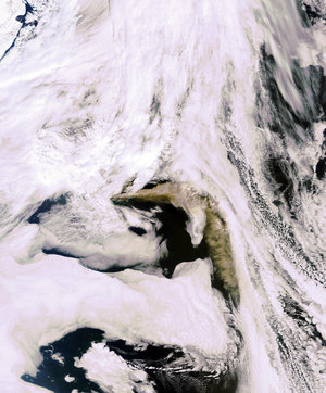
    Amassing land cover data enables researchers to see how it changes over time. Analysis of archived data helps accurately chart the rates that deserts are growing and forests are cleared, a coastline erodes or urban settlements grow. On a more rapid timescale, comparing satellite images can swiftly identify the damage done by disasters such as earthquakes, fires or floods.

    Combining radar imagery with a technique called interferometry can identify tiny changes in land surface down to a scale of millimetres: this can be used to monitor urban subsidence as well as the slow movement of tectonic plates and the 'breathing' of volcanoes.

    Rate this

    Views

    Share

    • Currently 0 out of 5 Stars.
    • 1
    • 2
    • 3
    • 4
    • 5
    Rating: 0/5 (0 votes cast)

    Thank you for rating!

    You have already rated this page, you can only rate it once!

    Your rating has been changed, thanks for rating!

    152
    facebook
    twitter
    reddit
    google plus
    digg
    tumbler
    digg
    blogger
    myspace
    • Related news
      • Envisat captures renewed volcanic activity
      • Related missions
      • ERS overview
      • Envisat overview
      • Earth Explorers overview
      • MetOp overview
      • MSG overview
      • In depth
      • EO Principal Investigator Portal

    Connect with us

    • RSS
    • Youtube
    • Twitter
    • Flickr
    • Google Buzz
    • Subscribe
    • App Store
    • LATEST ARTICLES
    • · CryoSat hits land
    • · Ariane 5 completes seven launches …
    • · Measuring skull pressure without t…
    • · Malargüe station inauguration
    • · The solar wind is swirly
    • FAQ

    • Jobs at ESA

    • Site Map

    • Contacts

    • Terms and conditions