
Measuring ozone over the poles
Earth's ozone layer is like a safety shield, preventing damaging ultraviolet light from reaching its surface. Chlorine stemming from industrial processes was breaking down the ozone atoms leading to the ozone hole over the poles. Since these chemicals got banned though, a slow recovery of the ozone layer has been observed.
Because of the high relevancy of ozone for our climate and the atmosphere ESA's General Studies Programme issued a study to measure ozone over the poles. A consortium led by the Belgian Institute for Space Aeronomy investigated the "Total Column Ozone retrieval from multispectral imagers operating in the visible spectral range".
Ozone has been measured from space for decades. It is routinely measured by spectral imagers that have been specifically designed for this purpose. Such instruments have provided measurements of Earth's radiation in the UV spectral range, i.e., below 400 nm (e.g.: OMI or SCIAMACHY). These instruments generally provide a daily global coverage at a spatial resolution that is compatible with the ozone spatial variability, i.e., several tens of kilometres.
MERIS is a multispectral imager that was designed for different mission objectives, namely, land and ocean colour monitoring (and few additional atmosphere parameters). This instrument does not operate in the UV but in the visible to near-infrared part of the spectrum. As ozone retrieval techniques conventionally make use of the UV spectral range, retrieving ozone information from the MERIS channel was not foreseen in its operational processing chain. Still, some of the MERIS channels are sensitive to ozone absorption (in the so-called Chappuis bands).
The ozone spectral signature in the 400 - 700 nm range on MERIS class of instruments (e.g.: MODIS, GLI) is generally not suitable to retrieve ozone absorption data as the ozone absorption spectral variations in this region are difficult to distinguish from the surface and atmospheric spectral signatures. However, under specific observational conditions, typically over very bright and white targets, a differential absorption retrieval technique has been successfully demonstrated in this GSP study exploiting the ozone Chappuis bands.
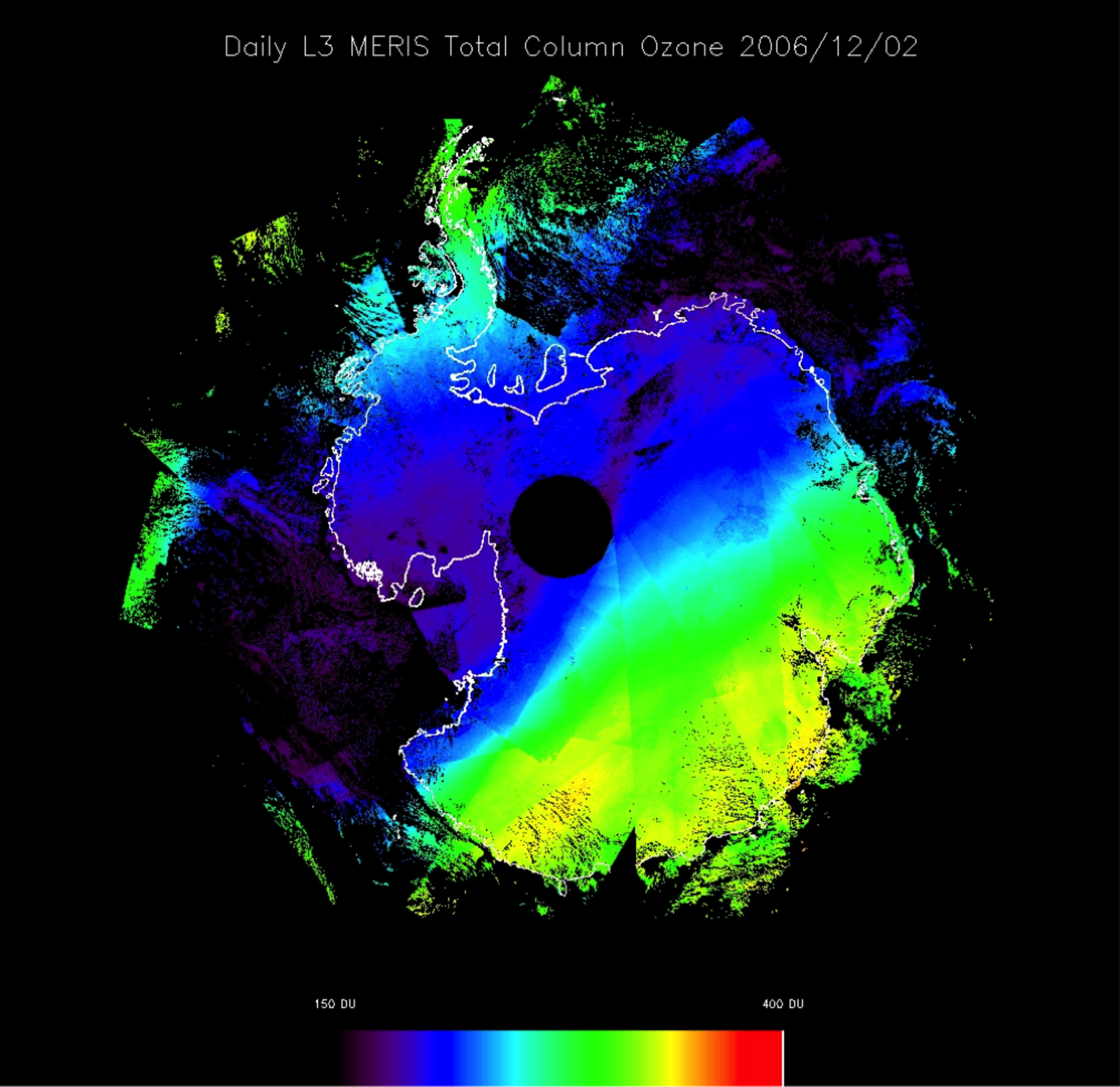
10 years of MERIS data were processed with the developed retrieval algorithm. Global validation showed that the results were sound. Daily Antarctic total ozone maps were generated as a demonstration product. Although ENVISAT is now lost, more sensors will be operated in the coming years that could routinely provide similar ozone-data products. While the derived products may suffer from spatial coverage limitations, they still offer the prospect of ozone mapping at high spatial resolution (MERIS and OLCI on-board Sentinel-3 have a spatial resolution of 300 m over land compared to the several tens of kilometres resolution of operational ozone-monitoring space missions).
For further information, please contact Marc Bouvet: Marc.Bouvet @ esa.int
