
Overview
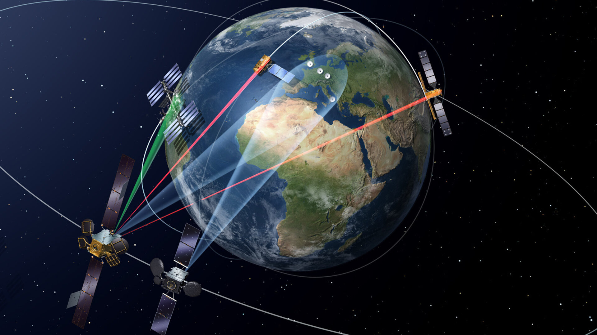
The European Data Relay System (EDRS) is the most sophisticated laser communication network ever designed.
Dubbed the ‘SpaceDataHighway’, EDRS helps Earth-observing satellites to transmit large quantities of potentially life-saving data down to Europe in near-real time.
Its two geostationary satellites use optical links to gather low-orbiting satellites’ information at far higher data rates than traditional radio frequency beams.
| Facts and figures | |
| Infrastructure |
|
| Launch dates |
|
| Launch site |
|
| Launcher |
|
| Platform/host satellite | EDRS-A
EDRS-C
|
| Intersatellite link capacity
|
|
|
Link capacity to ground (Ka-band)
|
Up to 1800 Mbit/s |
| Data transmission capacity | At least 50 TBytes/day
|
| Prime contractor | Airbus Defence and Space (DE)
|
| Mission Operation Centre | Airbus Defence and Space (DE)
|
| Anchor customer | ESA/EC Copernicus Sentinel-1 and -2
|
