|
Kilimanjaro - Worksheet
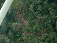
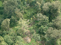
First we will study the whole area using images from 2000 to focus on vegetation zoning. Then we will focus on the changes from 1984 to 2000. The threats to the National Park and the Forest Reserve are studied using GIS overlay. Detailed images of the snow-capped summit and the southwestern part of the Forest Reserve can be studied by comparing the situation in 1984 with the situation in 2000. This is done using LEOWorks. Click to Download all Landsat images for Kilimanjaro, 7.4 Mb.
Landsat images from 1984 and 2000 for the exercises:
Kilimanjaro, SW part, 30m resolution:
Kilimanjaro, Top part, 30m resolution:
GIS files to be used in the exercise.
We will study the appearance of this great volcanic complex from space with an emphasis on vegetation and land use imposed/adopted by people over time. First we will construct an image showing the situation in the year 2000 in natural colours. 1) Start LEOWorks. Open Band2_00 and Band3_00 in LEOWorks 2.0 and enhance them using Interactive stretching. Compare the images. They look different because they are from different parts of the spectrum:
First we will construct an image showing natural colours. We must therefore select the band combination shown in the Combine RGB window. Save the image using the file name 'Kilim321'. Inspect the image. Try to find the following features:
To make a colour image, select Image/Combine from.../(Red Green Blue). Now select Kilimanjaro2000_4 for the Red band and Kilimanjaro2000_3 for the Green Band and Kilimanjaro2000_2 for the Blue band. Save the image using the file name 'Kilim432'.
Describe and compare this false colour image with the natural colour images you made above.
Find areas covered with vegetation in the two images. What colour does the vegetation have in the false colour image? A hint: Green vegetation absorbs visible light for photosynthesis and reflects near infrared light. The reflection of the near infrared light is shown in Band 4. Last update: 16 April 2013
| ||||||||||||||||||||||||||||||||||||||||||||||||||||||||||||