SMART-1 maps Kaguya lunar impact
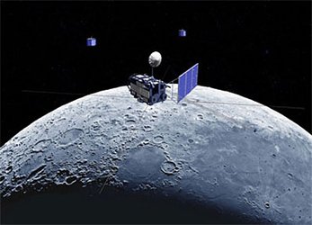
The Japanese lunar orbiter Kaguya has completed a productive operational phase and will conclude its scientific mission with a controlled impact on the lunar surface, scheduled for 20:30 CEST today.
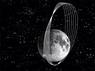
The impact is expected to occur on the near-side of the Moon, in the dark area close to the limb, at lunar coordinates 80°E and 64°S.
ESA’s SMART-1 team have prepared maps of the Kaguya landing site using survey images obtained by the SMART-1 AMIE camera.
The images show that the satellite’s final orbit and impact site lie in an ancient cratered highland.

Towards the end of SMART-1’s mission in September 2006, spacecraft operators were confronted with a similar situation, which necessitated a small manoeuvre just three days before the satellite was to impact the lunar surface so as to avoid impacting a crater rim. SMART-1 avoided the rim of the crater and the impact occurred at the planned time and location.
An analysis of the lunar topography has been carried out to determine the exact time at which Kaguya will impact the surface and whether it will graze the surface upon touchdown or if it will bounce, as SMART-1 did.
“We hope that future data will show the elongated crater that will form due to the Kaguya impact and bouncing secondary debris,” said Bernard Foing, ESA’s former SMART-1 Project Scientist.
For more information:
Bernard H. Foing, ESA former SMART-1 project scientist
Email: Bernard.Foing @ esa.int
Bjoern Grieger, ESA SMART-1 AMIE liaison scientist
Email : Bjoern.Grieger @ esa.int