New navsat sensor improves water monitoring
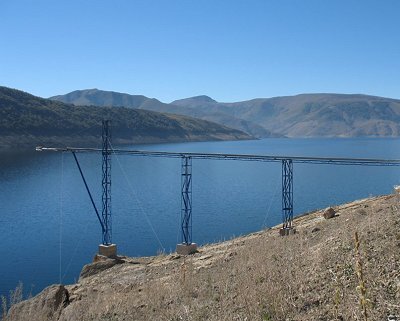
The start-up company Star2Earth, reared in the ESA Business Incubation Centre in the Netherlands, will improve electricity production from a hydroelectric plant on Lake Laja in Chile by using navigation satellite signals to measure water levels and wave heights.
Mounted on the lake's shore, the new Oceanpal sensor will accurately monitor the water level. It does not touch the water so it is almost maintenance-free, an important feature in the remote Andes Mountains. In general, water sensors require regular maintenance and calibration.

"Oceanpal was selected because no other similar sensor was available and because the data, together with information on snow cover from Earth observation satellites, can be integrated easily to improve hydrological models," says Ana Maiques, Star2Earth Director and Starlab Business Manager.
The hydrologic models represent Lake Laja’s water cycle and are used to predict the amount of water in the lake during the year, drawing on information such as snow coverage and the actual water level. The models are used by energy company Endesa to plan electricity production.
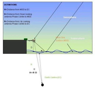
The prototype sensor for Oceanpal was developed by Starlab, Star2Earth’s parent company in Barcelona, based on ESA technology that uses navigation satellite signals reflected from a water surface.
Satellites make smart water-level measurements possible

Star2Earth was created by Starlab to develop and commercialise innovative instruments that use navsat signals.
Hosted at the ESA Business Incubation Centre (BIC) in Noordwijk, the Netherlands, the company improved their Oceanpal sensor with the help of ESA specialists.
"Being at the ESA BIC in Noordwijk gave us visibility and allowed us to be in touch with top-level technical people from ESA and in contact with other interesting technologies. It helped us to develop Oceanpal into a commercial ready-to-use sensor system," explains Ms Maiques.

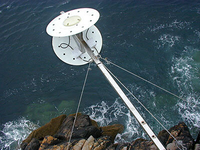
Mounted on a platform just above the water, the sensor measures reflected navsat signals and combines them with the direct signals to calculate real-time wave heights and water levels.
Oceanpal is already operational in Barcelona’s harbour, on Scheveningen pier in the Netherlands and at the LaBaells water reservoir in the Pyrenees.

Oceanpal is an economical solution for monitoring water reservoirs. Existing systems work out the amount of water in a reservoir by measuring the water pressure at a specific depth. They are complicated to calibrate and need frequent maintenance by divers.
When the Catalan Water Authority was looking for a more efficient alternative for their water reservoir at LaBaells, Oceanpal provided the perfect solution.

The Star2Earth team also has new systems in the pipeline using reflected navsat signals for monitoring soil moisture and vegetation.
This new technique, originally conceived for remote sensing from space, has found terrestrial applications before it has even been used in space.
Work is under way to fly a satellite soon to demonstrate the potential of the technique from space.
ESA's Technology Transfer Programme Office (TTPO)
The main mission of TTPO is to facilitate the use of space technology and space systems for non-space applications and to demonstrate the benefit of the European space programme to European citizens. The office is responsible for defining the overall approach and strategy for the transfer of space technologies, including the incubation of start-up companies and their funding. For more information, please contact:
ESA’s Technology Transfer Programme Office
European Space Agency ESA
Keplerlaan 1, 2200 AG, Noordwijk ZH
The Netherlands
Phone: +31 (0) 71 565 6208
Email: ttp@esa.int
Website: http://www.esa.int/ttp


