As Montreal Conference considers deforestation issues, ESA presents space solution
As the future of Earth’s forests moved up the agenda at the United Nations Climate Change Conference - negotiating a post-Kyoto strategy to combat global warming - ESA and its national collaborators presented delegates with promising results from projects using satellites to identify wide-area forest retreat and expansion.
The planet’s climate is moving into uncharted territory, as our burning of fossil-fuels and clearances of forests release massive amounts of heat-trapping greenhouse gases into the air, chief among them carbon dioxide. Research recently published in the journal Science on ancient air bubbles extracted from drilling more than three kilometres down into Antarctic ice shows prove that the current rate of carbon dioxide increase is unprecedented for the last 650 000 years.
The Kyoto Protocol to the United Nations Framework Convention on Climate Change (UNFCCC), which was agreed in 1997 and entered into force in February this year, was an initial effort to moderate climate change by setting caps on greenhouse gas emissions of industrialised nations based on 1990 levels. The Protocol was only ever considered a first step however, and its remit extends only until 2012.

Some 10 000 people, including delegations from 190 nations, plus intergovernmental organisations and non-governmental organisations, are gathered at a two-week event in Montreal – formally known as the eleventh session of the Conference of the Parties to the Climate Change Convention, held in conjunction with the first session of the Conference of the Parties serving as the Meeting of the Parties to the Kyoto Protocol (COP 11/MOP 1) – to negotiate what comes next after Kyoto.
Deforestation is proving a popular topic for debate so far. Up to a quarter of human-induced greenhouse gas emissions are due to deforestation. However the Kyoto Protocol did not deal with forest conservation, other than to give ‘Annex I’ countries in the developed world a responsibility to report changes in land cover influencing the amount of carbon stored on their territory, to gain emissions credits accordingly. Developed countries can also fund ‘Clean Development Mechanism’ afforestation projects in developing nations.
Now the government of Papua New Guinea has raised the proposal of a post-Kyoto mechanism to reward developing nations for preserving their forests. If deforestation rates in a given country decreased, the country as a whole would gain emission credits from it.
On Wednesday morning even the United States and Saudi Arabia – both countries opposed to the Kyoto Protocol – spoke in favour of discussing mechanisms to preserve forests on a national basis. The point was also made by Switzerland that besides serving as a means of reducing emissions, preserving and expanding forests also helps ensure sustainable development and food security. And the other functions of forests, including preserving biodiversity and conserving soils, could actually help reduce the vulnerability of local populations to climate change.
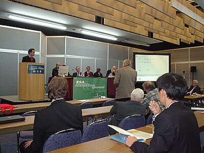
The Conference agreed to establish a contact group on the issue, to draft conclusions for consideration next week. That same day, ESA sponsored a special Conference side event addressing the topic of deforestation monitoring, together with the national delegations of Greece, Italy, Spain, South Africa and Switzerland. The subject was ‘Supporting Land Use, Land Use Change and Forestry Reporting from Space’.
Delegates in attendance heard that four years before the Kyoto Protocol was ratified, ESA began a project called Kyoto Inventory to develop satellite-based land cover mapping services to fulfil Kyoto reporting requirements, working with the responsible agencies in Italy, the Netherlands, Spain and Switzerland.
The results have been sufficiently promising that the work continues as part of a wider project called GSE Forest Monitoring, with an increased number of national European users and also in the developing world, including Indonesia and South Africa.
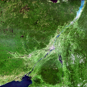
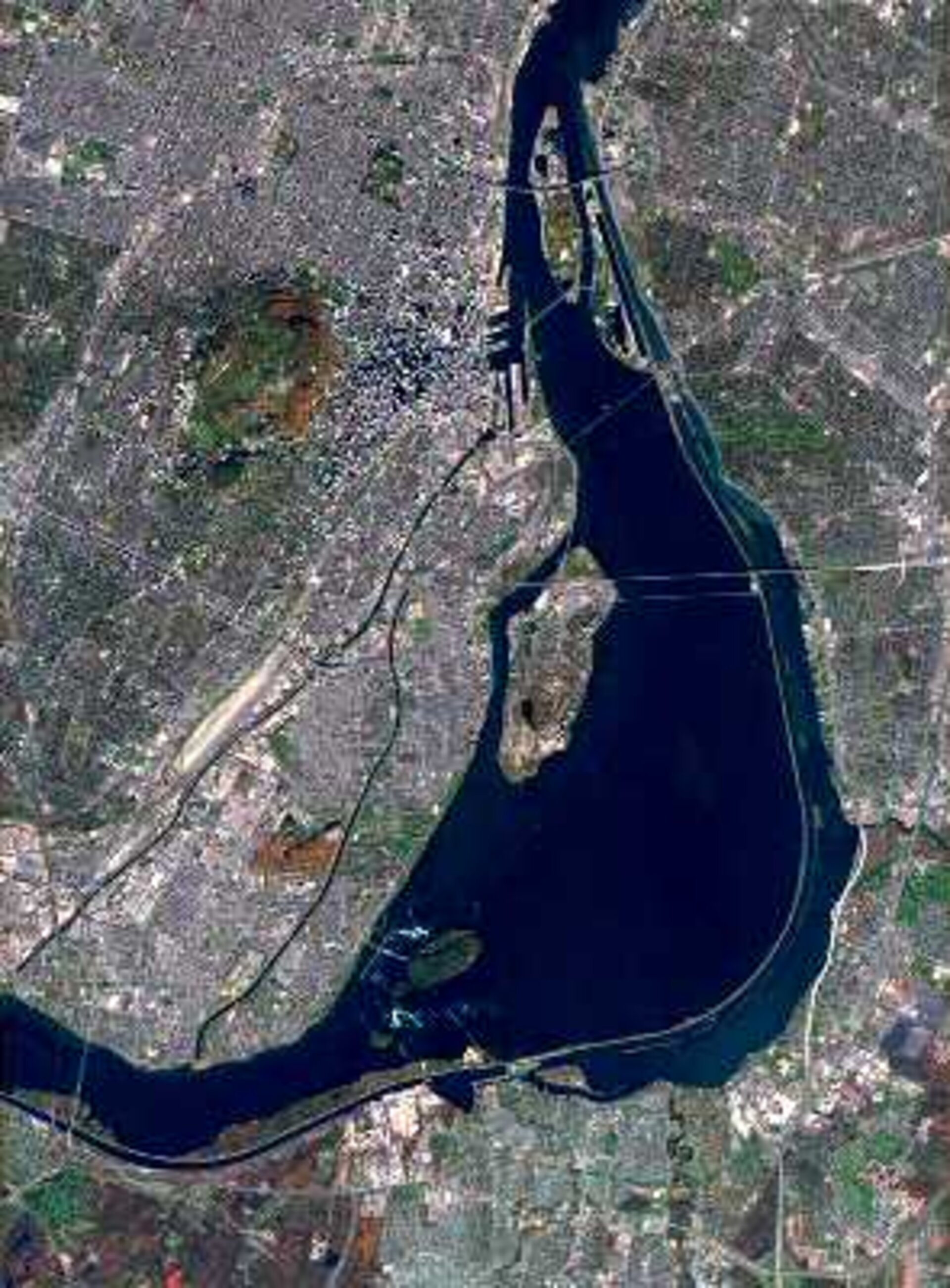
José Romero of the Swiss Agency for the Environment, Forests and Landscapes, and Deputy Head of the Switzerland Delegation at COP 11, explained that his country’s forest cover kept relatively stable, but that it was spread across the country’s 26 cantons in a complex and fragmented manner.
As part of Kyoto Inventory, all 41 290 square kilometres of Swiss territory was covered by satellite images. The resulting land use cover, land use change and forestry products had an accuracy – when checked against the country’s 12-yearly land use map – of 90% to 95%. The products were also combined with digital elevation models to take account of the country’s complex topography.

"For us the advantage is that these products are available annually, and this is something that compares very positively with our current land use surveys," said Romero. "It is very useful to have these remote sensing data in conjunction with our statistical information, to interpolate the two and improve our reporting."
Gerardo Sánchez Peña of the General Directorate for Biodiversity (DGB) of Spain's Ministry of the Environment explained that Kyoto Inventory products had been produced across three Spanish provinces of Lleida, Girona and Cacares, totalling 37 949 square kilometres of territory.
There were some subtleties of the Spanish landscape which would still require work – notably the ‘dehesas’, areas of open forest the satellite products sometimes misidentified as scrubland – but the results were being used to supplement Spain’s ten-yearly National Forest Inventory, and Pena suggested that in future such products could form the basis of a common European or global approach.
Antonio Lumicisi, working on Kyoto Protocol issues at Italy’s Ministry of the Environment, explained that Kyoto Inventory coverage of his country ranged across five regions of very different topography across the country, Abruzzo, Calabria, Lombardy, Molise and Toscana.

The satellite products agreed well with processed aerial photographs. In the case of Abruzzo the product accuracy was sufficient to show individual small limestone quarries characteristic of the regions. In Lombardy the effect of a landslide that filled in a lake could be seen.
Lumicisi explained that the potential for frequent updating appeared very promising, and that the 1990 data in particular was especially useful, because Italy currently lacked data for this Kyoto baseline year.
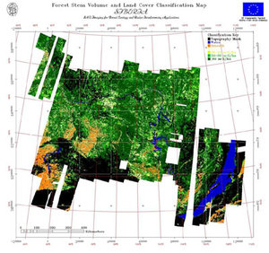
Humbulani Mudau, of the Natural Resources and the Environment Division of South Africa’s Council for Scientific and Industrial Research (CSIR) recounted results of a research project carried out as part of GSE Forest Monitoring, to measure land use and forestry change within part of South Africa’s Kruger National Park between 1992 and 2001.
"We utilised Landsat Enhanced Thematic Mapper imagery, and carried out an intensive ground campaign of the area of interest," explained Mudau. "We were able to identify a variety of land use classes, from old growth forest to fields of subsidence agriculture practiced at the boundaries of the Kruger Park."
"The project has been a useful opportunity for us to build capacity in this subject, and to enhance our existing dataset. We see the results as complementing our traditional forest inventory, and hope to participate in follow-up projects."
Dimitris Lalas of the National Observatory of Athens, Head of the Greek delegation to COP 11/MOP 1, explained that, as in Spain and Italy, forests in his country changed quickly due to droughts and forest fires. Based on studies of test sites, the wide-area view from satellites was useful for keeping track of these changes.
"This method has a number of advantages and addresses a number of our needs, and it does so in a manner which I think will turn out to be cost effective," Lalas said. "Studies in other parts of the world have shown this is a way to do it especially in cases when you do not have enough forest monitoring stations on the ground to make sure you have the appropriate accuracy, or the possibility to revisit the areas as often as you can with satellites."
Satellite monitoring for climate studies
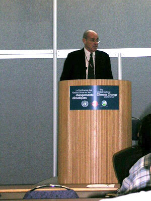
The side event will shortly be viewable as a webcast on the UNFCCC COP 11/MOP 1 website. Also available as a webcast is a talk from the previous day by Olivier Arino, Head of the ESA Earth Observation Projects Section.
Arino explained that GSE Forest Monitoring is proceeding as part of a joint initiative between ESA and the European Union called Global Monitoring for Environment and Security (GMES), aimed at developing a global monitoring capability for Europe in support of its environmental and security policies.
"Decades of space exploration have underlined the unique value and fragility of the Earth environment," Arino said. "Now through GMES space is coming back to Earth, as a means of managing and protecting our planet."
Arino also recounted how ESA has been contributing to the scientific study of climate, including projects to employ satellites to quantify global biomass and identify fire outbreaks, measure increases in the heat content of the oceans, changes in ocean current circulation and a steady rise in average global sea surface levels.
In the atmosphere, satellites are also able to quantify aerosol types and concentrations – which play an important part in regional climate – and even count the number of aircraft condensation trail ‘contrails’, which have a climate impact by increasing the amount of cirrus clouds.
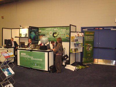
ESA is maintaining an exhibit throughout the Conference, which concludes on 9 December. A dedicated computer demonstrator on ESA and European Commision GMES projects is being shown in the European Union pavilion. ESA is also participating in a Canadian Space Agency thematic day at the Canadian pavilion on 8 December.