Ireland now part of Europe’s first satellite navigation system
EGNOS is a satellite navigation network currently being implemented all over Europe. In 2005 this network will enable everyone with an EGNOS receiver to pinpoint a position far more accurately than with GPS. The inauguration on 17 December of the EGNOS facility in Ireland is a new step towards this achievement.
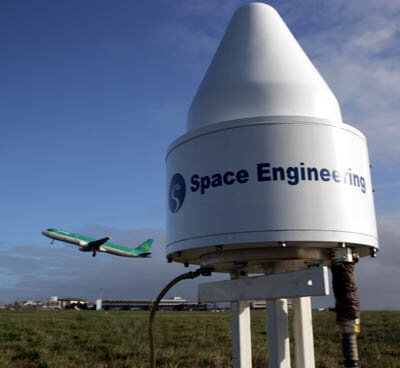
The EGNOS facility, called a Ranging and Integrity Monitoring Station (RIMS) is located at the domestic airport of Cork, within the facilities of the Irish Aviation Authority (IAA). This RIMS offers a coverage for the European Geostationary Navigation Overlay Service (EGNOS) for all of Ireland but will also offer a large window into the Atlantic region, one of the most populated aviation routes. This is of course fully in line with the main goal of EGNOS: to provide, for civil aviation, a highly accurate signal to improve safety with the potential for worldwide coverage.
For such so called “safety of life” services a certification process will start once the EGNOS signal is fully available. This system should be integrated in air traffic management systems by 2006. However other potential users of satellite navigation will benefit from it too, from car drivers to fishermen and many more.
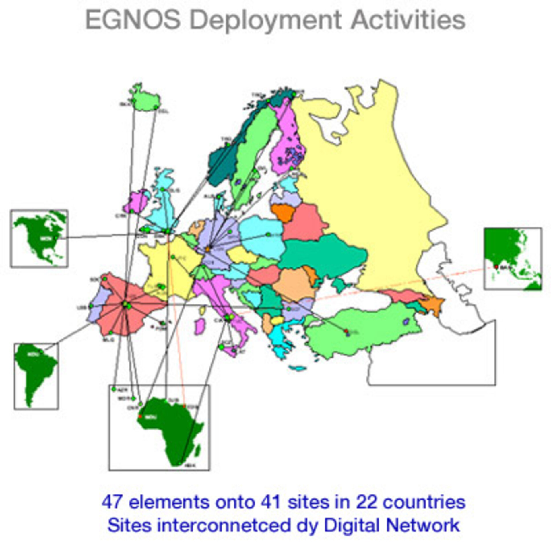
EGNOS is Europe’s first step into satellite navigation, based on the correction of Global Positioning System (GPS) signals, it offers a better accuracy but also integrity and continuity of services. To achieve this, a network of ground elements is needed, consisting of RIMS (Ranging and Integrity Monitoring Stations - 34 like the one in Ireland), MCCs (Master Control Centres) to process the data delivered by the RIMS and then uplink stations that send the signal to three geostationary satellites which relay it back to the ground to the users with their receivers.
Altogether there will be 47 EGNOS elements being deployed on 41 sites in 22 countries. Agreements have been concluded, with 28 hosting entities, like the IAA in Cork.
EGNOS was launched by the tripartite group: the European Space Agency (ESA), the European Commission and Eurocontrol.
With EGNOS, Europe is showing its know how in satellite navigation and creating a community of users in Europe and beyond, for the benefit of everyone, everywhere. This is another step towards Galileo, the civil initiative for global navigation satellite services.
For more information on this event, please contact:
The Irish Aviation Authority (IAA)
Lilian CASSIN + 353 613 66 226
Sean MacAdam O'Connell + 353 21 4322 558
European Space Agency (ESA)
Dominique Detain + 33 (0) 1 53 69 77 26