ESA highlights the potential of satellite data for the European Investment Bank
The European Investment Bank has an annual lending portfolio of around 75 billion euros, operating globally in more than 130 countries. The Bank has been increasingly mainstreaming environmental considerations into its lending portfolio, boosting the need to monitor the impact of the projects it funds. As its environmental commitments have increased, so too has the demand for geospatial information.
Earth observation (EO) from space can provide consistent, accurate and timely information on the state of the global environment that could help the Bank to assess the feasibility, monitor the progress and quantify the environmental impact of its investment projects.
ESA began collaborating with the European Investment Bank (EIB) with three EIB projects chosen as pilots for initial small-scale demonstrations to show how EO can help to monitor their implementation. Specific EO-information services relevant to each project were defined with the help of the Luxembourg-based company LuxSpace, acting as a local technical agent on behalf of ESA. Under the technical guidance of ESA, these specifications were used to select the best offers from value-adding companies across Europe to carry out the work.
First demonstrations
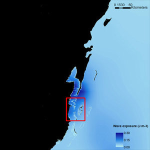
In 2007, the EIB signed a loan for a nickel-cobalt mining and processing project in the Ambatovy region in Eastern Madagascar. The project includes the development of an inland mine site, a refinery close to the harbour on the coast and a connecting 220-km-long pipeline.
Due to the impact on the environment caused by the construction, the borrowers proposed a series of measures to manage the conservation of biodiversity. The measures included the establishment of forest buffer zones at the mine site, the management of a substantial off-set area of primary forest and the monitoring of biodiversity fragmentation along the pipeline.

To assess the impact of the project and to monitor the effectiveness of the adopted measures, the Bank required information on the mining area, an area covered by primary forest, and the 1-km buffer zone around the pipeline.
ESA selected the Belgium-based Keyobs service provider to supply the EIB with a set of up-to-date high-resolution orthophoto maps and land-cover maps of the primary forests and the disturbed areas, based on the most recent EO data. Five SPOT-5 satellite images acquired during 2008 were georeferenced and orthorectified using Landsat ETM+ images and the 90-m digital elevation model.
"The service has been a success. It provides valuable information about the land cover of the area, demonstrates to the users exactly what can be monitored and allows them to make an informed decision about whether and how to proceed with EO-based monitoring of this important project," said the EIB’s Mr Eberhard Gschwindt, Technical Advisor in the EIB Projects Directorate.
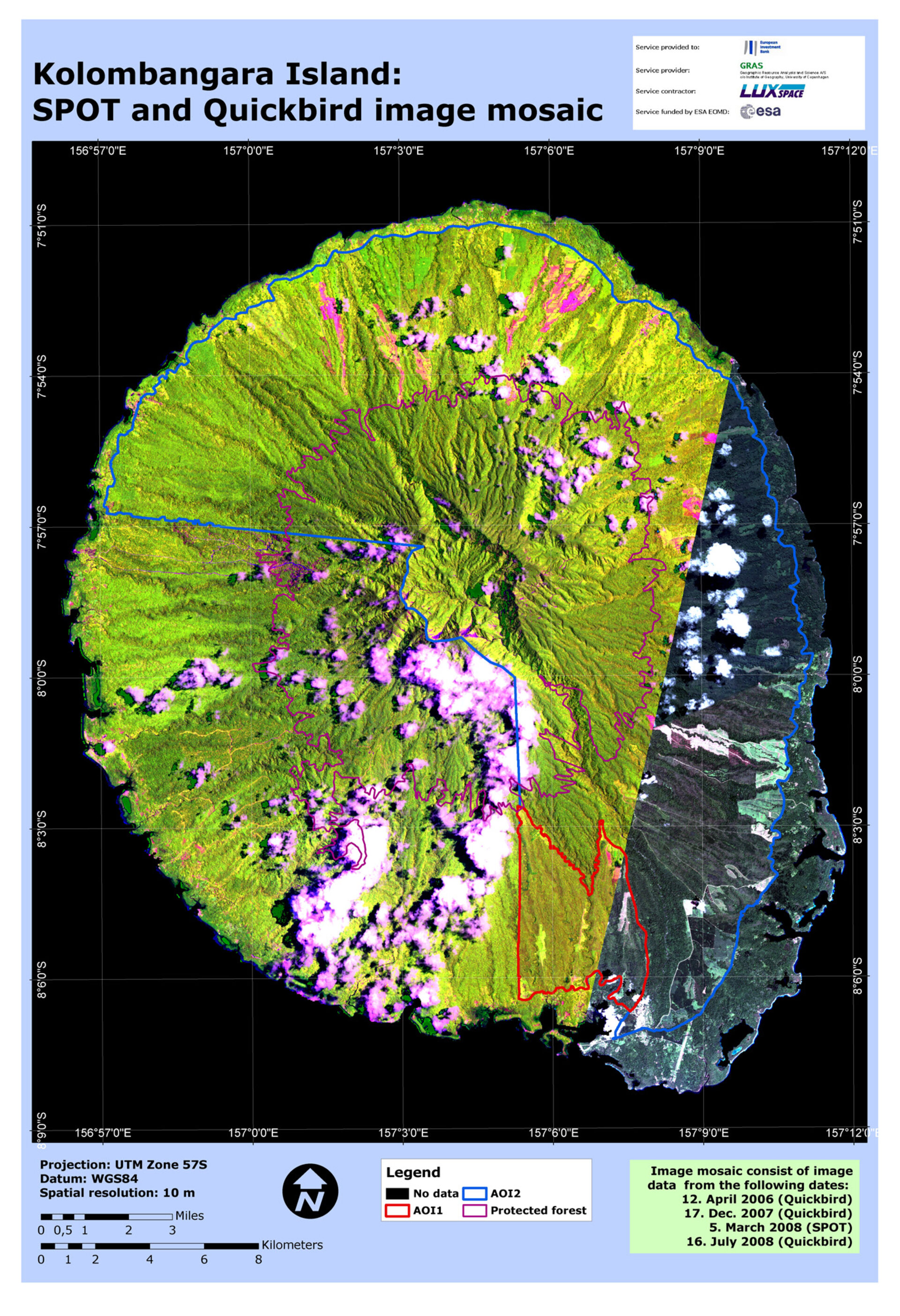
The second EIB demonstration focused on reforestation monitoring on Kolombangara, a small island located in the Western Province of the Solomon Islands. Replanting the forests began in 2007 and will continue until 2011.
The EIB needed information on the progress of replanting of the forests. To achieve this, historic and recent satellite data were used to set the baseline that enabled land cover change detection maps to be created. ESA selected the Danish-based Geographic Resource Analysis and Science (GRAS) service provider who supplied the EIB with mosaics of satellite images covering the entire island, providing information on the progress of the reforestation as well as the impact on the remaining regions of the island.
"The service provides useful information about the land cover of the area, both in the EIB project area and on the rest of the island, and it verifies the progress of the replanting," said EIB’s Mr Harald Jahn, Head of Division Services & SMEs, Argo-Industry (including Biofuels) in the Projects Directorate.
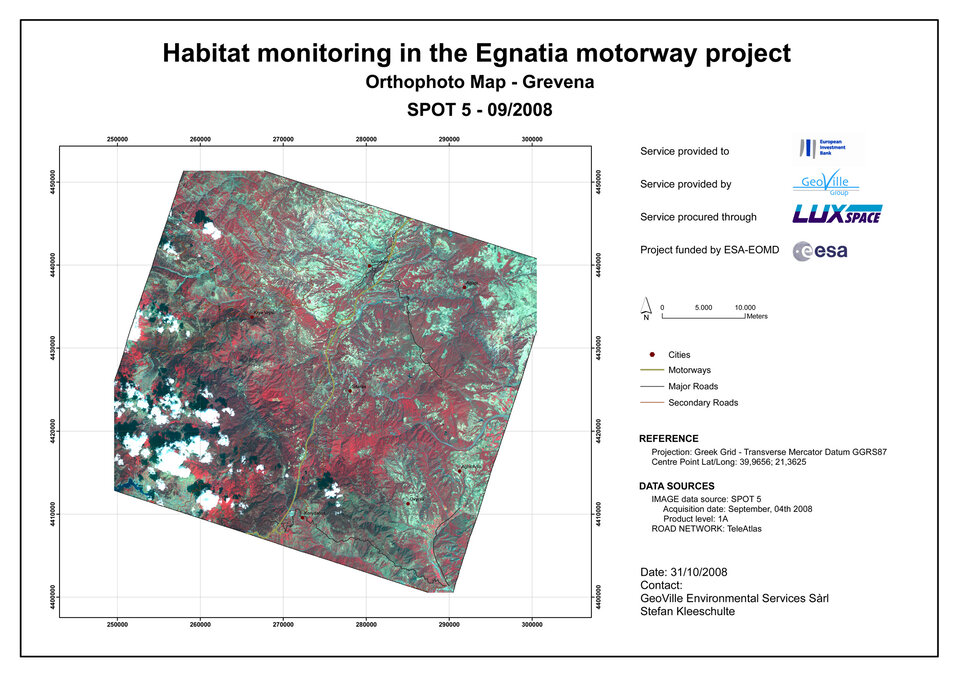
The third demonstration concerned the construction of the Egnatia Highway in Greece. The EIB provided investment support for the road transport project in 2002, and construction is now in its final stage around the 37-km-long section of the West Egnatia Motorway from Panagia to Grevena.
To monitor the progress of the construction work and to assess its impact on the landscape during and after the project, the EIB requested up-to-date information on the construction works and on the fragmentation of sensitive areas, with special attention placed on the brown bear habitat in the Pindos forest region.
ESA selected Geoville, an international consulting company based in Austria and Luxemburg, to produce and deliver a time series of land cover/habitat maps based on historic and recent satellite imagery from SPOT, showing the state of the landscape before and during the construction works.
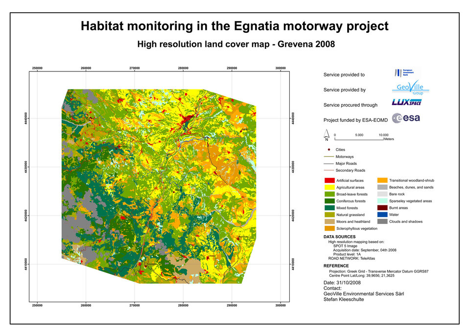
"The service provided the required information on the progress of the construction work. We have no doubts about the technical soundness, but we had difficulty understanding what the results mean for the project," said the EIB’s Mr Claus Eberhard, Economist in the Projects Directorate. "We would now like to take this forward by discussing the potential, and the limits, of these tools, based on what we’ve learned during this pilot exercise."
Next steps
Following these initial demonstrations, ESA held a workshop at EIB to discuss the value of EO to support investment and development projects. The EIB has expressed further interest in EO capabilities and is currently looking at additional projects to start a more substantial evaluation together with ESA of the benefits of EO information across a wider range of the Bank’s activities.
"As a pilot study, this has been a very useful learning exercise for all involved. From our user perspective it has allowed us to understand better the potential – as well as the possible shortcomings – of EO information. We intend now to build on this initial experience, considering the possibility of introducing a systematic use of EO for project monitoring and longer-term project evaluation," said the EIB’s Mr Peter Carter, Associate Director Environment and Social Office of the Projects Directorate.