GOCE muestra el campo gravitatorio terrestre con un nivel de detalle sin precedentes
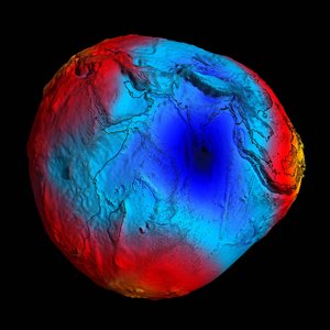
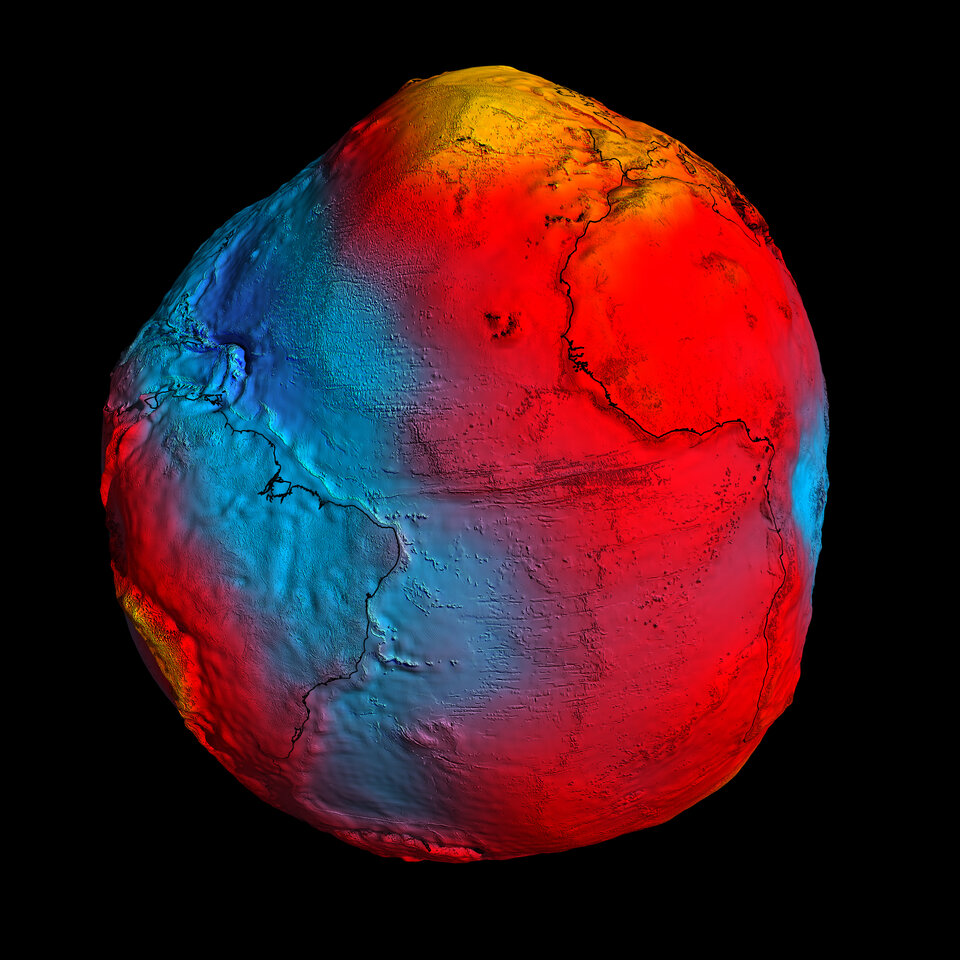
En apenas dos años, el satélite GOCE de la ESA ha registrado todos los datos necesarios para cartografiar el campo gravitatorio de la Tierra con una precisión sin precedentes. Desde hoy, la comunidad científica tiene acceso al modelo más preciso del geoide jamás visto, que ayudará a comprender mejor cómo funciona nuestro planeta.
El nuevo modelo del geoide fue presentado esta mañana en el 4° Taller Internacional de Usuarios de GOCE, celebrado en la Universidad Politécnica de Múnich, Alemania. Científicos de todo el mundo y medios de comunicación se complacieron al contemplar el mejor modelo disponible hasta la fecha del campo gravitatorio de nuestro planeta.
El geoide es la superficie imaginaria que tendría un océano que cubriese todo el planeta, en ausencia de corrientes o mareas, definida tan sólo por el campo gravitatorio. Es una referencia fundamental para estudiar la circulación oceánica, los cambios del nivel del mar y la dinámica del hielo polar – tres fenómenos afectados por el cambio climático.
El profesor Reiner Rummel, antiguo Director del Instituto de Geodesia Astronómica y Física de la Universidad Politécnica de Múnich comenta que “disponemos de un flujo continuo de datos de excelente calidad, generados por el gradiómetro a bordo de GOCE. Al final de cada ciclo de dos meses, disponemos de un modelo del campo gravitatorio de mayor calidad”.

“Ahora ha llegado el momento de utilizar los datos de GOCE en investigaciones científicas y en aplicaciones prácticas. Personalmente, estoy ansioso por ver los primeros resultados oceanográficos”.
“Estos resultados demostrarán que GOCE es capaz de describir la topografía dinámica de los patrones de circulación oceánica con una resolución y calidad sin precedentes. Estoy convencido de que estos resultados contribuirán significativamente a mejorar nuestro conocimiento de la dinámica de los océanos”.
Durante los dos días que durará este taller, la comunidad científica escuchará las últimas novedades sobre la misión y recibirá información detallada sobre los resultados y servicios que ya se encuentran disponibles.
Los asistentes también discutirán cómo el geoide generado por GOCE ayudará a avanzar en los estudios climáticos y oceanográficos, y a comprender mejor la estructura interna de nuestro planeta.
Como ejemplo, los datos obtenidos por GOCE están ayudando a desarrollar un modelo mejorado de los procesos que dan lugar a terremotos como el que recientemente devastó el noreste de Japón.
El terremoto del pasado día 11 de marzo fue causado por el movimiento de las placas tectónicas en el fondo del océano, lo que hace imposible observarlas directamente desde el espacio. Sin embargo, los terremotos dejan una huella visible en las mediciones del campo gravitatorio, que pueden ser utilizadas para comprender mejor los procesos que dan lugar a este tipo de catástrofes naturales y quizás algún día ser capaces de predecirlas.
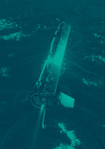
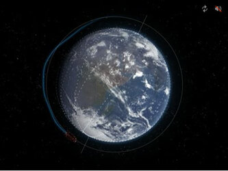
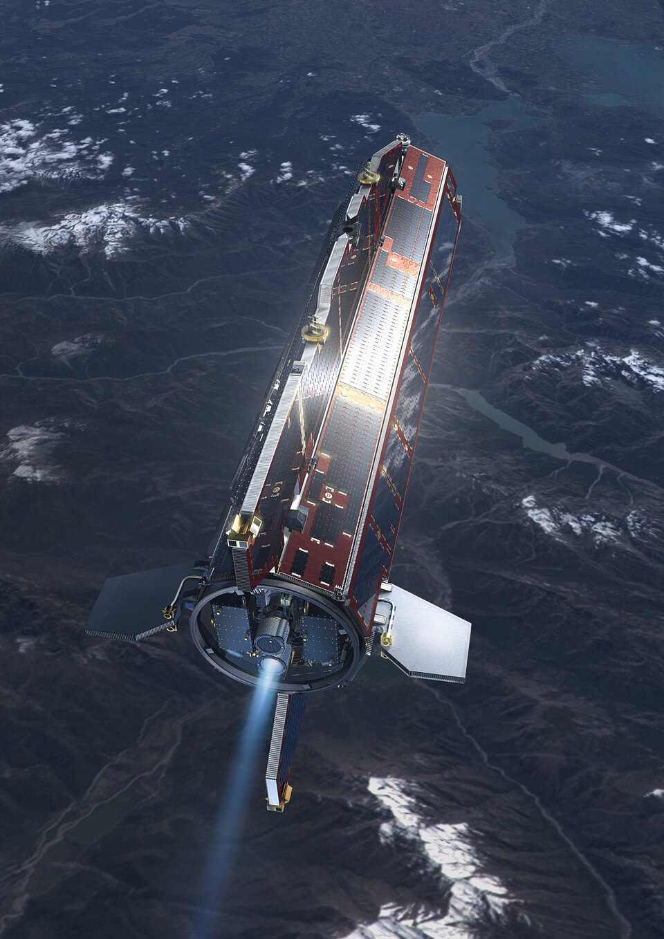
El satélite GOCE fue lanzado en marzo de 2009, y ya ha completado su misión original de recoger datos sobre el campo gravitatorio terrestre durante doce meses.
Volker Liebig, Director de los Programas de Observación de la Tierra de la ESA comenta que “hemos tenido la ventaja de aprovechar un periodo de actividad solar excepcionalmente baja, por lo que GOCE ha podido permanecer en una órbita más baja y completar sus observaciones seis semanas antes de lo que estaba inicialmente previsto”.
“Esto también quiere decir que todavía tenemos combustible para continuar midiendo el campo gravitatorio terrestre hasta finales de 2012, lo que supone duplicar la vida de la misión y la oportunidad de elaborar un modelo del geoide de mayor precisión”.
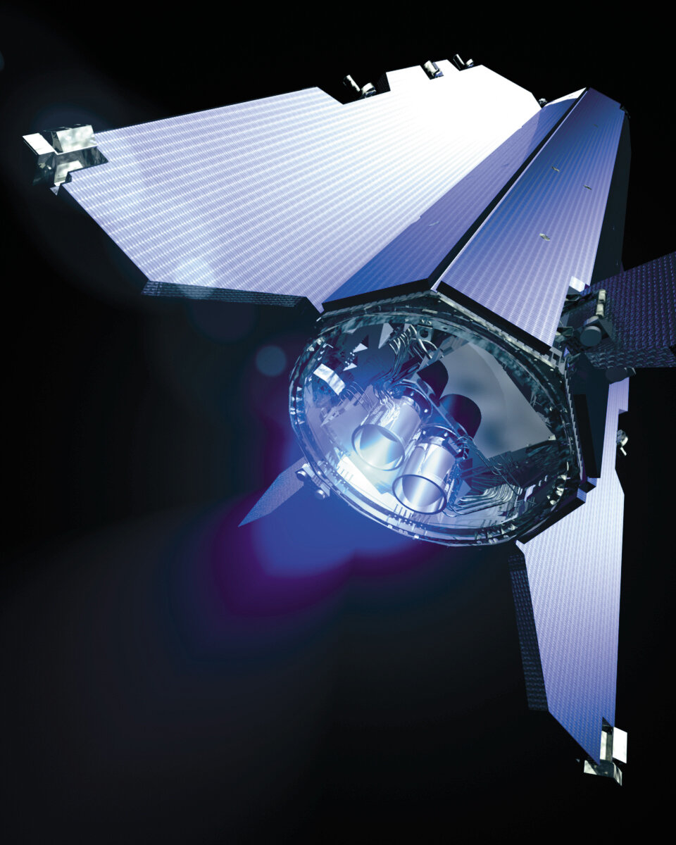
GOCE ha marcado muchos hitos en la historia de la observación de la Tierra. Su instrumento principal – un gradiómetro equipado con seis acelerómetros de alta precisión capaces de medir el campo gravitatorio en 3D – es el primero de su clase en salir al espacio.
Su órbita es la más baja jamás utilizada por un satélite de observación, lo que le permite estudiar el campo gravitatorio con mayor precisión. El diseño estilizado de este satélite de una tonelada de masa tampoco tiene precedentes.
Por si fuera poco, GOCE utiliza un innovador motor iónico que genera una fuerza ínfima pero continua, capaz de compensar con precisión la resistencia aerodinámica que encuentra el satélite en su órbita extremadamente baja.
Volker Liebig añade que “podríamos decir que, desde las primeras etapas de diseño, GOCE parecía una misión de ciencia ficción. A día de hoy ha demostrado ser la misión más innovadora de la historia de la observación de la Tierra desde el espacio”.
Rune Floberghagen, Responsable de la Misión GOCE para la ESA, reconoce que “este es un momento muy importante para la misión. En los próximos meses, a medida que se realicen nuevas observaciones, la comunidad de usuarios podrá utilizar un modelo del geoide todavía más preciso”.