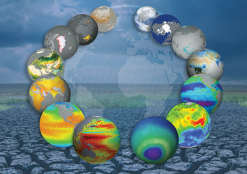
Signs of thawing permafrost revealed from space
Satellite are seeing changes in land surfaces in high detail at northern latitudes, indicating thawing permafrost. This releases greenhouse gases into parts of the Arctic, exacerbating the effects of climate change.
Permafrost is ground that remains at or below 0°C for at least two consecutive years and usually appears in areas at high latitudes such as Alaska, Siberia and Northern Scandinavia, or at high altitudes like the Andes, Himalayas and the Alps.
About half of the world’s underground organic carbon is found in northern permafrost regions. This is more than double the amount of carbon in the atmosphere in the form of the greenhouse gases carbon dioxide and methane.
The effects of climate change are most severe and rapid in the Arctic, causing the permafrost to thaw. When it does, it releases greenhouse gases into the atmosphere, exacerbating the effects of climate change.
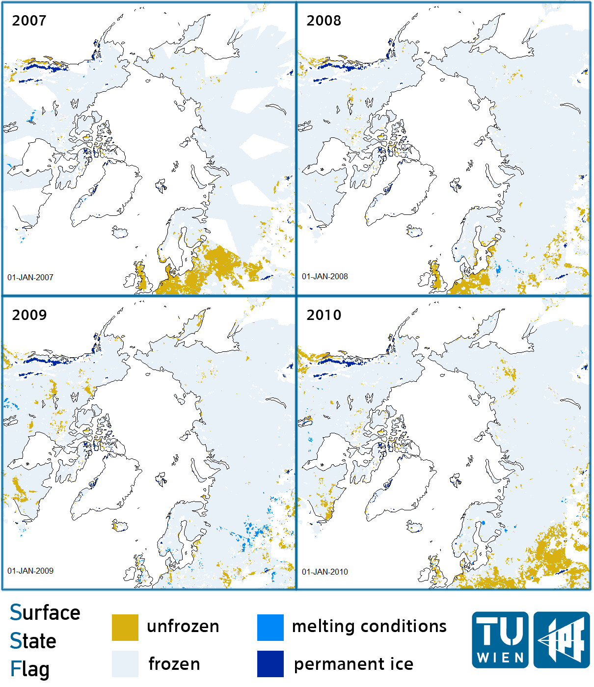
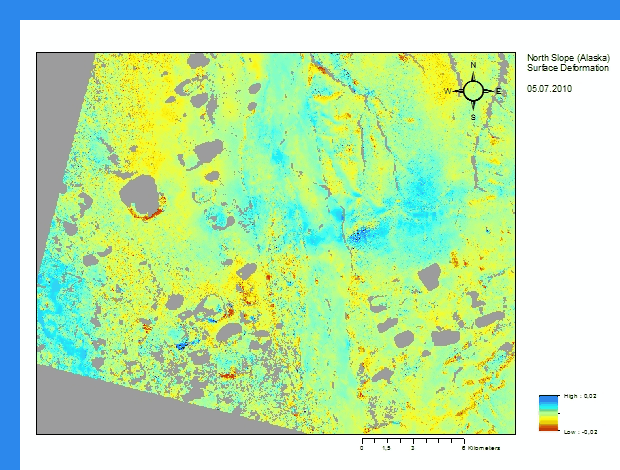
Although permafrost cannot be directly measured from space, factors such as surface temperature, land cover and snow parameters, soil moisture and terrain changes can be captured by satellites.

The use of satellite data like from ESA’s Envisat, along with other Earth-observing satellites and intensive field measurements, allows the permafrost research community to get a panoptic view of permafrost phenomena from a local to a Circum-Arctic dimension.
“Combining field measurements with remote sensing and climate models can advance our understanding of the complex processes in the permafrost region and improve projections of the future climate,” said Dr Hans-Wolfgang Hubberten, head of the Alfred Wegner Institute Research Unit (Germany) and President of the International Permafrost Association.
Last month, more than 60 permafrost scientists and Earth observation specialists came together for the Third Permafrost User Workshop at the Alfred Wegener Institute in Potsdam, Germany, to discuss their latest findings.
“The already available Permafrost products provide researchers with valuable datasets which can be used in addition to other observational data for climate and hydrological modelling,” said Dr Leonid Bobylev, the director of the Nansen Centre in St. Petersburg.
“However, for climate change studies – and in particular for evaluation of the climate models’ performance – it is essential to get a longer time series of satellite observational data.
“Therefore, the Permafrost related measurements should be continued in the future and extended consistently in the past.”
ESA will continue to monitor the permafrost region with its Envisat satellite and the upcoming Sentinel satellite series for Europe’s Global Monitoring for Environment and Security (GMES) programme.