Take a closer look at our planet at the Palais de la Découverte in Paris
ESA PR 15-2007. From Tuesday 3 April to Sunday 26 August, visitors to the 'City of Light' will have one more attraction to pack into their busy schedules. A stop at the Palais de la Découverte will allow them to take a closer look at our planet, as ESA and this renowned Parisian museum have teamed up to exhibit an amazing selection of views of our Earth, with a high science content, taken by ESA’s environmental satellite Envisat.
A large 1:4 scale model of Envisat will be the centrepiece of the 280m² exhibition, while videos and interactive demonstrations will show Envisat’s achievements over its five years of successful operation since launch aboard an Ariane 5 in March 2002.
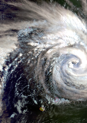
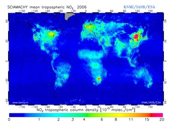
Huge 4 x 4m images, produced using data from the satellite's highly sophisticated imaging instruments, will highlight features of our environment as seen by Envisat, giving the visitor an impressive view of changes in the ice sheets, vegetation and rivers, together with a global picture of water-vapour content, sea temperatures, chlorophyll content and other such vital indicators of the state of our planet and of global change.
In a dedicated room next to the exhibition, videos and slide-shows will enable visitors to extend their journey into our planet and discover more about our fragile environment and the means Europe deploys through ESA to help care for it.
The official inauguration of the exhibition, open to the press, will take place on Monday 2 April. Media representatives wishing to attend the opening ceremony under the auspices of Jack Guichard, Director of the Palais de la Découverte, and ESA’s Director General Jean-Jacques Dordain, are kindly invited to fill in the attached registration form and return it by Friday 30 March at the latest.
Note for editors
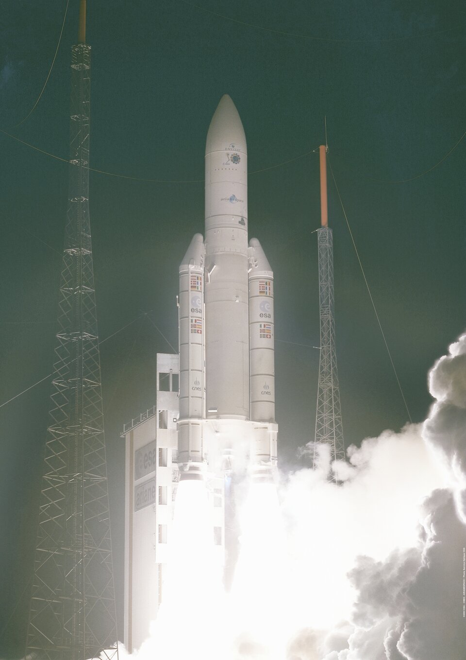
Launched from Kourou in French Guiana on the night of 28 February 2002, ESA’s Envisat spacecraft marks its fifth year in space.
Having orbited Earth over 26,000 times, the world’s largest and most complex environmental satellite ever launched has travelled a distance of more than 1,000,000,000 km, which is almost equivalent to travelling to Jupiter and back.
Envisat is the largest Earth observation spacecraft ever built. It carries ten sophisticated optical and radar instruments to provide continuous observation and monitoring of the Earth's land, atmosphere, oceans and ice caps. Envisat data collectively provide a wealth of information on the workings of the Earth system, including insights into factors contributing to climate change. Furthermore, the data returned by its suite of instruments are also facilitating the development of a number of operational and commercial applications.

Its largest single instrument is the Advanced Synthetic Aperture Radar (ASAR), operating in the C-band. It features unprecedented capability in terms of coverage (i.e. radar beam elevation steerage and the selection of different swaths, 100 or 400 km wide), range of incidence angles, polarisation, and modes of operation.
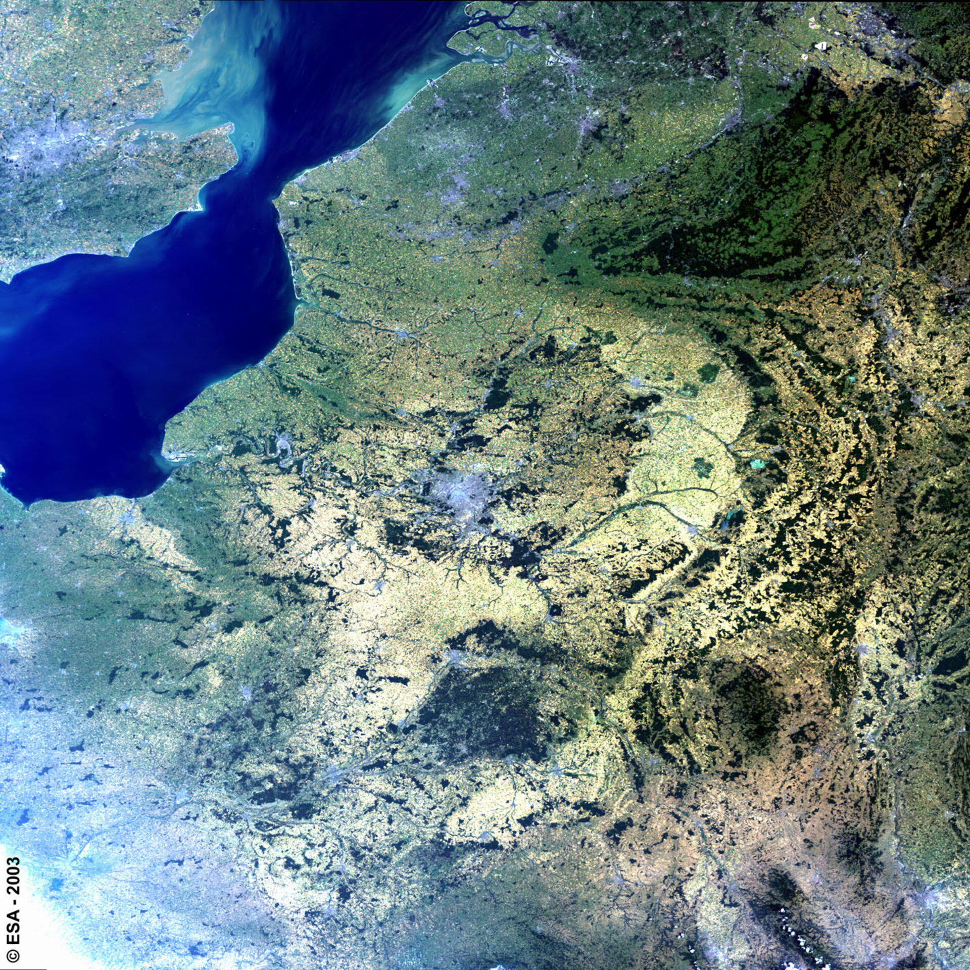
The MEdium Resolution Imaging Spectrometer (MERIS) measures the solar radiation reflected by the Earth, at a ground spatial resolution of 300m, with 15 spectral bands in visible and near infra-red and programmable in width and position. MERIS enables global coverage of the Earth every three days.
The primary mission of MERIS is the measurement of sea colour in oceans and coastal areas. Knowledge of sea colour can be converted into a measurement of chlorophyll pigment concentration, suspended sediment concentration and aerosol loads over marine areas. It is also used for land and atmospheric monitoring.
Generating some 280 Gigabytes of data products daily, in the course of five years' service, Envisat has gathered 500 Terabytes of data. The amount of data returned by Envisat’s suite of ten instruments is providing scientists with a global picture of our environment and helping to fulfil the initial needs of the Global Monitoring for Environment and Security (GMES) initiative until the launch of the future Sentinel satellites.
The satellite was initially only intended to stay in orbit for five years. However, given the excellent overall record and condition of the satellite, the ESA Member States have agreed to fund mission operations until 2010.
For further information, please contact:
Franco Bonacina
Media Relations Office
ESA Communication Department
Phone:+33(0)1.53.69.7155
Fax: +33(0)1.53.69.7155
Queries: media@esa.int