La Terra dallo spazio: terre mediorientali
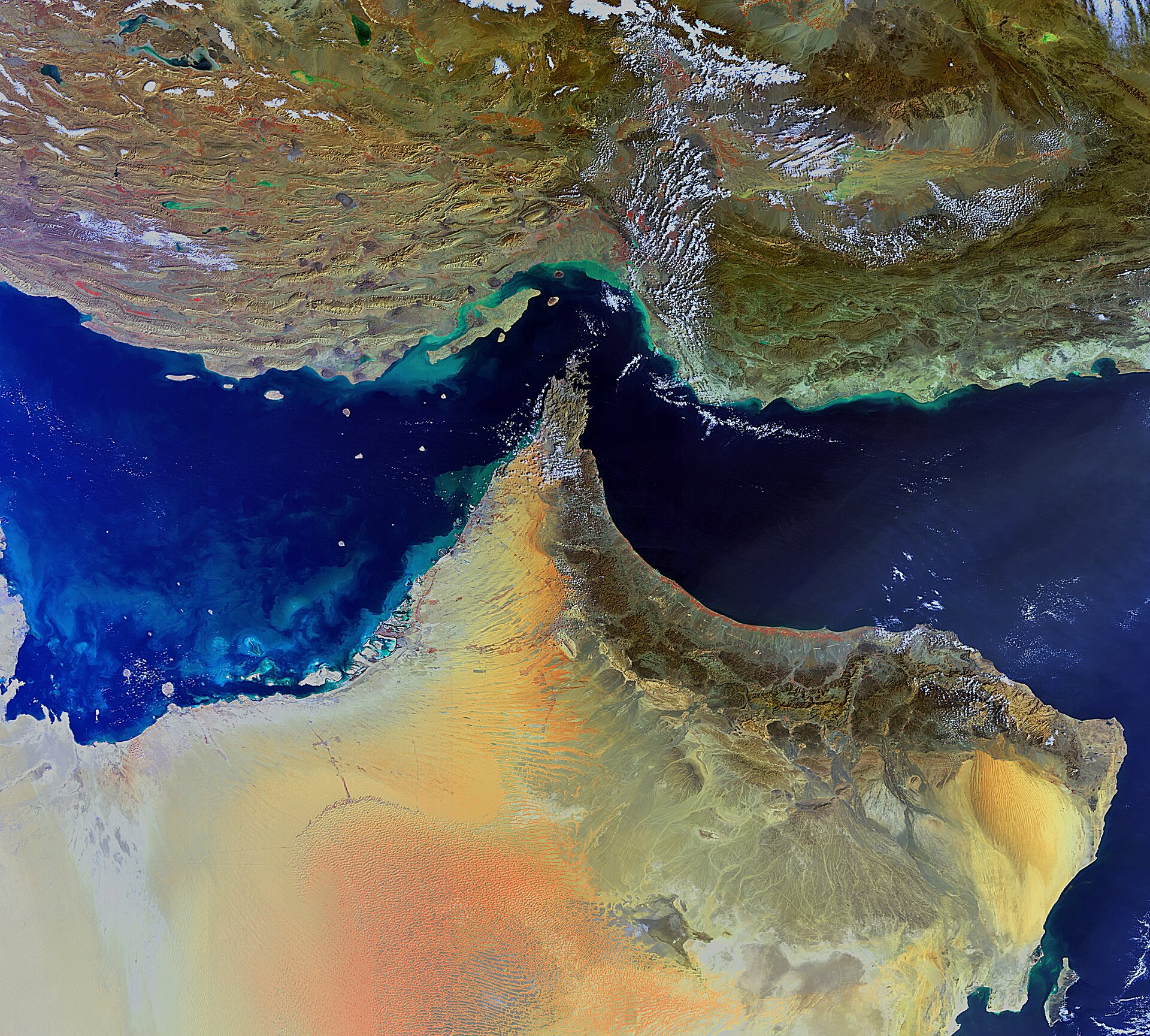
In questa immagine del satellite Envisat vediamo raffigurati parte dell’Iran (in alto) e della Penisola Arabica.
Il paesaggio iraniano presenta aspre catene montuose, un altopiano centrale, deserti, steppe e fasce costiere, a differenza della Penisola Arabica, dominata invece dal deserto.
Il punto dove i due territori sono più vicini è lo Stretto di Hormuz (al centro), il tratto di mare che mette in comunicazione il Golfo Persico (a sinistra) con il Golfo di Oman (a destra in alto) e il Mare Arabico (a destra più in basso).
In territorio iraniano sono visibili i crinali, gli altipiani e le depressioni della provincia di Hormozgān e, parallela alla costa, l’isola di Qeshm, la più grande dell’Iran. I piccoli vortici verde chiaro lungo le coste sono dovuti ai sedimenti trasportati nelle acque.
Nella penisola arabica invece l’immagine inquadra Emirati Arabi Uniti (a sinistra), Oman (a destra) e Arabia Saudita (in basso a sinistra).
In Oman l’unica zona montuosa si trova nella parte settentrionale della nazione, con numerosi picchi fra i 1500 e 2100 m. La maggioranza della popolazione risiede nella regione costiera di Batinah, la lingua di terra verde e arancio nell’immagine, affacciata sul golfo ai piedi delle montagne.
Le isole artificiali di Dubai davanti alla costa degli Emirati Arabi Uniti sono circondate da piccoli vortici di plancton e sedimenti. Il fondale relativamente poco profondo del Golfo Persico e l’ampia piattaforma continentale al largo delle coste di Dubai ne hanno reso possibile la realizzazione.
L’immagine è stata acquisita il 4 febbraio scorso ad una risoluzione di 300 m dallo strumento ottico MERIS a bordo del satellite Envisat.