

Improving healthcare response in Haiti
Earthquakes, tsunamis and hurricanes have taken their toll on many parts of the world. Communities struggle for years to rebuild without immediate access to basic necessities like proper healthcare. Satellites are helping to make this transition easier.
A new system designed by The Institute for Space Medicine (MEDES) in France and Local Insight Global Impact (LIGI) in Portugal, and supported by ESA through its integrated Applications programme, provides access to healthcare using satellite telephones and satellite navigation.
It is designed for regions where trained medical professionals are sparse and where communications are limited due to the damage caused by a natural disaster. Telephone cables can be blown down, rendering phone networks useless.

The system has been used with success in Haiti, where the massive earthquake of 2010 has left its mark.
Health units in many Haitian regions are few and far between and if someone decides to make the journey to a unit, there is a very good chance no one will be there to provide care.
This system makes up for the lack of local health care by ensuring anyone from anywhere can be trained to report the symptoms of a patient accurately.
It uses a special interface designed for satellite and smartphones that walks a user through a series of steps to send data as SMS messages via satellite or a ground-based system, if available. This information is then accessed by local and national health systems via an Internet portal.
Feedback on what to do for the patient can be given within a few minutes. For example, if serious medical attention is needed after the diagnosis, this is dispatched immediately.
Because these data are sent in real time, it can also help the early detection of potential epidemics by revealing trends in symptoms.
Satnav signals are used to ‘geo-tag’ symptom records, simplifying where the data are being collected.
This helps to map potential epidemics based on the symptoms reported. Geo-tagging can also help to put patients in contact with the nearest healthcare provider.
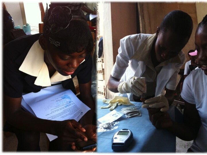
A five-month trial took place in Carrefour, a poor district in the Ouest Department of Port-au-Prince, where 10 teachers from urban and rural areas were trained to use the interface.
More than 4300 symptom declarations were sent, allowing health care professionals to diagnose and make decisions on treatment almost immediately.
“We have shown that the interface is easy to use, and that non-health professionals can be trained to use it,” explains Susana Frazao Pinheiro, representing LIGI.
“This system can make basic healthcare more universal by making a more efficient and cost-effective use of resources, information and knowledge.”
LIGI and MEDES will be expanding the system in Haiti to include more remote areas.
