
Earth from Space: Island nations
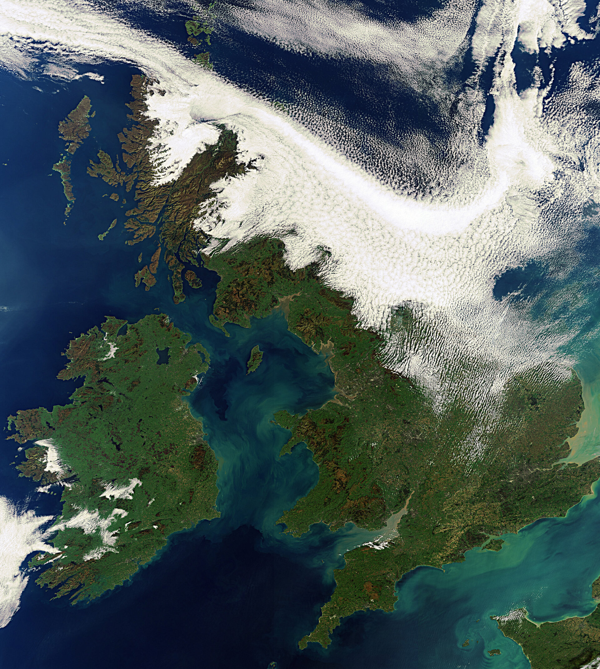
The varied landscapes of the islands of Great Britain and Ireland are featured in this Envisat image.
Within Great Britain, the sprawling rugged Scottish coastline (north) stands in contrast to the green plains of southern England (central and southern two-thirds).
The island boasts mountainous landscapes, as seen in Scotland, England and Wales.
Some 800 lakes are found in Ireland, made up of the Republic of Ireland (covering five-sixths of the island to the south) and Northern Ireland (top eastern corner). The largest lake in the region is Lough Neagh in Northern Ireland.
Brown rugged cliffs along the island’s west coast frame its plush green interior.
The Isle of Man (left of centre) is located between the two islands in the Irish Sea. The English Channel (lower right) flows between southern England and western France. The islands of Jersey and Guernsey are visible in the channel off the coast of Normandy.
The green and tan-tinted swirls in the Irish Sea and English Channel are due to sediments being transported in the water.
This image was acquired by Envisat’s Medium Resolution Imaging Spectrometer on 11 October 2010 at a resolution of 300 m.

