Laser radar illuminates the way to deep space
This car was not snapped with a camera but scanned by a 3D imaging lidar, the laser equivalent of radar. ESA is developing the sensor as a navigation aid for exploring deep space.
Lidar stands for ‘light detection and ranging’, with a pulsed laser beam scanning targets by measuring the time it takes for the light to bounce back.
The wavelength of light is so much shorter than that of radio waves – measured in billionths of a metre rather than centimetres – that lidar gives much more precise measurements.
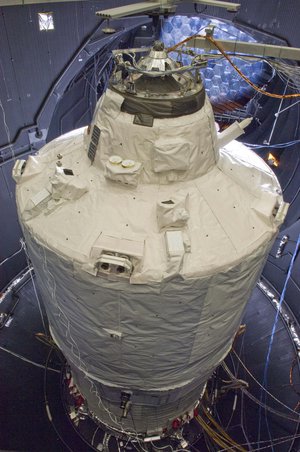
Laser ranging is already used for rendezvous and docking in orbit. When ESA’s ATV cargo ferry docks with the International Space Station it bounces laser beams off reflectors on the orbital outpost to judge the distance to within a couple of centimetres.
For missions deeper into our Solar System, ESA hopes to use 3D imaging lidar to build up a complete picture of targets such as a boulder-strewn surface.
This would be like a stereoscopic imager but it would also work in total darkness or blinding sunlight.
“The 3D imaging lidar we’ve been working on has three main potential applications,” explains Joao Pereira Do Carmo, overseeing the project for ESA.
“The first is for the guidance, navigation and control of planetary landers, in particular in selecting a safe landing site.
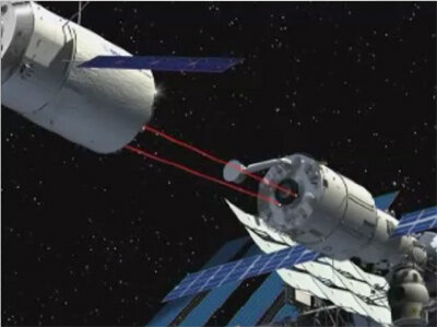
“The second is for steering rovers on planetary surfaces, and the third is for docking in planetary orbit. That would be essential for the proposed Mars Sample Return Mission, for example, when the ascent module carrying material off the martian surface will have to be tracked and captured by its mother craft waiting in orbit.
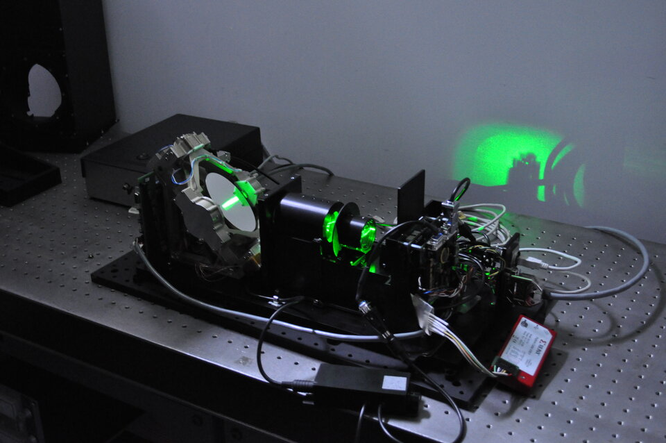
“Terrestrial imaging lidars already exist, typically used for scanning buildings or industrial sites, but they are much too bulky for use in space.

“The challenge is to produce a new class of imaging lidar, much smaller and needing less power.”
Reflecting the technical difficulties involved, separate designs were developed in parallel by two consortia, one led by Jena-Optronik in Jena, Germany and the other by ABSL in Culham, UK.
The shoebox-sized imaging lidars rely on a steerable scan mirror that flicks the laser beam across the target, with a highly sensitive light detector capable of measuring the returning beams from up to several kilometres away.

The two designs aim at different guidance and navigation applications. The German-led unit demonstrates a future rendezvous sensor, while the British-led design is intended to help a lander touch down safely on a planet, detecting and avoiding hazards.
The Imaging Lidar Technology project was supported through ESA’s Basic Technology Research Programme aimed at prototyping promising new engineering concepts.

Building on this progress, a landing lidar is now being designed for ESA’s Lunar Lander, planned to touch down at the lunar south pole in 2018.
The engineers are also looking at ways of making the lidars even smaller perhaps by using new types of detectors and micro-mechanical optical mirrors.
“It is expected that we can reduce the mass and power consumptions of current commercial imaging lidar systems by at least 70%,” Joao concludes.