Envisat images delivered to Antarctic eclipse spotters
The great white expanse of Antarctica experienced the eerie darkness of a total solar eclipse late Sunday night. A lucky few people had reached the scene by icebreaker to see it happen - their route mapped out for them by Envisat satellite imagery.
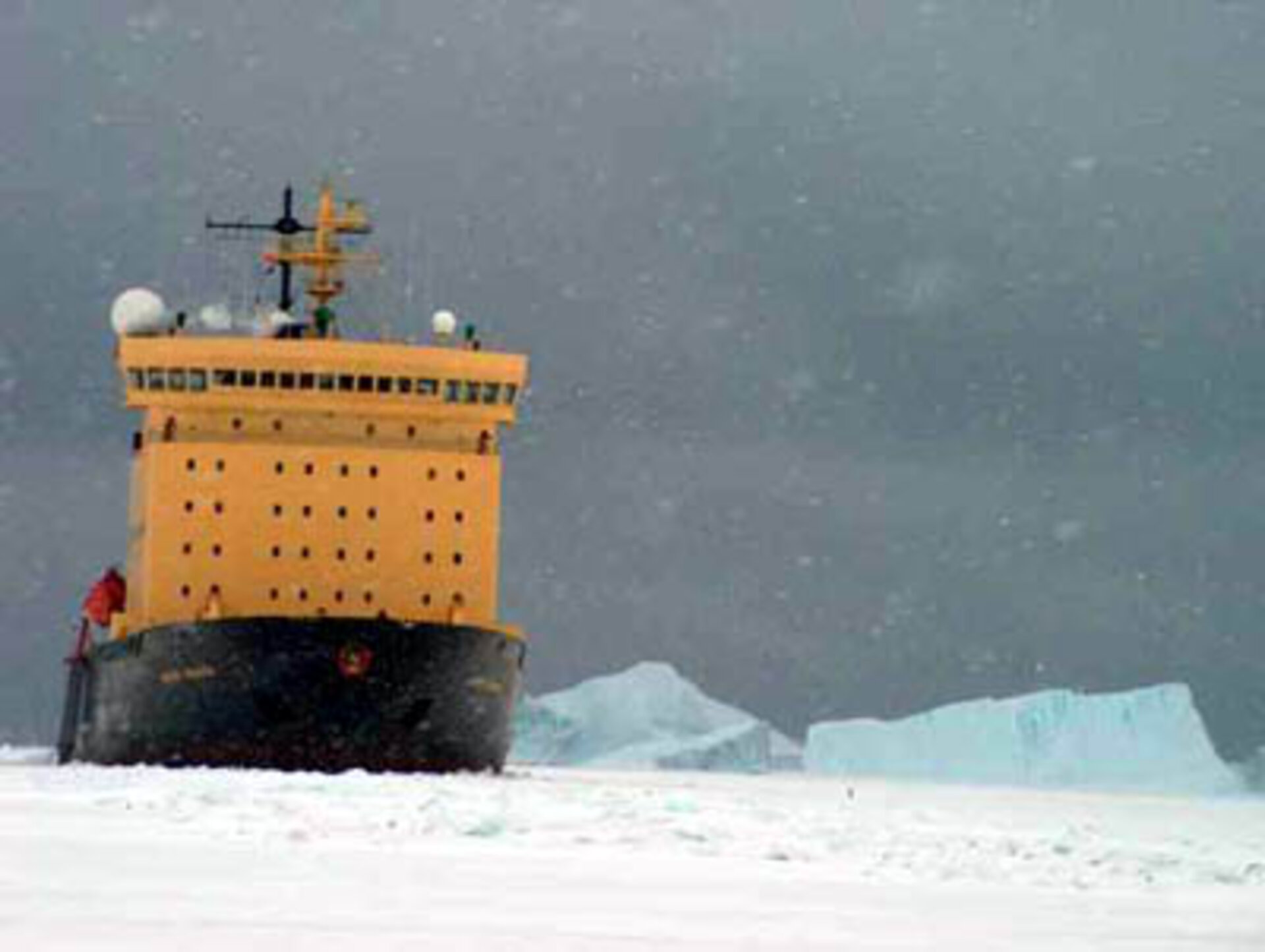
The passengers of Russian icebreaker Kapitan Khlebnikov experienced a little under two minutes of totality around 2340 CEST (2240 UTC) on Sunday 23 November, as the shadow of the Moon blocked out the Sun across eastern Antarctica. Local penguins are accustomed to near-permanent daylight during the south polar summer but they are not reported to have become upset.
A project called Antarctica 2003 has enabled thousands of school children across the world to follow the Kapitan Khlebnikov's journey to this remarkable event from their computers. The International Polar Foundation and the Footbridge Science Centre of the University of Geneva joined together to send specially selected 18-year-old Swiss student Loren Coquille on the trip, together with two accompanying scientists and also radio journalists.
Loren and the two scientists work as special correspondents during the trip, writing dispatches for the Antarctica 2003 website and also carrying out a variety of experiments. Schools across French-speaking Switzerland, France, Belgium, the United Kingdom and Canada are taking part in the project, designed to boost students' interest in science.
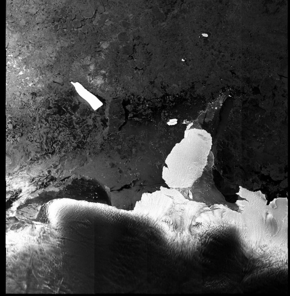
Eduspace, the European Earth Observation website for secondary schools, also contributed by supplying Envisat imagery of areas the ship was sailing into. MERIS and AATSR images are being used in open sea areas to compare against local chlorophyll and temperature measurements carried out from the ship, but while the Kapitan Khlebnikov made its way through the ice to make its eclipse deadline, ASAR radar imagery was sent.
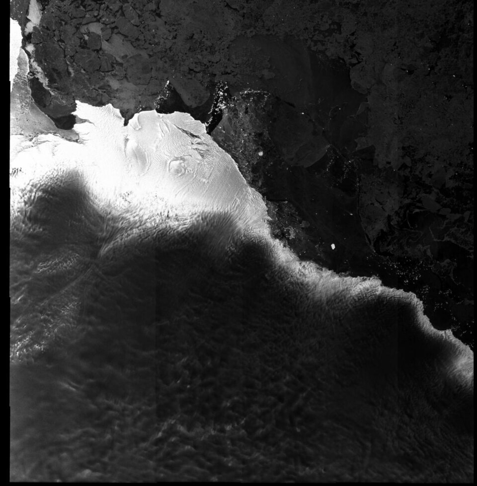
"One of the scientist teachers, Didier Raboud, said he was very interested in comparing the radar data with the ice situation as presented on the ground, and also gave the images to the icebreaker's captain" said Juerg Lichtenegger, Eduspace team co-ordinator, and the person responsible for relaying the images to the ship.
Radar images work through clouds and darkness, and because they record surface roughness instead of reflected light, they can provide information on ice texture and thickness.

As the Kapitan Khlebnikov prepared to reach its planned berth off the Russian Antarctic base of Mirny last week, ASAR images were sent more frequently. On Thursday, Lichtenegger received an image of the region within three hours of its acquisition.
"I modified it for easier dissemination and interpretation and then sent it directly on to the ship and the website," said Lichtenegger. "So they were able to view it that same day. To get to them the image had journeyed twice around the world – acquired by Envisat over Antarctica, then downlinked to the ESA station at Kiruna in northern Sweden, then via internet to my computer in Switzerland, and finally back to Antarctica again!"
Antarctic weather is always unpredictable, although luckily the sky stayed clear enough for Loren and the others to see the eclipse, although at the last moment thin clouds prevented seeing the corona. And the darkness from the Moon's 5000-km-long shadow was striking. Loren was thrilled with her first ever eclipse, and you can hear her describe it in her own words at a radio report on the Anatarctica 2003 website.
The passengers of Kapitan Khlebnikov are spending the next few days on a very busy sightseeing itinerary. The icebreaker leaves the area on 27 November, due to dock at Hobart in Tasmania on 3 December. "They will continue receiving ASAR images in near real time up to the ice edge around 60 degrees south," explained Lichtenegger. "Envisat will then acquire further ASAR samples, and coverage of MERIS and AATSR for offline delivery and later evaluation using the measurements performed onboard." And you can follow the rest of their trip out of the ice via the internet.