
Keeping an eye – from the sky – on volcanoes
The importance of global and frequent data coverage of volcanoes was highlighted in a recent article published in Science. Satellites are finding that volcanoes previously thought to be dormant are showing signs of unrest.
As the 2010 eruption of Eyjafjallajökull in Iceland demonstrated, volcanic eruptions can have consequences over large regions, so the global perspective offered by satellite systems is vital for monitoring volcanoes in remote and inaccessible terrain.
Most volcanoes around the world are not monitored effectively – or at all. The ‘Monitoring Volcanoes’ article made reference to a study of over 440 active volcanoes in 16 developing countries. The study revealed that 384 have rudimentary or no monitoring, including 65 volcanoes identified as posing a high risk to large populations.
Earth-observing satellites, such as ESA’s Envisat, can detect unrest on currently unmonitored volcanoes.
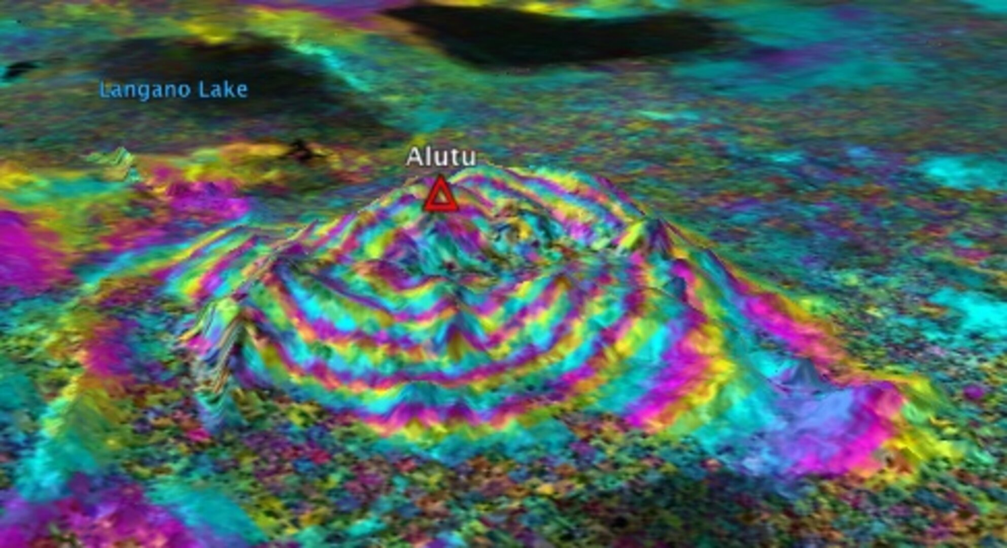
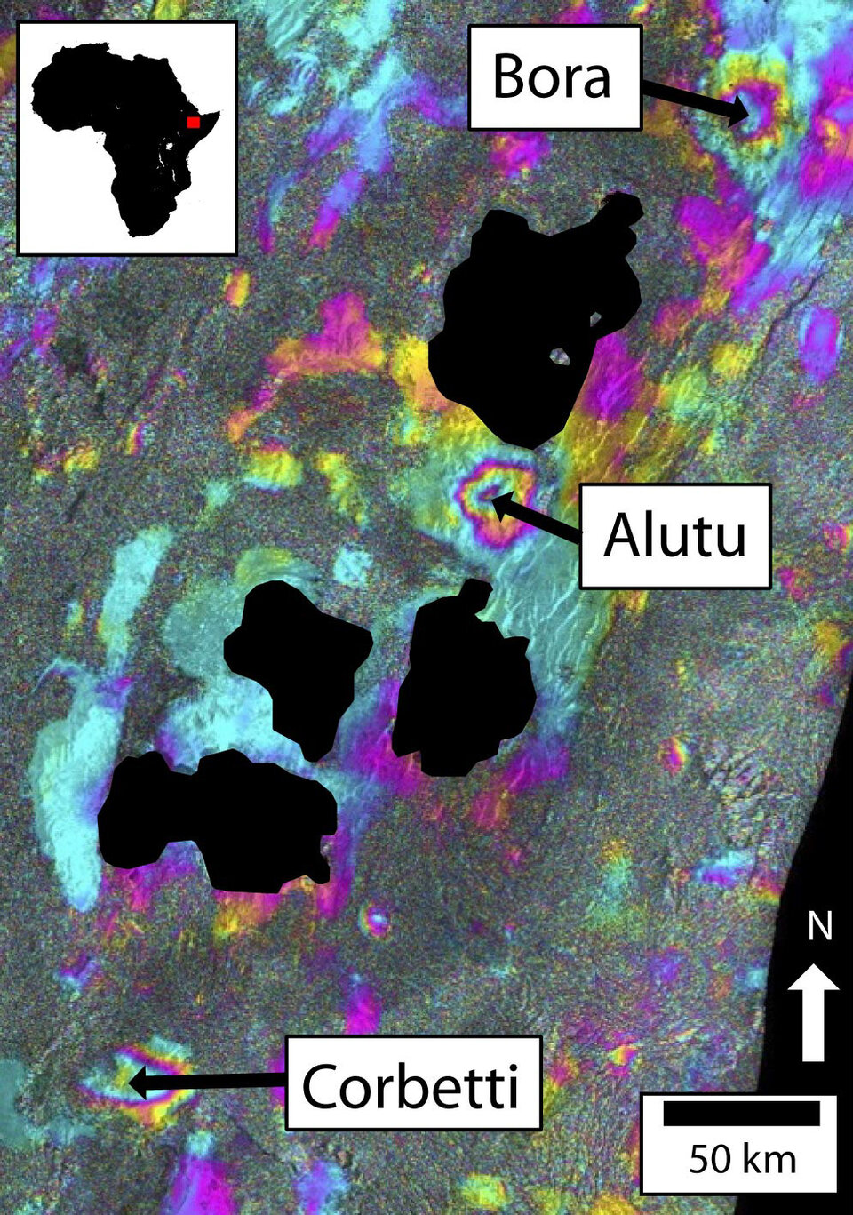
Interferometric Synthetic Aperture Radar – or InSAR – is a remote sensing technique where two or more radar images over the same area are combined to detect slight surface changes occurring between acquisitions.
Tiny changes on the ground cause changes in the radar signal and lead to rainbow-coloured interference patterns in the combined image, known as a ‘SAR interferogram’.
Movement of magma underground may cause deformation of the surface above, thus InSAR can be used to monitor volcanoes.
Active volcanoes are often dangerous and difficult to access, so satellite methods provide a global perspective not achievable using ground instruments.
InSAR is particularly useful for tropical areas – where cloud cover can obscure visual observations – because the radar beam can see through clouds.
Satellite views also provide a global perspective, mapping tectonic strain across continents and allowing the exploration of volcanoes in remote or inaccessible areas.
As a result, many volcanoes previously thought to be dormant are now known to be showing signs of unrest. The resources for acquiring more detailed, ground-based monitoring can now be targeted at such volcanoes.
One example outlined in Science’s article was the uplift detected at Mount Longonot, Kenya. Using radar data from ESA’s Envisat satellite, scientists recorded a 9 cm uplift between 2004 and 2006.
InSAR has enormous potential, but is still a relatively new technique that relies on frequent repeat times and mission longevity. But launching new Earth-observing satellites can provide the data continuity necessary to carry on observations using InSAR.
The upcoming Sentinel satellites, being developed for Europe’s Global Monitoring for Environment and Security (GMES) programme, are expected to acquire data over all land masses every six days for the next two decades.

“InSAR is a growing field – in the past 10 years of my involvement, the number of satellites, processing algorithms and applications has multiplied,” said Juliet Biggs, co-author of ‘Monitoring Volcanoes’ and postdoctoral fellow under ESA’s Support to Science Element.
“The community has gone from a small handful of specialists to a wide range of practitioners in academia, government and industry.
“ESA’s mission policy has been at the root of this expansion, and I hope to be working with them for many years to come on the next generation of Sentinel satellites.”
Early warning of eruptions still faces major challenges, and scientists are still trying to figure out how to tell whether a period of volcanic unrest will lead to eruption. But consistent monitoring can provide insights into patterns and consequences of activity that can help to get a clearer picture of a mountain’s behaviour. And high-resolution satellite data can also support the civil protection authorities to draw up evacuation plans.


