
Earth from Space: Caribbean islands
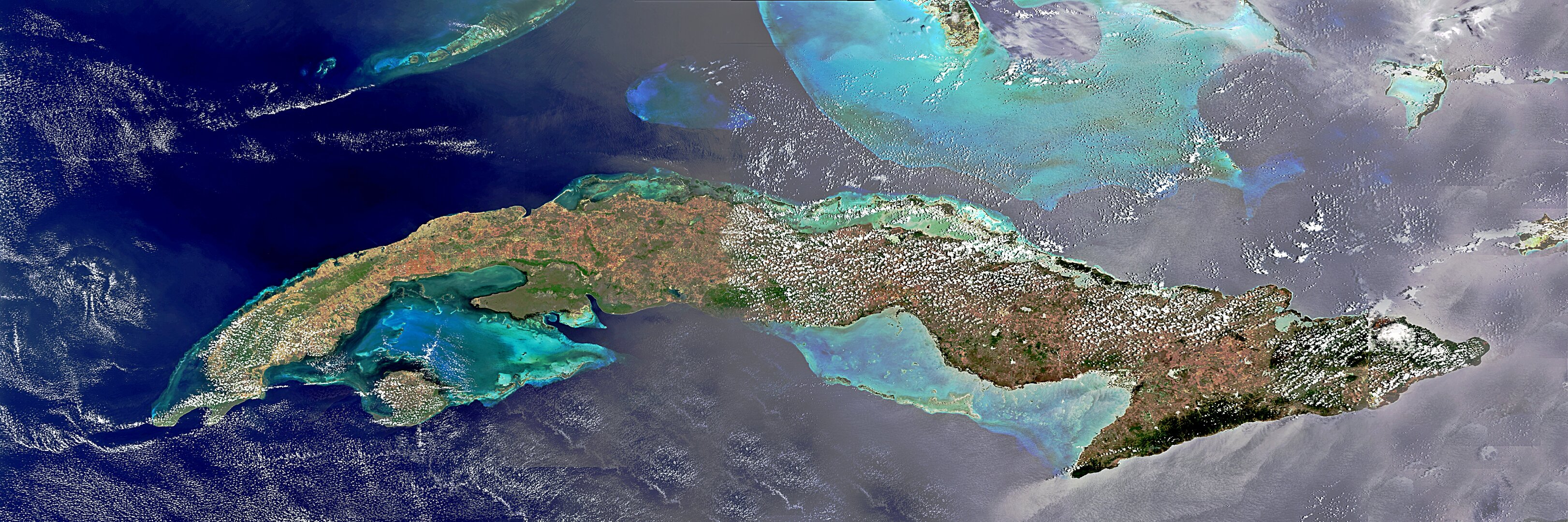
The Caribbean country of Cuba is pictured in this image from the Envisat satellite.
Cuba is an archipelago of islands in the northern Caribbean Sea at the confluence with the Gulf of Mexico and the Atlantic Ocean.
In the southeast, the dark coastal area is home to the Sierra Maestra mountains. It is the highest mountain range on the island, with Pico Turquino reaching nearly 2000 m. The area is also rich in minerals, like copper and iron.
The rounded green zone on the central southern coast of the island is the Sierra Del Escambray mountain range, including the 1160m-high Pico San Juan, Cuba’s second highest peak.
Staying on the south face of the island, the brownish-green area west of the mountains is the swampy Zapata Peninsula, home to a national park – an ideal destination for bird-watching.
Off the southern coast is the Isle of Youth, the country’s second largest island. Much of the island is covered in pine forests, but is also the site of many beaches and resorts.
Northwest of Cuba, we can see the tip of the Florida Keys, a coral archipelago belonging to the US state of Florida.
To the east, the southern portion of the Bahamas is also visible.
This image is a compilation of three images from Envisat’s MERIS instrument, acquired on 15 April, 23 April and 12 May 2011. The images were stitched together to give us a nearly cloudless view of the island.
The Image of the Week is featured on ESA Web-TV, broadcast online every Friday at 10:00 CEST.

