Satellites join watch on Naples' volcanic hinterland
The world's oldest volcano observatory has added satellites to its repertoire of instruments to monitor volcanic features flanking Naples. The result has been the most detailed view ever of ground motion in this vicinity.
When it was founded back in 1841, the Vesuvius Observatory of Italy's National Institute of Geophysics and Volcanology was the world's first scientific institution devoted to volcanoes. Now its remit is more than simply scientific: the Observatory's 24-hour volcanic and geophysical monitoring makes it an official reference point for local and national civil protection authorities.
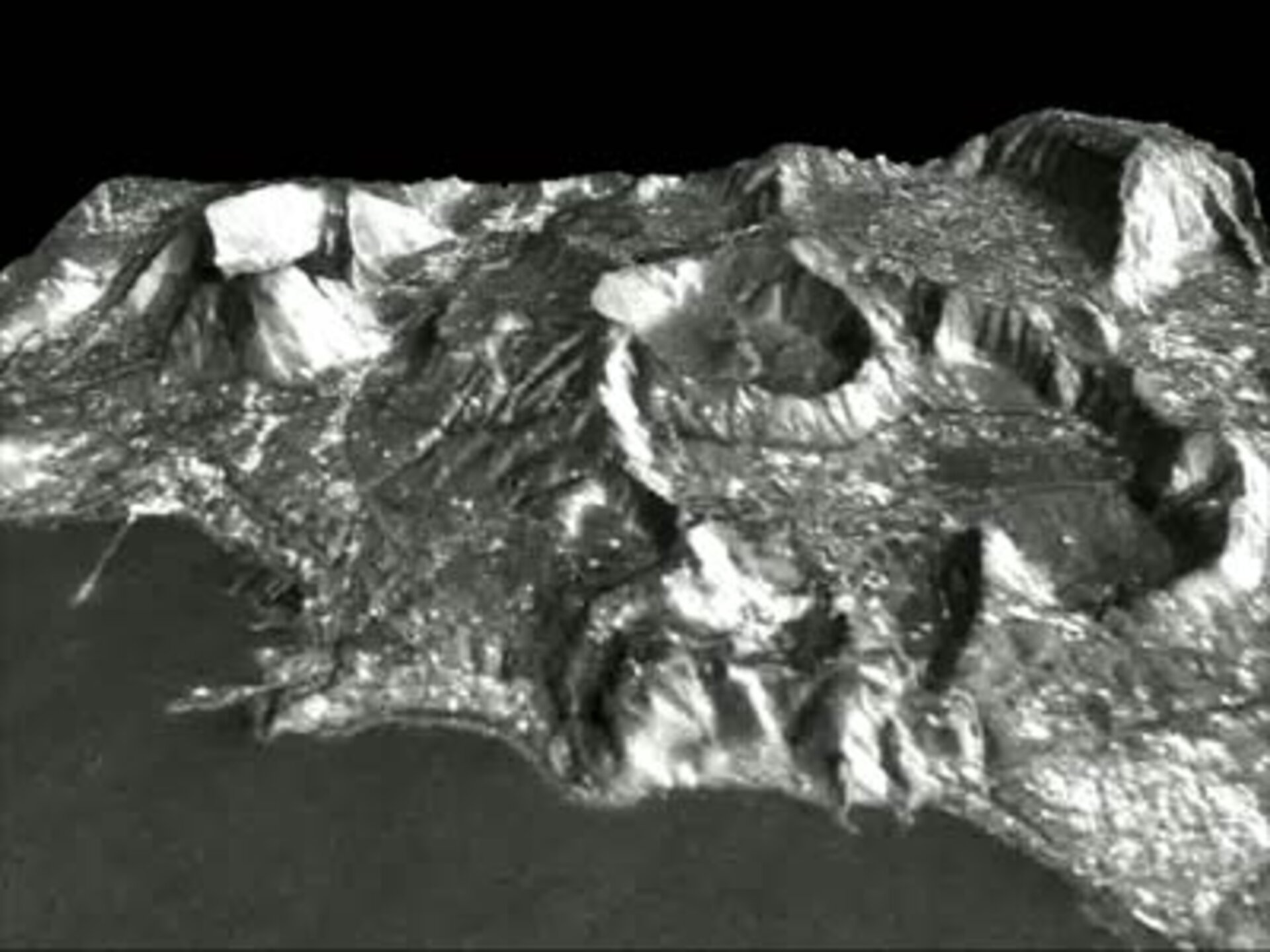
The historical site of the Observatory is located on the slopes of the active Vesuvius volcano, which stands east of the city of Naples and its surrounding metropolitan areas – the vulnerable home of three million people. To the west is another, unrelated volcanic feature, the cratered, smoky landscape of the Phlegrean Fields (known in Italian as Campi Flegrei).

According to the evacuation plan issued by the Civil Protection Department (Dipartimento della Protezione Civile, DPC) in 1995, it could take a week or more to evacuate everyone living in the vicinity of Mount Vesuvius in the event of new activity. This being so, continual monitoring is vital.
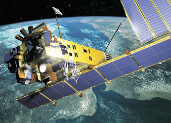
Since 2002, the Observatory has included satellite-derived data in its Surveillance Reports, an innovation following a project with ESA called MINERVA (Monitoring by Interferometric SAR of Environmental Risk in Volcanic Areas).

These space-based views of ground deformation across these volcanic areas agree well with ground-based measurements but extend across a wider area and are accurate to a sub-centimetre scale.
On 23-24 June the Vesuvius Observatory is hosting an English-language workshop on 'The Use of Remote Sensing Techniques for Monitoring Volcanoes and Seismogenetic Areas', intended as a platform for exchanging experience of integrating Earth Observation-based information with traditional observation methods and models.
The workshop's aim is to gather contributions on the experience of different groups in order to formulate technical and general requirements for future activities in this area, as ESA intends to integrate the needs of the geophysical/volcanological community into its future Earth Observation programmes.
Keeping watch from space on the Phlegrean Fields
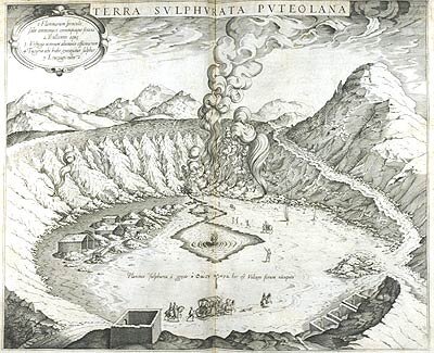
With a diameter of 13 kilometres, the Phlegrean Fields caldera had its last eruption back in 1538 but has exhibited signs of unrest in recent years. Its underlying magma system remains active, leading to rapid periods of ground uplift followed by longer-term subsidence. The most recent uplift event occurred between March and August 2000.
Such ground motion needs accurate measuring. Geodetic ground networks can provide very high accuracy deformation information, but only within the network layout – any change in deformation beyond the area covered is lost.
The vertical component of ground motion is obtained through a geodetic technique called levelling, based on height measurements carried out on single points called benchmarks, which together constitute the levelling network. Levelling data is supplemented with GPS readings to provide 3-D measurements of motion.

However, levelling is costly in money and time. Obtaining measurements across a network is a lengthy process - the Phlegrean Fields network has more than 300 benchmarks – as is the consequent data processing. Typically levelling is only carried out once or twice a year.
Obtaining GPS results is somewhat cheaper and faster, but it still requires a week or more for precise measurements across the 25 vertices of the Phlegrean Fields GPS network. There is also a permanent eight-station GPS network in the area making continuous recordings, but its spatial coverage is limited for economical reasons. GPS measurements beyond it are only carried out every six months or less.
"Considering this frequency of field measurements, our need is to retrieve information with a higher temporal sampling," explained Sven Borgström of the Vesuvius Observatory. "Use of satellite data allows optimal coverage in both space and time – every 35 days in the case of ERS-2 or Envisat, against once or twice a year with GPS and levelling techniques."

It appears to be a paradox: how can a satellite 800 kilometres away in space measure ground motion to a detail comparable to GPS and leveling data acquired right down at the surface?
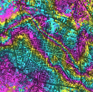
The answer lies in a technique called Synthetic Aperture Radar (SAR) Interferometry, or InSAR for short. InSAR involves mathematically combining two or more radar images of the same site. Any change to the total signal distance travelled (to the surface and back again) causes a shift in signal phase, leading in turn to rainbow-coloured interference fringes that run like contour lines across the resulting interferogram.
For a start this technique can be used to create highly accurate digital elevation models (DEMs), the combination of images working in the same way that human stereoscopic vision lends the illusion of depth.
Then, if relief images are subtracted from the resulting interferogram, (known as differential InSAR) the technique works like a mathematical version of 'spot the difference' to highlight tiny changes occurring between acquisitions. Remaining interference fringes are interpreted to identify even the slightest ground motion occurring along the radar sensor line-of-sight.
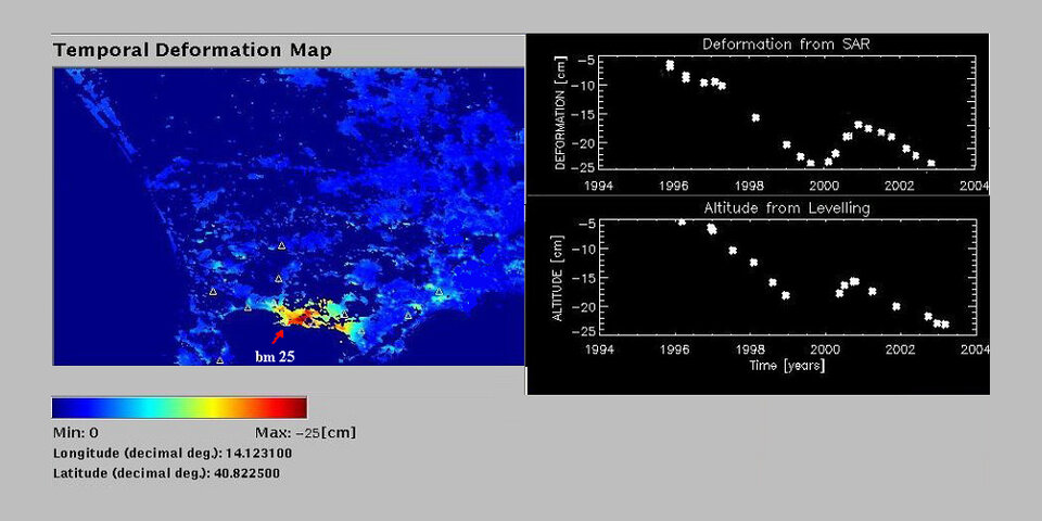
A combined geodetic/InSAR approach has been applied to the study of the March-August 2000 Phlegrean Fields uplift event, using radar images from ESA's ERS-2 satellite. InSAR shows a ground heightening of more than four centimetres occurring in that time. Crucially, the InSAR data corresponds to the levelling/GPS results in this case – as in all cases to date.
In addition, these results are part of a much larger InSAR dataset that enables researchers to pinpoint the time at the start of 2000 when subsidence turned to uplift. The combined ground-and-space data indicate a stasis after the 2000 uplift event, followed by the renewal of subsidence – a pattern typical of the area during the last two decades.
Knowledge from MINERVA

The ESA-funded MINERVA project, part of the Agency's Earth Observation Data User Programme (DUP), was aimed at developing, demonstrating and assessing an information service based on SAR imagery from ERS-1, -2 and Envisat.
The project was based on a new InSAR data processing approach that optimized the quality of interferograms spanning from a 35 day interval up to several years, and to merge them to generate a single product describing the temporal evolution of deformation within the area under investigation.
As installed at the Vesuvius Observatory, MINERVA software allows this product to be updated each time a new SAR image becomes available. At the request of the Observatory, the software code has been adapted in order to achieve complete integration between InSAR and geodetic data, allowing a comparison between the two and retrieving information on deformation taking place between levelling/GPS measurements.
The Italian company Carlo Gavazzi Space was MINERVA prime contractor, with additional partners being the Italian National Research Council's Institute for Electromagnetic Sensing of the Environment (CNR-IREA), the Delft Institute for Earth-Oriented Space Research at the Netherlands' University of Technology (DEOS Delft TU) and the Netherlands National Aerospace Laboratory (NLR). MINERVA concluded in 2003.