SMOS has a better look at salinity
Earth observation measurements shouldn’t be taken with a pinch of salt. ESA is comparing readings of sea-surface salinity from drifting floats to confirm the SMOS water mission’s measurements.
Since its launch in 2009, ESA’s Soil Moisture and Ocean Salinity (SMOS) satellite has been helping us to understand the water cycle.
As with any Earth observation mission, it is important to validate the readings acquired from space.
This involves comparing the satellite data with measurements taken directly in the water.
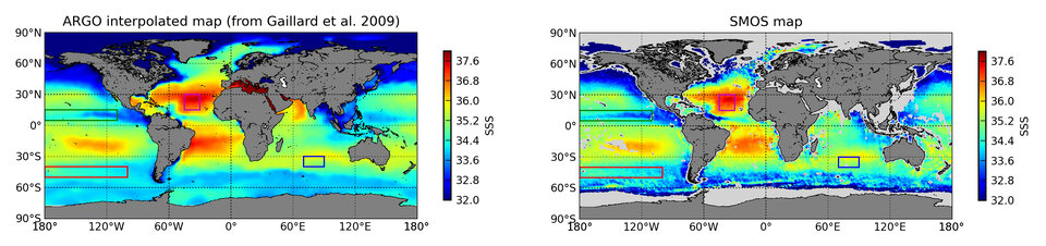
For SMOS, that means comparing its readings to data from floats or drifters that measure ocean salinity at different depths.
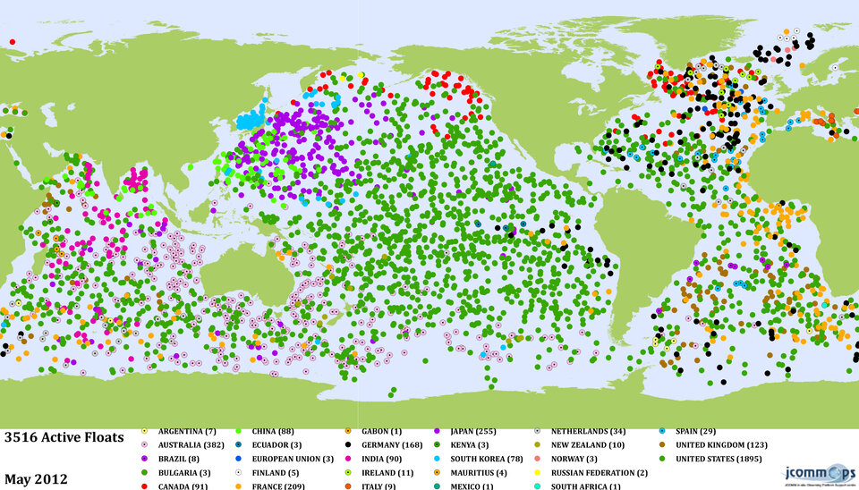
One of the major networks of in-situ drifters is Argo. The network, involving over 50 research and operational agencies in more than 30 countries, uses autonomous floats to collect temperature, salinity and deep current data.
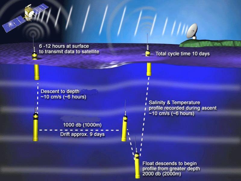
With over 3500 active drifters, the Argo floats acquire in situ data in the upper 2000 m of the ocean.
These measurements are then directly compared to SMOS data, which in turn cover the global ocean and provide measurements of the salinity in the first centimetre of the sea surface.
SMOS provides measurements averaged over a surface of 40x40 sq km, but the difference of the size of the area measured and other influencing factors like background noise lead to differences between SMOS and Argo measurements.
“Since Argo measurements are taken much deeper than SMOS’s, the stratification of the upper layer of the ocean needs to be taken into account when comparing the two salinities in rainy regions,” said Jacqueline Boutin from France’s Laboratory for Oceanography and Climate (LOCEAN).
“For example, rain over the ocean will cause SMOS to pick up lower salinity readings than Argo.”
The advantage that SMOS has over the Argo floats is that the satellite provides a complete view of the global ocean every five days.
Argo measurements, on the other hand, provide punctual salinity data sampled at a lower resolution than SMOS every 10 days.
The higher precision provided by the Argo floats, however, complements the SMOS measurements.
There are many factors that can affect SMOS data quality, like temperature. SMOS measurements have proven to be more accurate in warmer waters where the signal to noise ratio is more favourable.
SMOS and Argo floats therefore agree better in warm waters, such as in the subtropical Atlantic Ocean.
In addition, radio signals transmitted in the same frequency range that the satellite uses to collect data can impede the measurements. Therefore, SMOS salinity is more accurate in areas with less radio-frequency interference.
Over the last year, over a dozen radio signals at northern latitudes were switched off in an international effort to improve SMOS’s observations.
The elimination of radio interference along with enhanced data processing has improved SMOS measurements.
The mission is now approaching its objective of 0.1 psu (practical salinity unit) accuracy for a 10–30 day average, over an open ocean area of 200 km by 200 km.

Measuring salinity is important because it is one of the factors that determine the density of seawater, and density plays a role in driving the ocean currents.
Ocean salinity is therefore one of the key variables for monitoring and modelling ocean circulation, and for better understanding of the global water cycle.
Currents and circulation can moderate the climate, like transporting heat from the Equator to the poles.
SMOS data are also being compared with data from other satellites that measure salinity, such as NASA’s Aquarius mission, to further validate the mission through the Ocean Salinity and Synergy project under ESA’s Support to Science Element.