Pioneering ERS environment satellite retires
After 16 years spent gathering a wealth of data that has revolutionised our understanding of Earth, ESA's veteran ERS-2 satellite is being retired. This pioneering mission has not only advanced science, but also forged the technologies we now rely on for monitoring our planet.
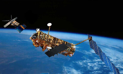
ERS-2 was launched in 1995, following its sister, the first European Remote Sensing satellite, which was launched four years earlier.
Carrying suites of sophisticated instruments to study the complexities of the atmosphere, land, oceans and polar ice, these two missions were the most advanced of their time, putting Europe firmly at the forefront of Earth observation.
The twin satellites were identical, apart from ERS-2's additional instrument to monitor ozone in the atmosphere. Both exceeded their design lifetime by far, together delivering a 20-year stream of continuous data.
In 2000, ERS-1 unexpectedly stopped working and now it is time to bid farewell to ERS-2 before it succumbs to a similar fate.

To avoid ERS-2 ending up as a piece of space debris, ESA will take the satellite out of service by bringing it down to a lower orbit while there is still sufficient fuel to make the careful manoeuvres.
The decision to retire ERS-2 was not taken lightly, but after orbiting Earth almost 85 000 times – travelling 3.8 billion km – the risk that the satellite could lose power at any time is clearly high.
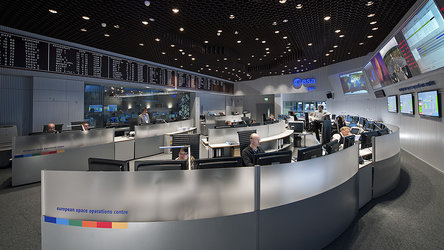
The deorbiting procedure will be carried out over a number of weeks by spacecraft operators and flight dynamics experts at ESA's European Space Operations Centre in Germany.
Starting on 6 July, a series of thruster burns will gradually lower the satellite's orbit from its current altitude of 800 km to about 550 km, where the risk of collision is minimal. Eventually, ERS-2 will enter Earth's atmosphere and burn up.
Its destruction will occur within 25 years, in accordance with European Code of Conduct on Space Debris Mitigation.
ERS-2 has been delivering data right to the end. In one of its last operations, the satellite was placed in an orbit that allowed it to capture radar images every three days of some of Earth's most rapidly changing features.
Over their lifetimes, the missions have achieved many outstanding results. With thousands of research projects and published scientific papers based on ERS data, it is difficult to list them all.
Carrying the first spaceborne civil radar, the missions offered a new perspective of Earth.
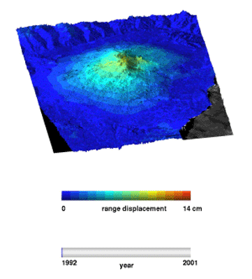
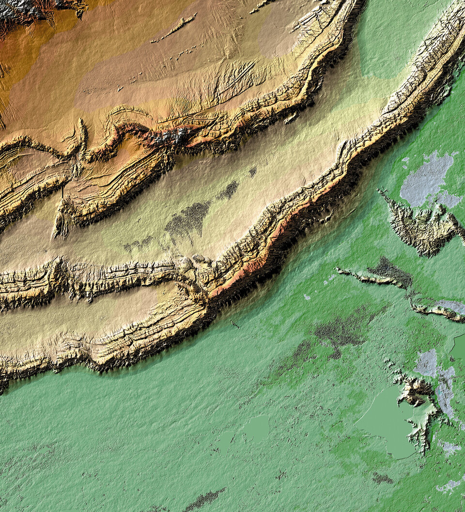
In particular, by exploiting the process of synthetic aperture radar interferometry we have been able to monitor how the ground moves during events like the earthquake that recently devastated Japan. A similar technique is also used to generate digital elevation models.
Moreover, these data build up a long-term archive so that changes over time can be carefully monitored.

The radiometer has provided precise maps of global sea-surface temperature, leading to novel observations of the 1997 El Niňo, and the radar altimeter provided new information on sea level, a major concern linked to climate change.
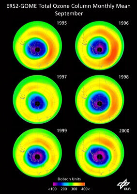
In addition, the Global Ozone Monitoring Experiment (GOME) on ERS-2 provided insight into the depletion of stratospheric ozone over Antarctica.
GOME was one of the longest serving ozone monitors in the world, with its success leading to a string of similar satellite sensors.
The continual improvement of data processing since ERS-2 was first placed in orbit has meant that a wealth of other information on atmospheric gases such as nitrogen dioxide could also be gleaned from GOME.
While the observations from ERS have been used in a multitude of application areas, they also form a valuable contribution to a long-term data archive to understand how Earth works as a system and the impact climate change is having.
It is difficult to overstate the value that the ERS missions have brought to science, but just as important has been the technological excellence the instruments have demonstrated.
These various technologies live on in successor missions such as ESA's Envisat, the Earth Explorers and the Sentinels for Europe's Global Monitoring for Environment and Security programme, as well as in many other national satellite missions.
In essence, ERS provided the scientific and technical heritage for Europe to continue monitoring our planet from space.