Huge waves from one storm slam coasts some 6000 km apart
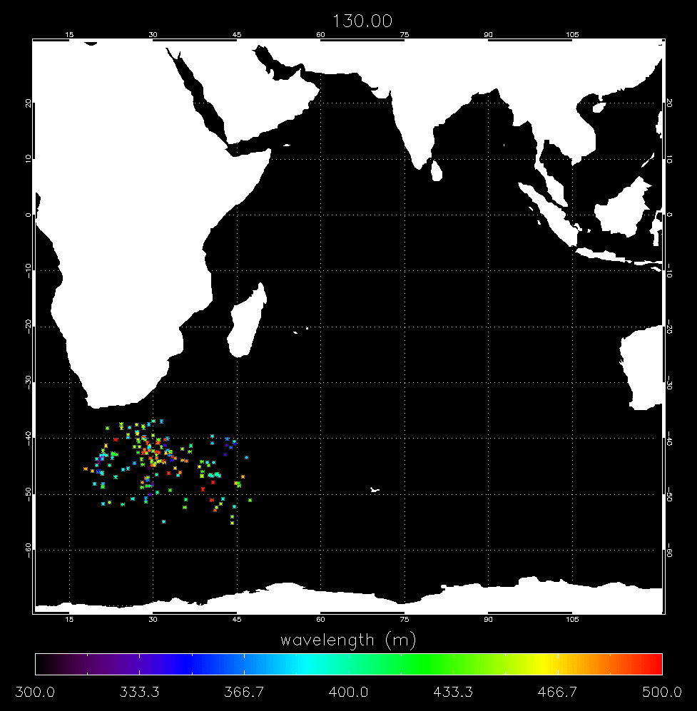
Huge waves that struck Reunion Island and coastlines across Indonesia earlier this month all originated from the same storm that occurred south of Cape Town, South Africa, and were tracked across the entire Indian Ocean for some 10 000 kilometres over a nine-day period by ESA’s Envisat satellite.
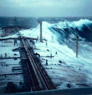
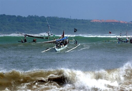
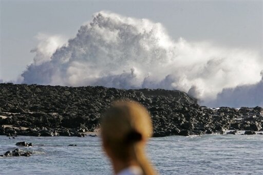
Waves reaching up to 11 metres devastated France’s Reunion Island in the Indian Ocean when it slammed into the southern port of Saint Pierre on 12 May. Six days later waves created from the same storm measuring as high as seven metres began crashing into Indonesia coastlines from Sumatra to Bali, killing at least one person and causing some 1200 people to flee their homes.
Dr Bertrand Chapron of IFREMER, the French Research Institute for Exploitation of the Sea, and Dr Fabrice Collard of France's BOOST Technologies in Brest located and tracked the swells using standard processed Synthetic Aperture Radar (SAR) ESA Wave Mode products, as shown in the animation above.
"The extreme swell systems originated from the same storm, which moved rapidly and had two main strong wind periods," Chapron said. "As illustrated in the animation, the resulting waves were organised into two main swell systems that followed each other across the entire Indian Ocean, hitting Reunion Island, Mauritius, Australia and Indonesia."
The waves that hit Reunion Island were forecasted, but their intensity was predicted to be 20 to 30% below measurements, Collard explained.
"Although swells are still surprise factors, these particular swells were created by natural events so they could be tracked," Chapron said. "By using the SAR Wave Mode product, we can locate and systematically track swells globally, making it possible to put a network of early warning systems in place in the near future."
"Because of its unique capacity to restitute wavelength and directional information of the propagation of swells, the SAR instrument is about to bring a remarkable contribution to the monitoring of energetic wave systems," Collard said.
Chapron and Collard are working on a global swell-tracking project, which was presented for the first time at the Envisat Symposium held in Montreux, Switzerland, from 23 to 27 April 2007, using the Advanced Synthetic Aperture Radar (ASAR) aboard Envisat to follow these waves in order to refine their propagation paths and determine their arrival times and intensities.
Once in place, this system will be the equivalent of deploying a global network of virtual buoys that are able to detect and track large swell systems carrying large energy from all available remote sensing measurements of waves, such as SAR and radar altimetry.
Each virtual buoy will have the capacity to detect and measure the wavelength and the direction of propagation as well as the height of the swell systems crossing the oceans, complementing the sea forecast models used by weather centres and allowing alarms to be raised a few hours before these devastating swells hit coasts.
Storms are capable of generating waves of different wavelengths that travel in several directions upon leaving the storm system, with the longest wavelengths travelling the fastest. As these waves cross open seas, they can accumulate energy at precise locations and become very dangerous for marine safety.
In addition, wave systems slow down as they approach the coastline, and individual waves increase to reach at least two times the mean average of their initial wave height. For instance, a 5-metre significant wave height system can hit the coast with the height of 10 metres.
Today, the ASAR Wave Mode acquires 10 by 5 km small images, or 'imagettes', of the sea surface every 100 km along the satellite orbit. These small ‘imagettes’ are then mathematically transformed into averaged-out breakdowns of wave energy and direction, called ocean-wave spectra, which ESA makes available to scientists and weather centres.
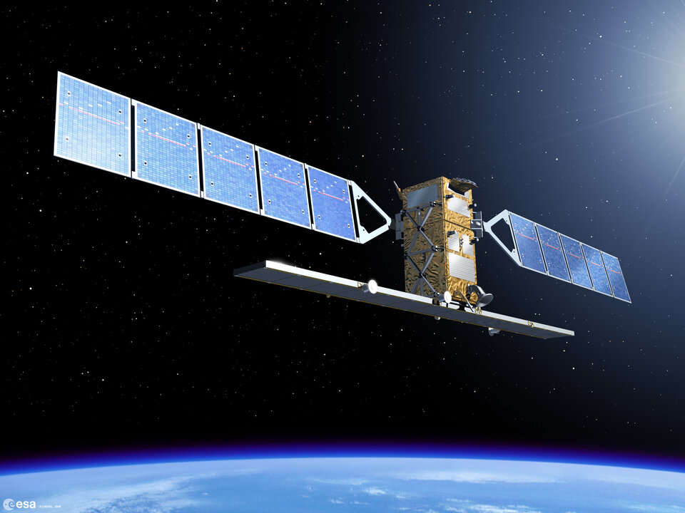
As part of the Global Monitoring for Environment and Security (GMES), a joint initiative of the European Commission and ESA, the space agency has undertaken the development of Sentinel-1, a European polar-orbiting satellite system for the continuation of SAR operational applications.
The Sentinel-1 SAR instrument will also have a dedicated enhanced Wave Mode capability to double the present ASAR Envisat Wave Mode samplings, to improve the actual demonstrations for a Near Real Time tracking and forecasting of swell for European users.
ESA and IFREMER will sponsor an ocean wave data user workshop at IFREMER in Brest, France, on 20 and 21 September 2007 that will address and capture user requirements for a possible future wave data service.
In January 2008, ESA will host its second SAR oceanography workshop, SEASAR 2008, entitled "Advances in SAR Oceanography from Envisat and ERS missions," at ESRIN, ESA’s Earth Observation centre, in Frascati, Italy.