
Could short wavelength radar reveal new views of Earth from space?
As our quest for knowledge about our planet grows, so does the need for novel technologies to offer new insight into the changing face of Earth. Researchers are excited about the potential of a new radar wavelength to image Earth from space.
As part of ESA’s continuing efforts to develop new and better instruments for observing Earth from space, a field experiment has been exploring a very short radar wavelength – only 8.5 mm – called Ka-band.
Since it can offer both very high-resolution images and precise measurements of surface height at the same time from one satellite, scientists and engineers believe that it could be suitable for a wide range of environmental applications – from measuring ocean currents across the globe to monitoring changes in mountain glaciers.
However, as with any new technology, there are challenges to overcome if a Ka-band imaging radar is ever going to orbit Earth.
Unlike current and near-future radar satellites such as ESA’s Sentinel-1, which operate using wavelengths of 3–24 cm, shorter-wavelength sensors are much less established, so a lot of research and development are required.
An additional complication is the fact that Ka-band sensors also operate at the very edge of the atmospheric ‘window’ that allows radar sensors to ‘see through’ the atmosphere and gather information about Earth’s surface.
Any shorter than 8.5 mm and the images would not be able to see the ground.
A final complication – but one that is readily solved using airborne testing – is that very little is known about radar images at Ka-band.
ESA’s Remo Bianchi, who is leading the activity, said, “Even basic questions such as how bright or how dark Ka-band images are when they are taken over different features such as roads, forests, agricultural land, rivers and oceans need to be answered before embarking on any detailed mission design.”
ESA’s KaSAR airborne campaign is, for the first time, providing answers to these critical questions as well as a tantalising glimpse of what such a future radar satellite mission might bring.
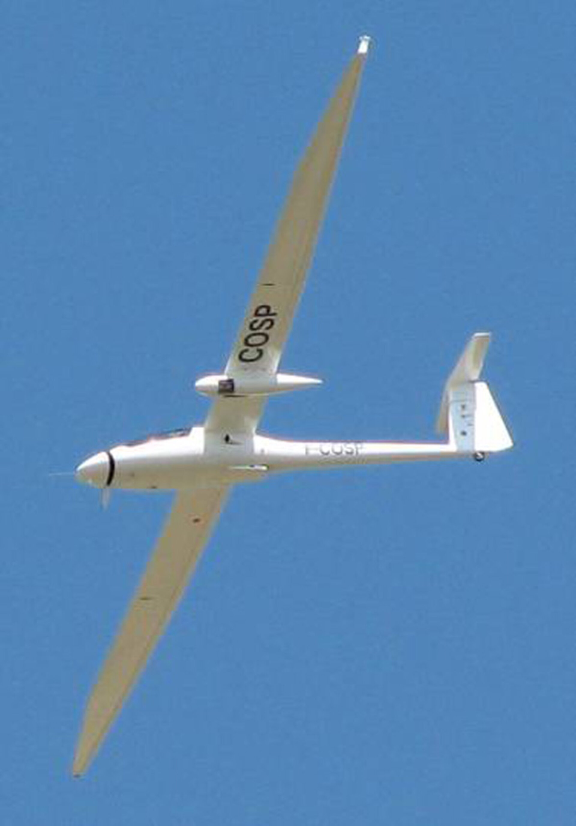
The campaign, organised and funded by ESA and carried out by the French national aerospace research centre Onera in southern France, saw three flights of a Ka-band synthetic aperture radar instrument on a Busard light motorised glider.
“The flights were a success, we were lucky with the weather conditions and the instrument performed well,” said Jean-Francois Nouvel from Onera, responsible for the airborne effort.
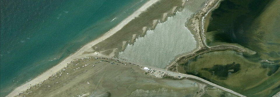
“We managed to fly and take Ka-band radar images over all sorts of different surfaces, including lakes, rivers, the Mediterranean Sea as well as urban and agricultural areas.”
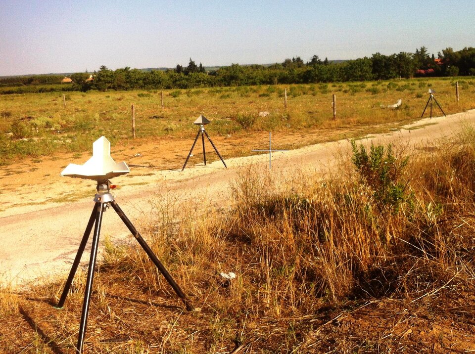
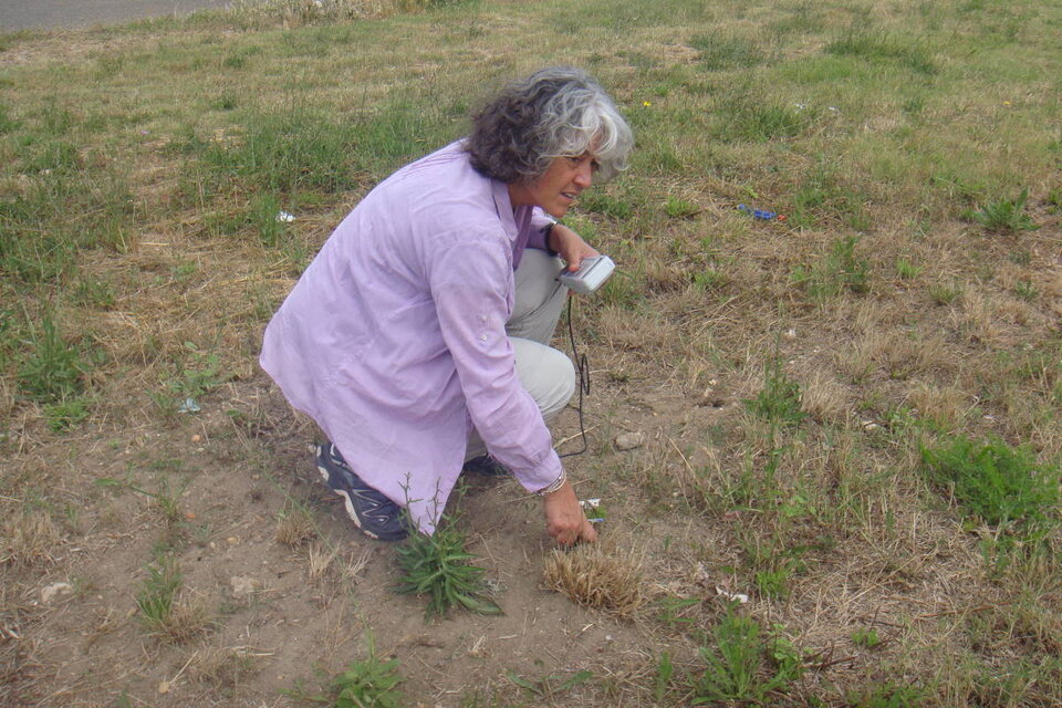
The team erected trihedral structures called corner reflectors, which are essential for calibrating the radar images.
Information on land type, crops, the condition of the ground and atmosphere was also collected to help interpret the radar images later.
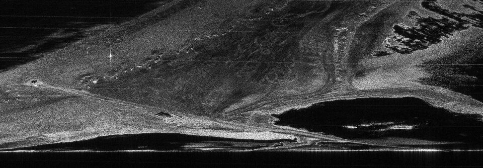
“A Ka-band radar has never been flown in space,” said Pascale Dubois-Fernandez, Onera’s project manager and now leading the data analysis.
“We still need to understand how Ka-band radar waves interact with the surface and are reflected back to the airborne or spaceborne sensor. This campaign is a big step in this direction.”
Following this summer’s flights, Onera is processing the Ka-band data recorded by the airborne instrument and is looking forward to present the preliminary results at the first international workshop ‘Ka-band Earth Observation Radar Missions’.
The workshop will take place on 8–9 November at ESA’s ESTEC centre in the Netherlands. For more information about the workshop, following the link in the right-hand bar.

